Martian Geomorphology
The purpose of this blog is to share some observations I have made while drilling down on images from Google Earth/Mars and JMars 5, mainly along the Dichotomy Boundary dividing the Southern Plateau from the Northern Plains. Topics that will be discussed and illustrated are:
- Shorelines of an ancient ocean at two levels, at approximately the -3600 and -3900 meters relative to datum
- Circumstantial evidence of an icecap extending right to the shoreline at -3600 at the Deuteronilus/Acidalia transition
- Rifting due to likely magmatic up-welling in the same area, with associated lava flows
- Mud volcanoes, thumbprint terrains, and large gryphons and their genesis
- Rudimentary stratigraphy in “coastal” Deuteronilus Mensae
- Uplift of the -3900 shoreline over the Tharsis inflation, followed by local subsidence as a result of a major landslide
- Amazonian lava flows near Lyot crater, interaction between lava and ice in lobate debris aprons, and lava tubes and inflations as potential habitats for exploration
- Structural inversion at Aeolis Dorsa, documented by the uphill vergence of various (alluvial) deltas
- ….and anything else that may come up; an attempt will be made to provide Earth analogues in many cases.
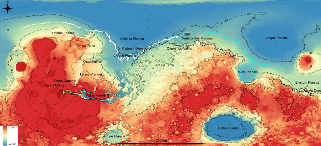
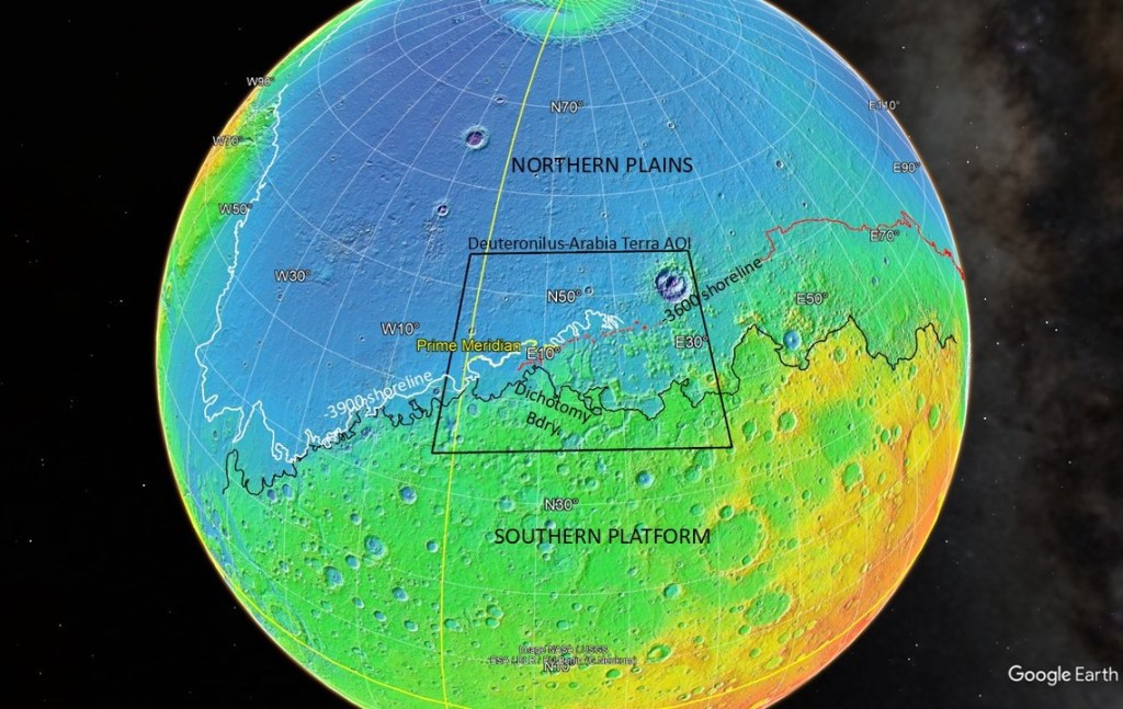
To set the stage, below is a Google Earth display highlighting some of the major features to be discussed. It is centred on the Deuteronilus and Arabia Terra regions, and shows the -3600 and -3900 shorelines to the extent that I have been able to pick them. Also featured is the Dichotomy Boundary (in black) which separates the Southern Platform from the Northern Plains, some 2km lower. The origin of the Northern Plains has been attributed variously to a giant impactor early in the planet’s history, with some having it come from the North, and some from the opposite side of the planet; or, an early episode of plate tectonics, or mantle plumes. The density of impact craters differs significantly between the two, with the Southern Platform, composed of older rocks, being heavily scarred over its long history, while the younger surface of the Northern Plains, having been re-surfaced by the mystery event, and less affected by impacts in its shorter life, is relatively smooth.
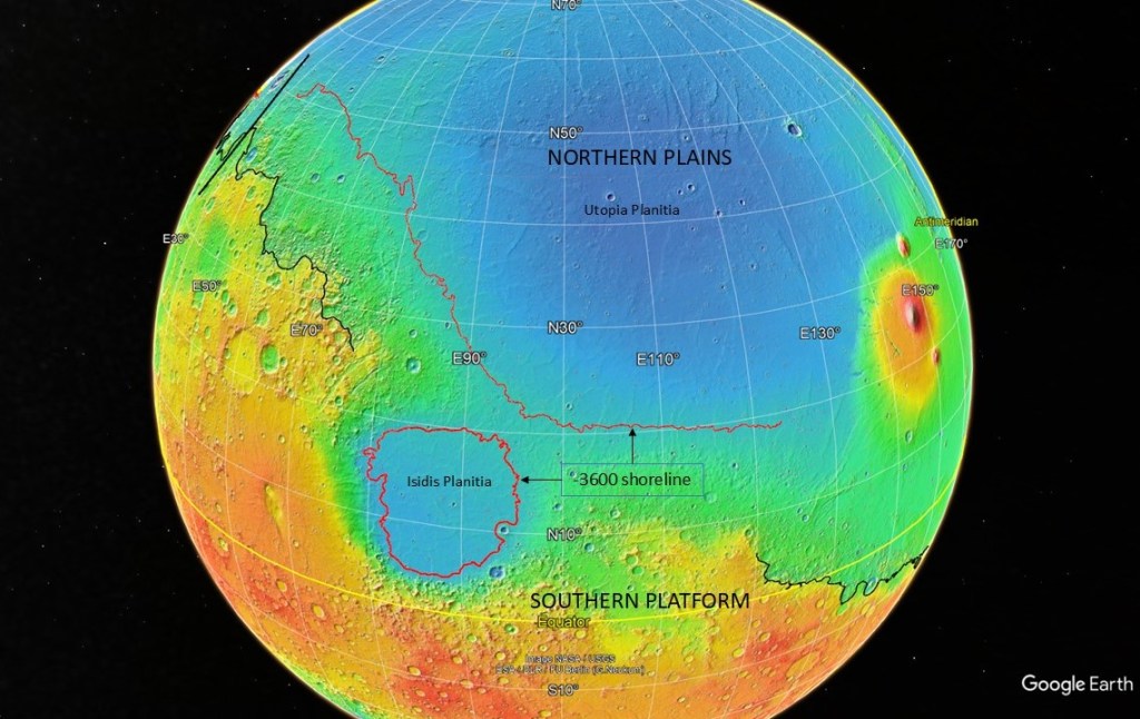
On the flip side, the Isidis and Utopia Basins with their -3600 shoreline:
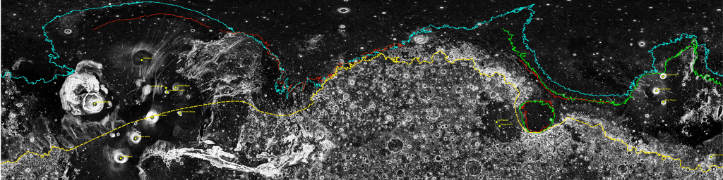
To show the dramatic change in crater density across the Dichotomy boundary, an illustration of the “roughness” attribute calculated on the MOLA digital elevation model (dichotomy boundary in yellow):