I have alluded to thumbprint terrain and mud volcanoes as indicative of marine environments several times and will try to expand on the subject.
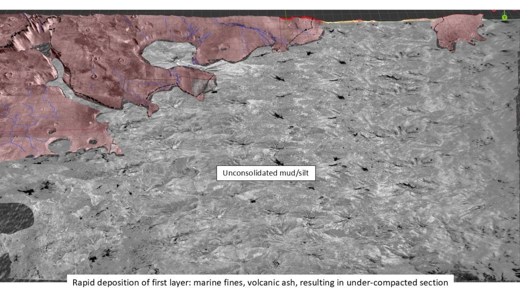
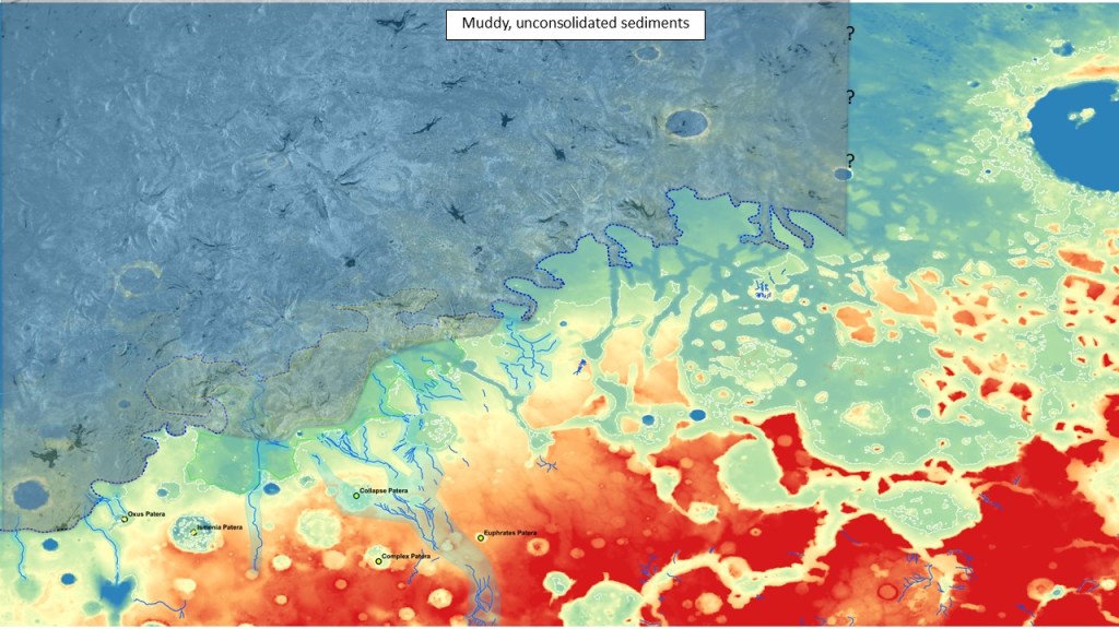
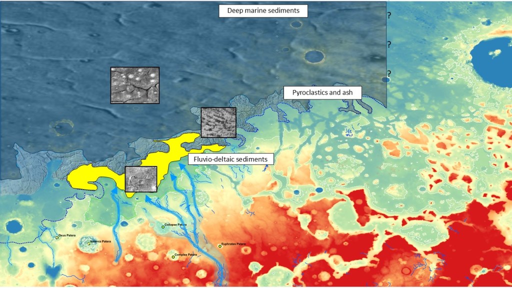
To set the stage for the widespread occurrence of extruded volatiles in large parts of Acidalia Planitia, Isidis Planitia, Utopia Planitia and offshore Deuteronilus, we posit a huge and rapid discharge of fine clastics (mud) from various outflow channels, of which the Valles Marineris System is one example. These sediments were carried in suspension over large distances, and after settling out were buried too quickly to expel all their interstitial water, similar to over-pressured sediments in the Gulf of Mexico.
When the atmosphere was largely lost to space, resulting from the loss of the magnetic field, the water/ice evaporated/sublimated away, lowering the overburden pressure and causing the unconsolidated muds to be squeezed (buoyed?) up to the surface.
A simple expression of this phenomenon is solitary mud volcanoes which are ubiquitous in Acidalia, Utopia and Isidis Planitia; they sometimes follow polygonal cracks (de-watering or ice expansion?) which act as lines of weakness, but mostly penetrate the caprock directly.
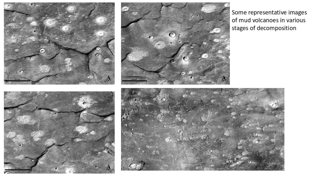
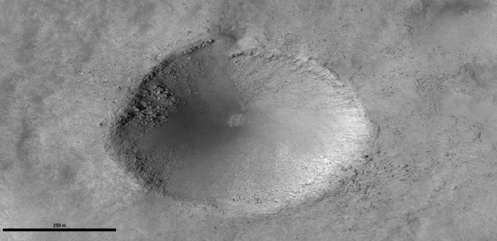
Closeup of various MVs with measured diameters below: In this region they come in two size ranges: 400m-600m, and tiny ones, at about 100m; there are also some enigmatic holes, 300m-500m, conical pits that look like they have exploded outwards. They may represent clathrate blowouts, similar to those recently found on the Yamal Peninsula in Siberia, resulting from thawing permafrost. They do not have the rim or centre cone normally seen in impact craters.
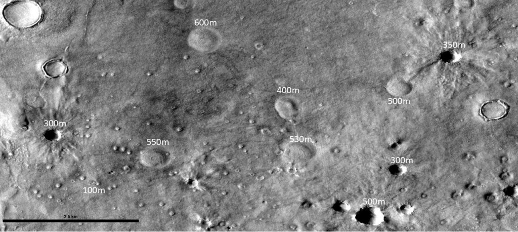
Below is an illustration of three kinds of circular features encountered here: impact craters, mud volcanoes, and (postulated) clathrate blowouts:
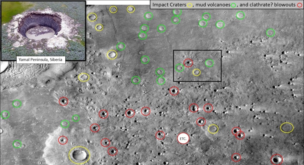
Close-up of “blowout” on HiRISE:
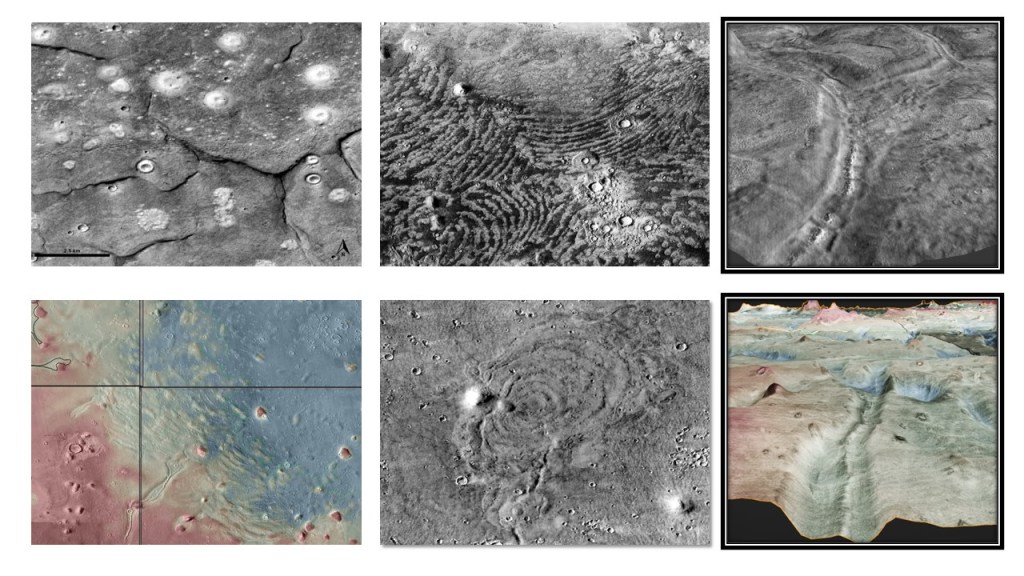
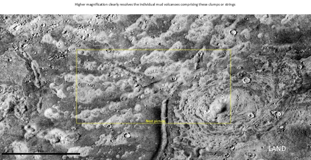
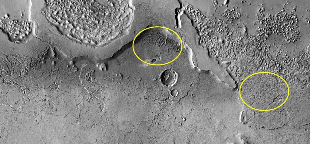
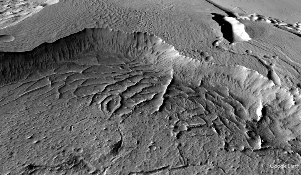
Turning to Thumb-print Terrane: various explanations have been offered for these strange features, from glacial deposits to sediment dumps due to interference between in-going and reflected tsunami waves. As can be seen in the sequence below, magnification reveals them to be lined up mud volcanoes, likely passing through a fractured overburden which effectively filters them.
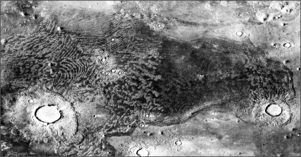
In order of increased magnification:
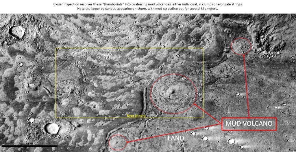
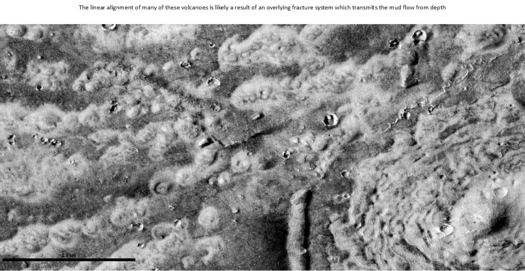
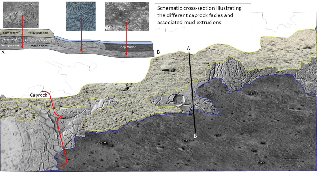
This begs the question of how mud flows can have these different surface expressions. In all three settings, over-pressured mud is being forced up through an overburden, breaking through a caprock with insufficient seal capacity to hold it back. The patterns then, must reflect something of the nature of the caprock: in the solitary MV case, horizontally isotropic; in the thumbprint case, fractured, providing lines of weakness to pass the mud through; and in the massive gryphon/mudflow case, again isotropic, but competent enough to promote pooling at its base, resulting in relatively fewer but massively larger extrusions.
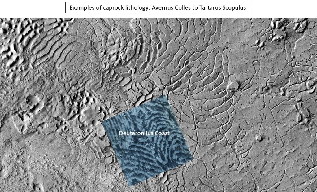
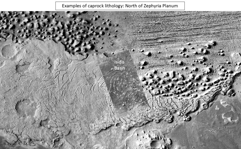
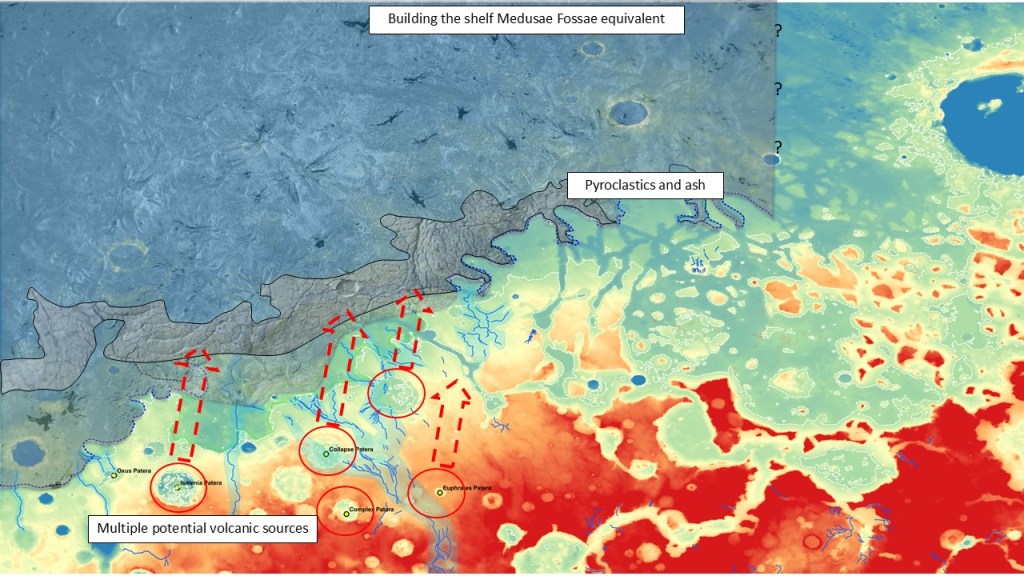
So where do we go for these types of rocks? For the fractured caprock, the other side of the planet gives some hints. Almost 180 degrees to the East lies Apollinaris Mons, and north of it a heavily fractured area called Avernus Colles. The main formation here is claimed to be composed of lava flows because of its platy appearance; however, there are areas containing yardangs nearby making them part of the more friable Medusae Fossae Formation, thought to represent airfall ash and dust from explosive eruptions. Whatever the lithology is, it lends itself to a very distinctive style of concentric fracturing which is reminiscent of conchoidal fractures in glass or flint or any fine-grained, amorphous material. Whatever the case, geometrically, the fracture patterns mirror the thumbprint terranes.
Varieties of fractured terrain in Elysium Planitia and Avernus Colles:
Juxtaposition of thumbprints and fractures:
Location map for the next illustration: box on the right side of the image
The block referenced above, showing a fracture pattern on the right, and cemented and exhumed fractures on the left. It is uncertain whether these are calcareous or silica cements, or even sandstone “injectites”.
This type of structure was encountered on Mount Sharp in Gale Crater, and termed “box-work structure”, thought to represent fluid-based cementation of fractures in the phreatic zone.
Some of the ridges below are quite high, and as the scale on bottom left indicates, of considerable length:
Although this is a bit of a digression from the thumbprint discussion, it serves to illustrate how fracture patterns influence the transmission of water, mud, or other volatiles and how they are expressed at the surface.
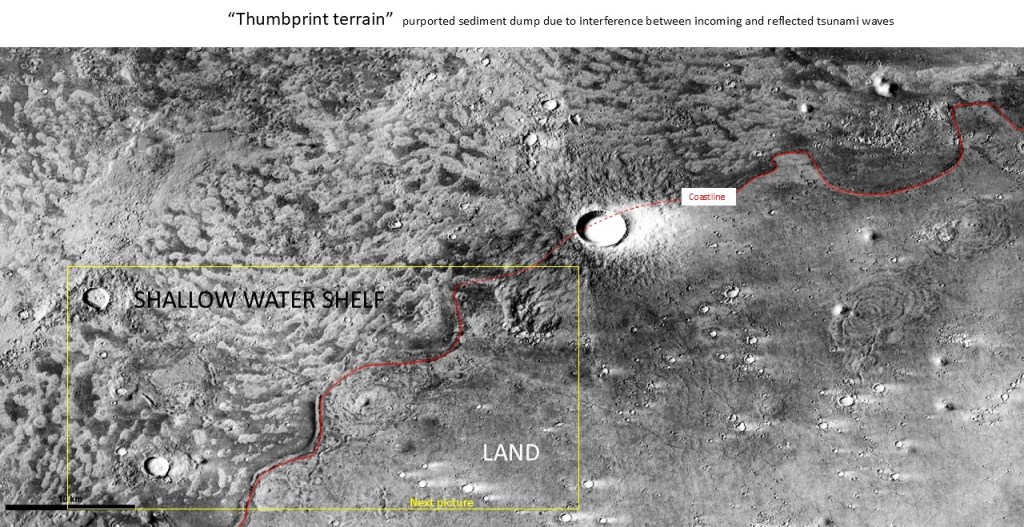
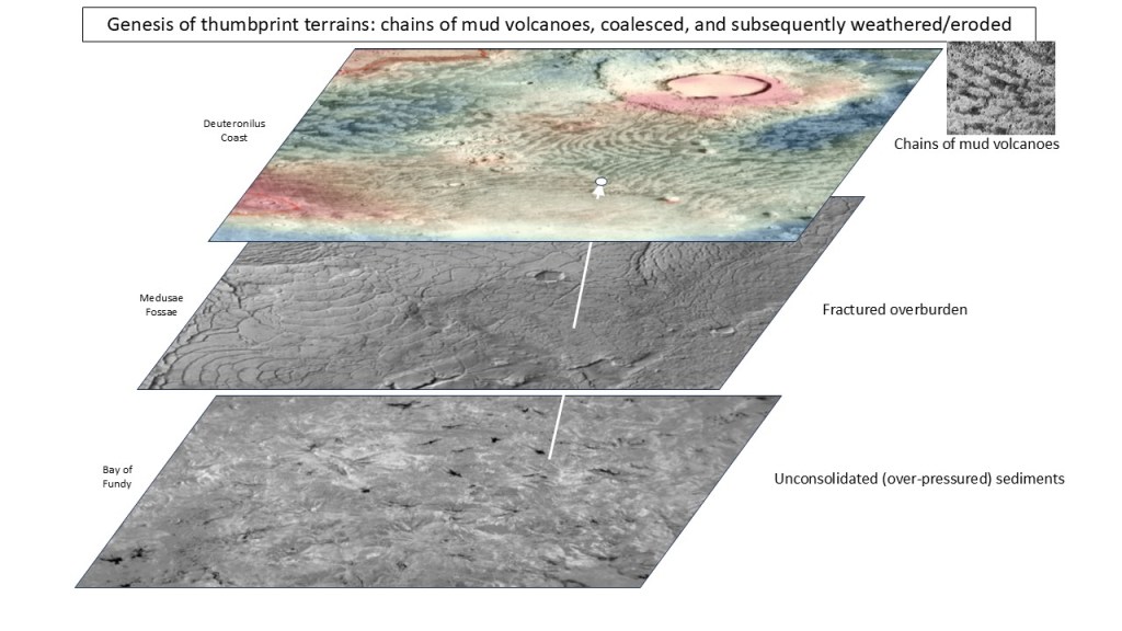
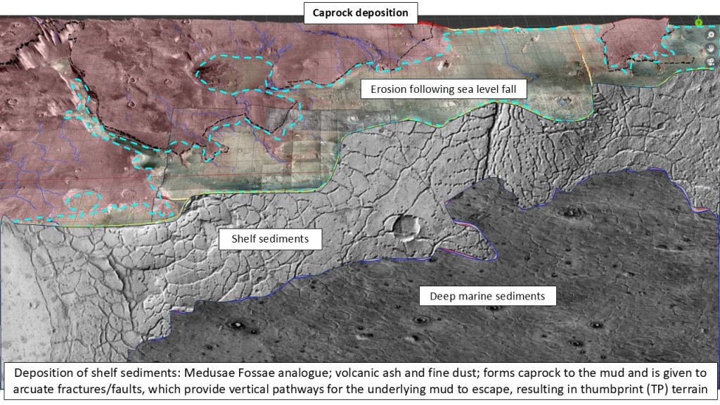
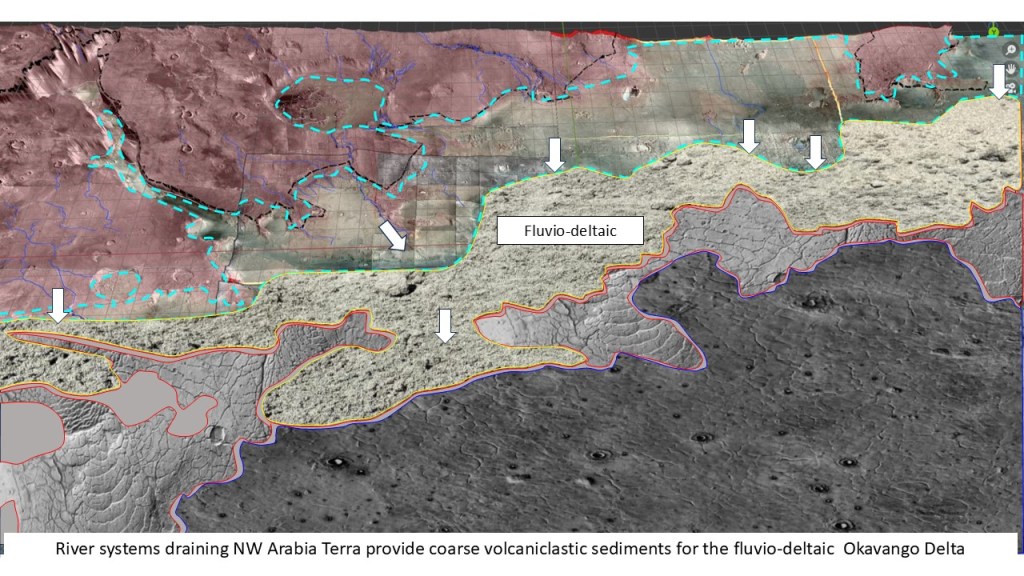
The development of the thumbprints is postulated as follows: the fine, silty/muddy sediments were rapidly flushed into the northern basin by catastrophic floods, and subsequently covered by normal marine sediments; at a later point in time, explosive volcanism deposited ash, dust and pyroclastics in the near-shore shelf zone. This layer, upon lithification, fractured into the unique patterns seen at Avernus Colles (and the thumbprint terrain elsewhere). This caprock layer was limited to the near-shore or shallower parts of the basin, maybe the farthest extent of ignimbrite flows, or because of diffusion and dissipation by open ocean currents. In any case, the thumbprints are always fairly close to the shoreline. As the mud was mobilized, it was filtered through the fractures, telegraphing the fracture pattern to the surface.
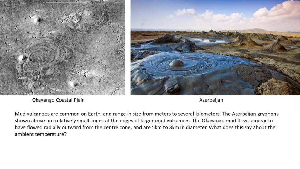
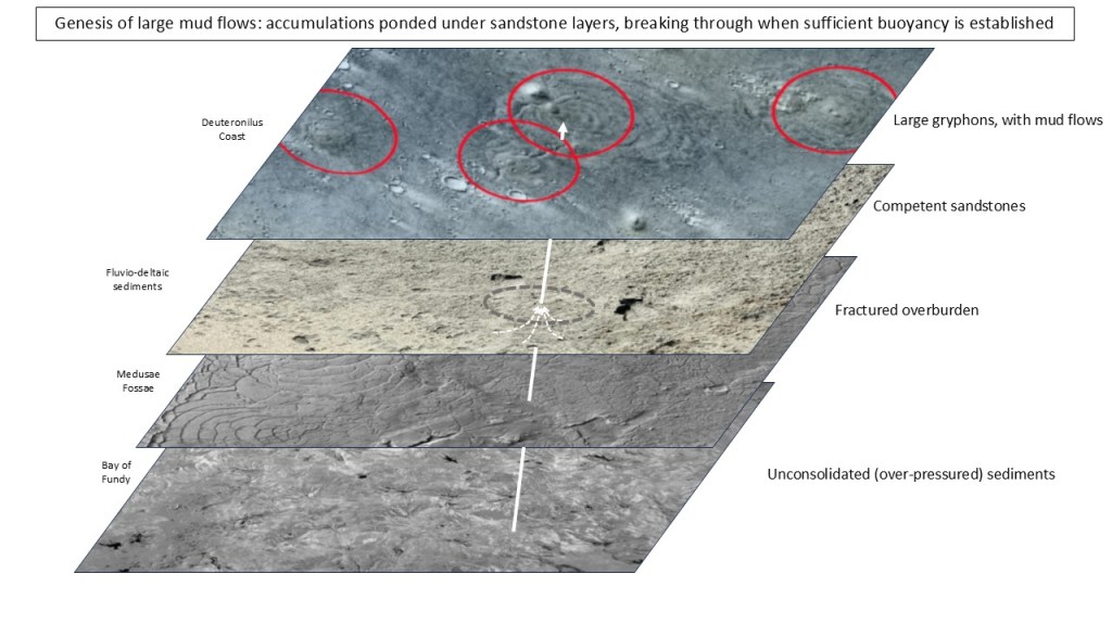
The gryphons and large mudflows were mediated by a more competent overburden in the form of fluvio-deltaic sands. These caused a greater buildup of pressure before releasing the mud ponded beneath, and resulted in much larger volumes expelled at each site. The surface pattern attests to radial flow from the centre and the great areal extent raises questions about the duration of these flows and the ambient temperature. Some of these flows extend over 50km^2 and dwarf the recent Sidoarjo Mud flow, “Lusi”, in East Java, Indonesia, with its mere 7km^2.
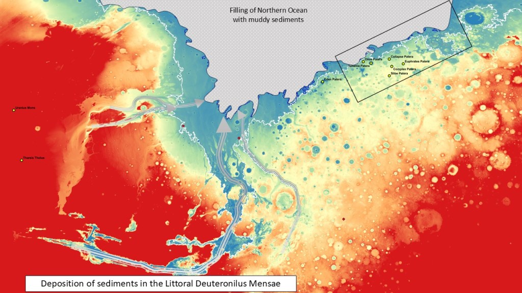
Reconstructing the depositional sequence:
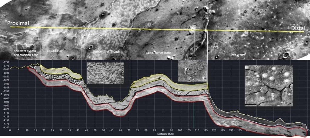
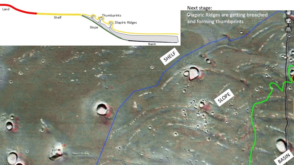
A transect across the various physiographic features: coastal plain-shelf-delta-basin, from proximal to distal.

Reconstruction of the subsurface along this transect, and the resulting expressions of the mud extrusions:
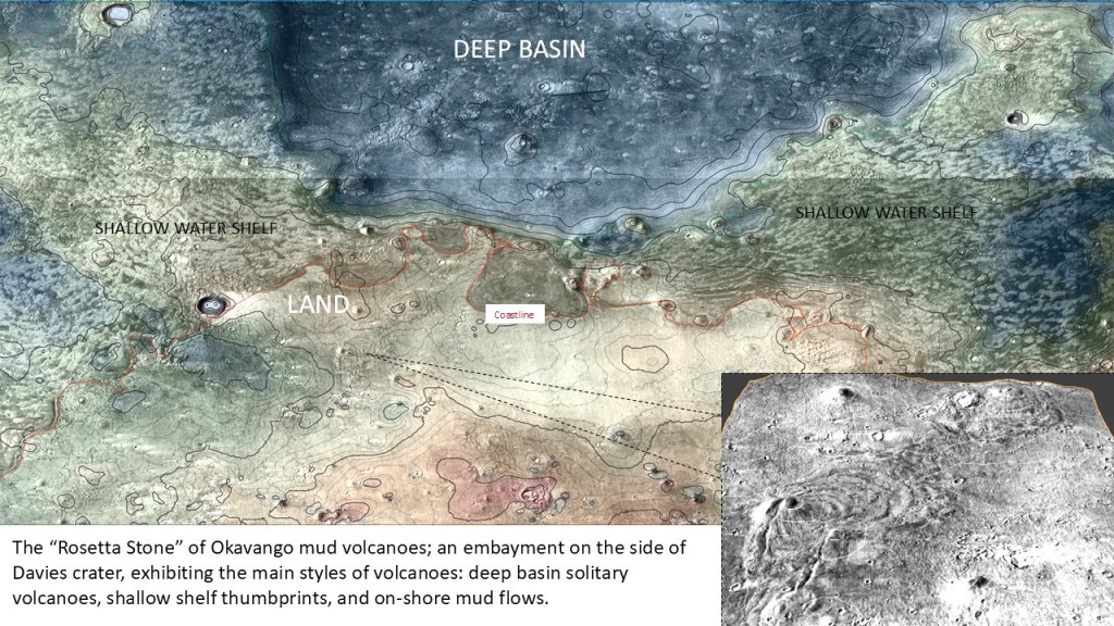
To recapitulate, mud volcanoes come in three styles: solitary, thumbprint and massive flows. At the Deuteronilus coast, the big picture:
Phase 1:
Phase 2:
Phase 3:
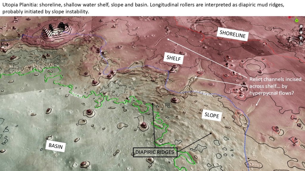
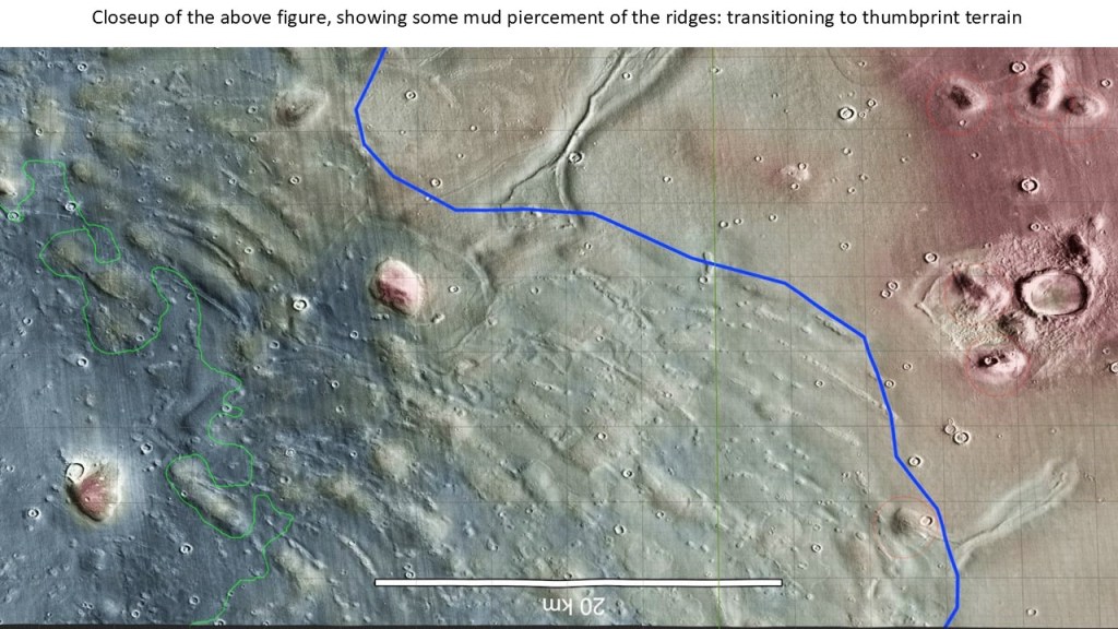
Additionally, in certain situations, such as on a slope, the mud can be subject to diapirism, similar to terrestrial salt or shale diapirs. In the Utopia Basin it forms ridges just below the shelf break, possibly initiated by incipient gravity faulting. As an extensional fault develops, the mud gets squeezed up along the fault plane and, through its buoyancy creates a ridge in the overlying sediments. It eventually can break through to form a line of mud volcanoes just like the thumbprints. Various stages of this progression are observed along the Utopia Planitia slope.
Conceptual model for the diapiric ridges:
(the fault-induced diapiric model is somewhat speculative; the fractured MF model may still apply here, and may play a role in constructing these ridges and their piercements)
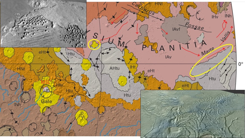
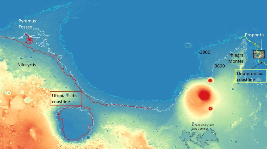
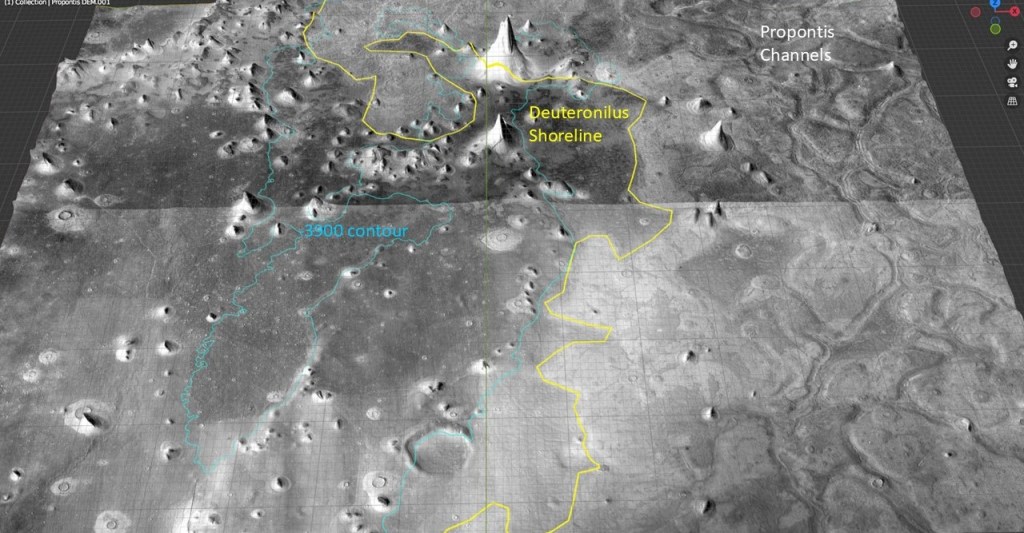
Pyramus Fossae and Propontis
I would be remiss if I didn’t include the Pyramus Fossae and Propontis in my discussion of mud volcano-thumbprint terranes. The canali-like features there would have would have delighted Schiaparelli and Lowell if they had access to modern MRO data.
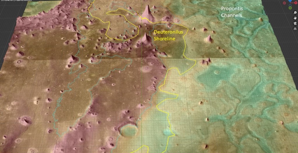
Pyramus Fossae are located North East of the Nilosyrtis region, just outboard of the -3600 (Utopia) shoreline; Propontis is East of Phlegra Montes, just outboard of the -3900 (Deuteronilus) shoreline.
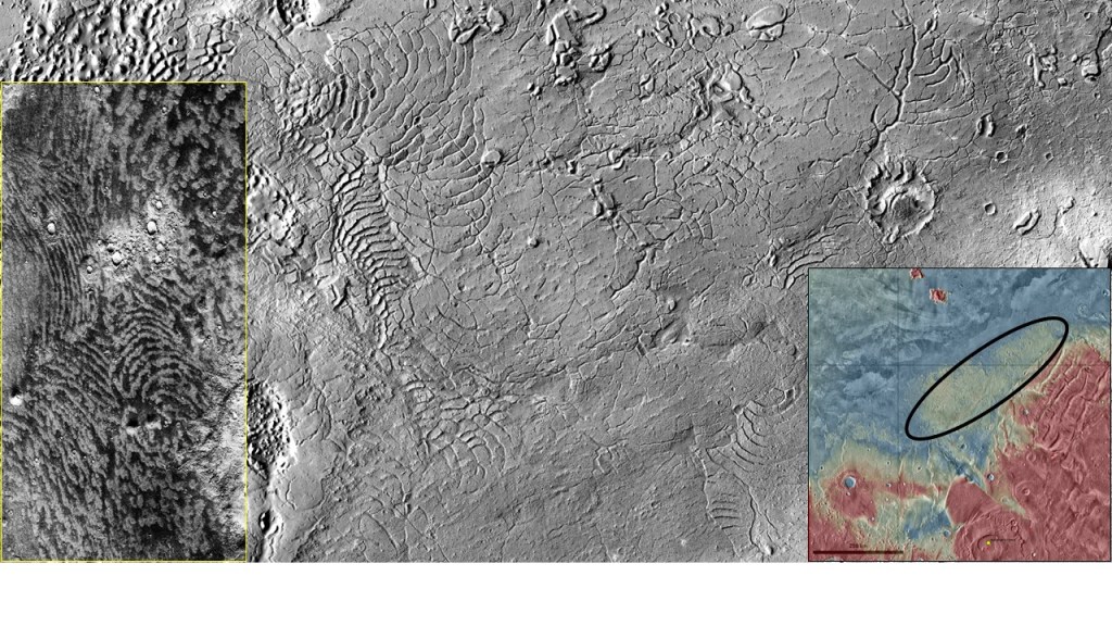
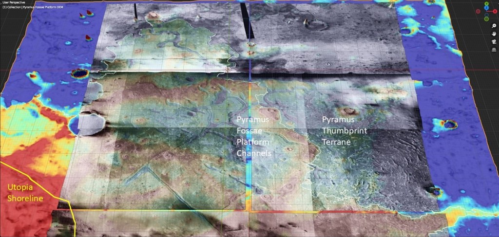
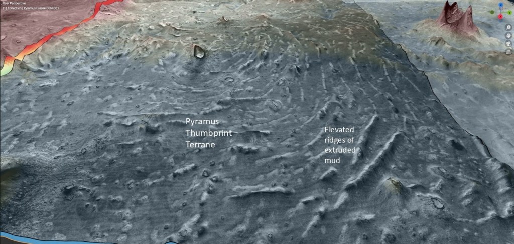
The Pyramus Fossae channels? grooves? appear to be superimposed on a sort of platform, maybe a thickened layer of pyroclastics. This platform is bounded on the East by typical thumbprint terrane. (North is up)
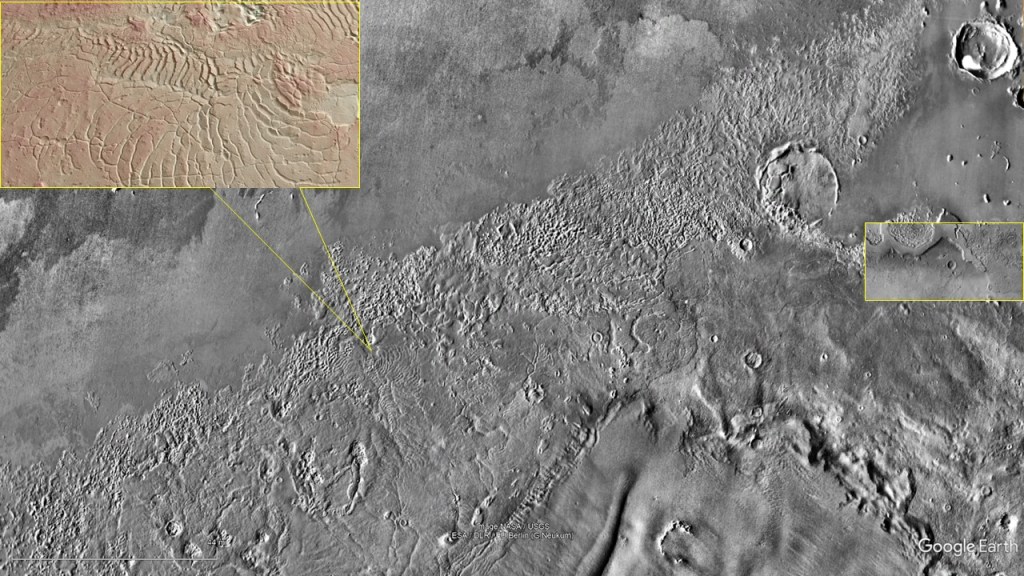
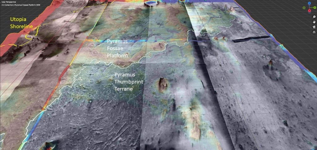
An oblique view showing the abrupt change in character from the PF platform to the thumbprint terrane. (North to the right)
A closer view of the thumbprints showing them to be, in essence, diapiric structures.
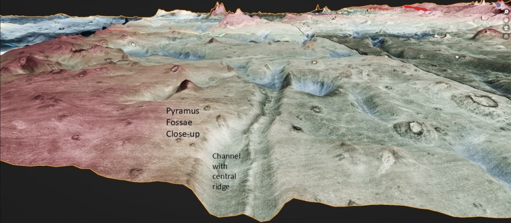
Close-up of a Fossa with its central, diapiric? ridge.
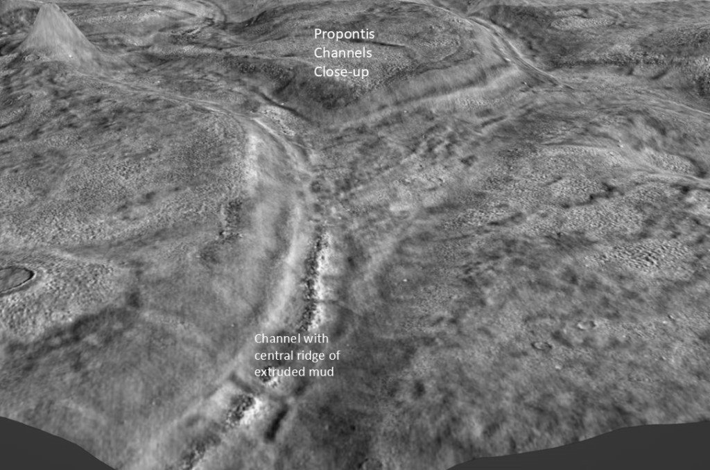
Propontis, displaying similar channels, also with central ridges:
In colour, to show elevation:
Detail of a channel, where the central ridge resolves into a thumbprint composed of discrete mud volcanoes:
Direct comparison of Propontis and Pyramus Fossae, with two genetic models:
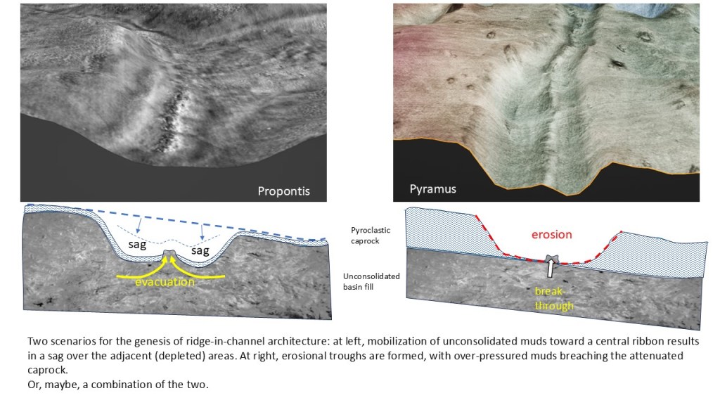
I believe these ridge-in-channel features to be yet another manifestation of mud volcanism, and include them in my mud volcano menagerie: