Some thoughts on the Medusae Fossae “Formation”, its distribution and characteristics.
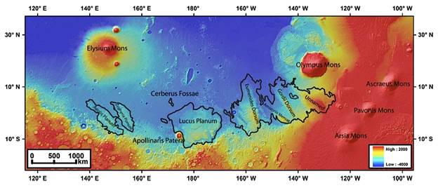
In the literature and on geological maps, it is described as Amazonian to Hesperian eolian and/or pyroclastic and air-fall deposits, perhaps involving ignimbrites. Its upper layers are relatively soft and friable, subject to intensive wind erosion, forming yardangs, one of its most diagnostic features. It is also a major source of the dust on Mars, making it difficult to find fresh exposures/outcrops as it is everywhere covered. Below, a location map of the main bodies:
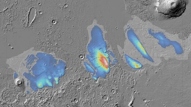
…and a map of the thickness (some of which is postulated to be composed of water ice)
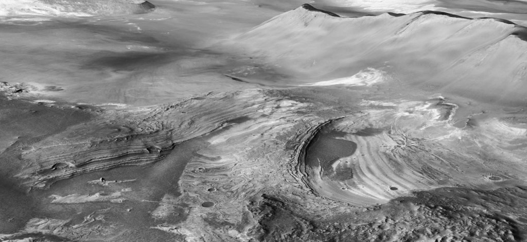
These two images were taken from Google Images, and are better than anything I could have created. Of particular interest is the washboard-like nature of the NW corner of Lucus Planum; I had wondered if some kind of listric faulting could account for the large-scale boudinage (pinch and swell) of this unit, and a plastic (glacier) ice core would facilitate this kind of deformation.
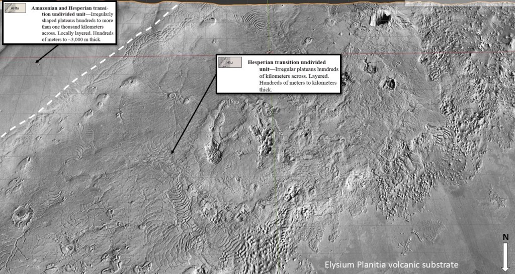
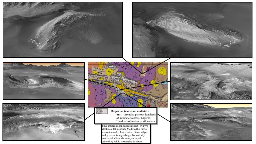
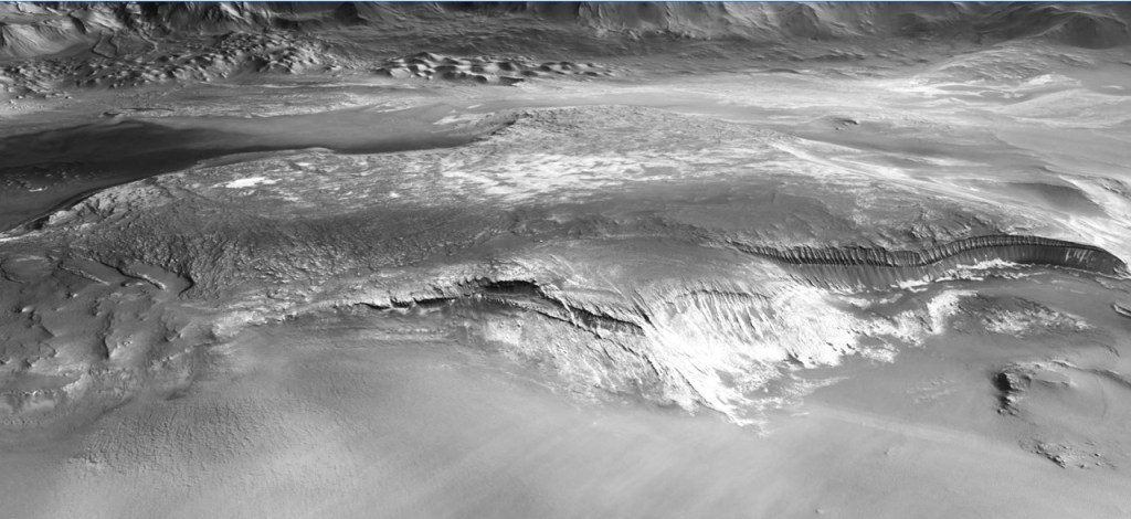
What is of more importance for my model is the basal unit, the one marked Htu at the periphery; it has a more brittle character and displays a thumbprint terrane-like fracture pattern, suggesting an ignimbrite. Stratigraphically lowest, it was the first thing out of the vent, followed by many ash-fall layers over a long period of time.

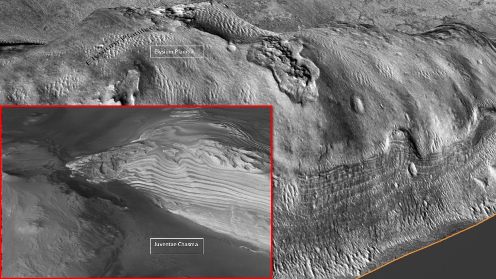
Another place where we see similar rocks is in the various chasmae at Valles Marineris. Not explicitly recognized as Medusae Fossae Fm, they tick all the same boxes: layered section, easily eroded into yardangs, and of the same age and provenance.
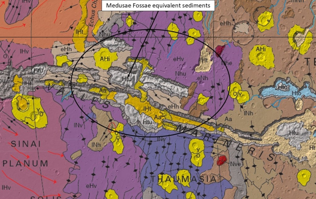

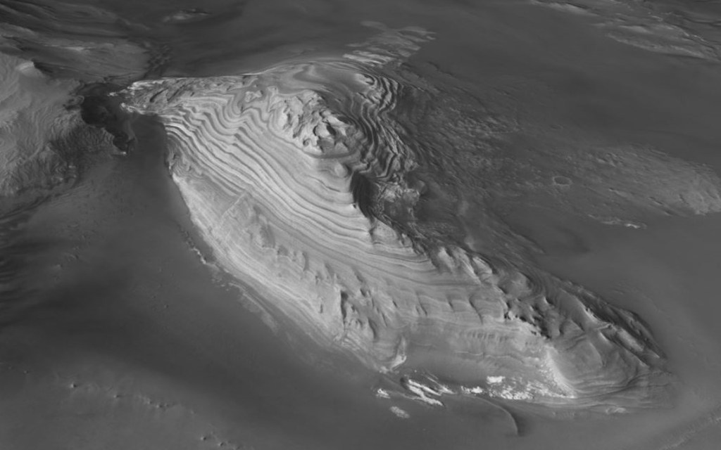
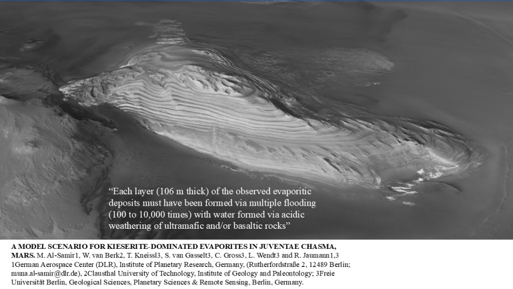


These rocks contain some evaporitic layers and were perhaps formed in a lacustrine setting when the chasmae were filled with water.
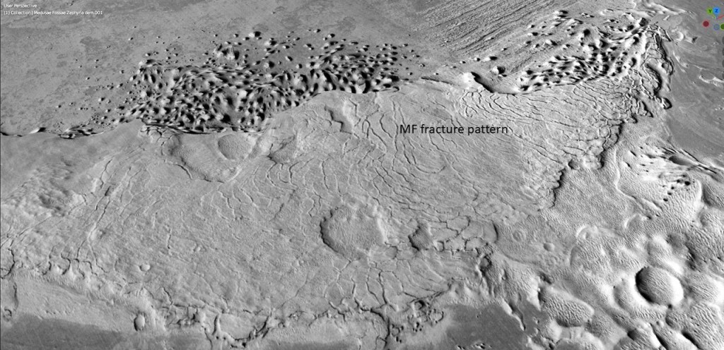
Back up in northern Elysium Planitia, an erosional outlier of MF that exhibits both the fracture pattern and the layering of successive ash deposits:
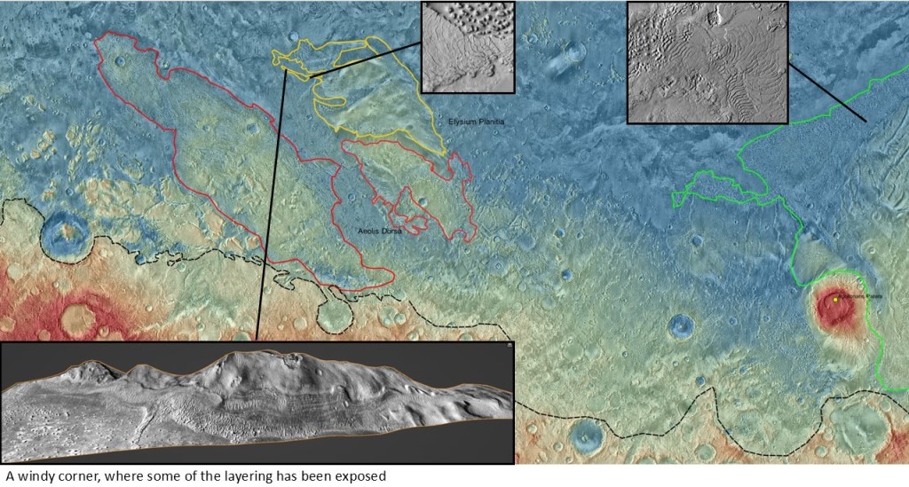

For context:
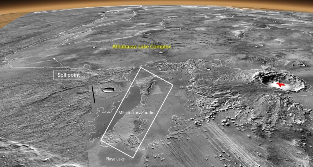
Note the Athabasca Lake Complex. That’s a subject for another section.
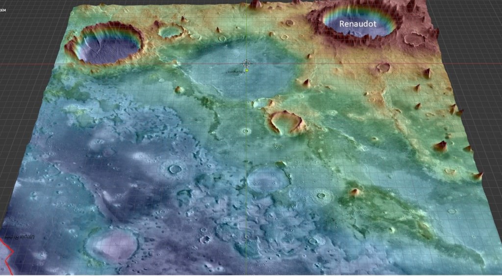
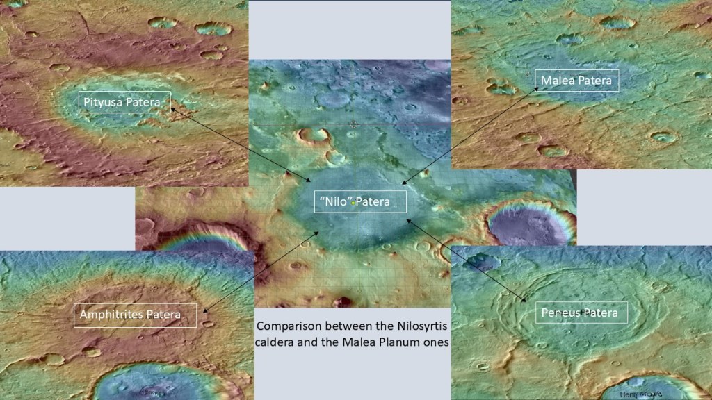
In the meantime, how do we tie this into the Thumbprint Terrane story? First, the volcanoes, of which several have been located in Arabia Terra, accounting for the Deuteronilus coastal TPs. I have located another, previously unreported, complex at Nilosyrtis, which would have supplied pyroclastics to the nearshore Utopia Basin:


In living color…
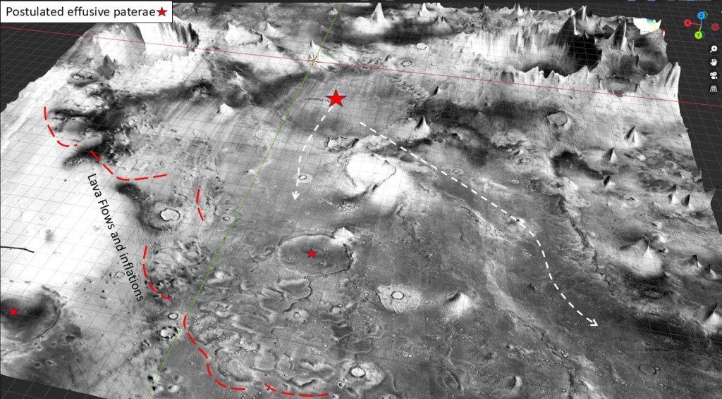
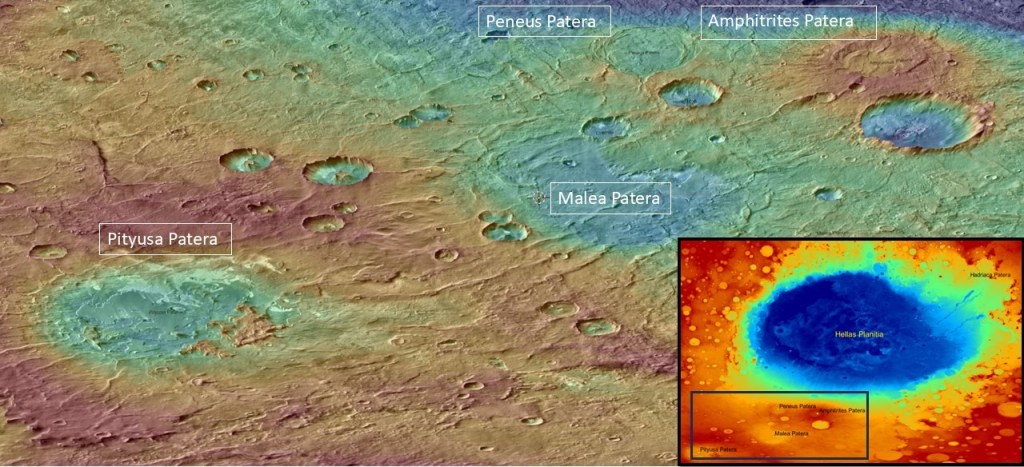
A good analogy can be found in the Malea Planum region, namely Peneus, Amphitrites, Pityusa and Malea paterae:
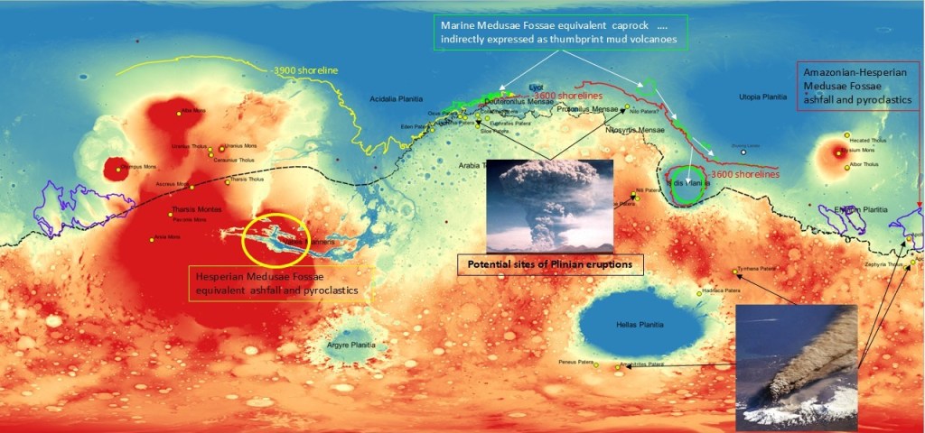
Putting it all together, the volcanoes accounting for Medusae Fossae deposits, on land and as thumbprint terrane caprock:
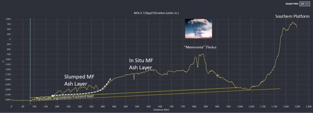
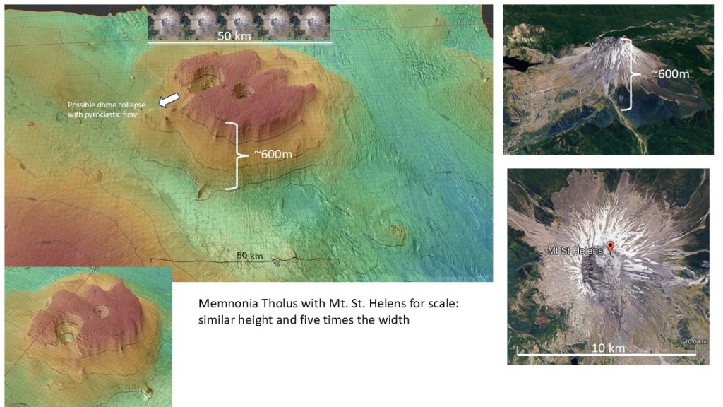
A closer look at the Medusae Fossae accumulation in the Apollinaris-Lucus Planum region reveals a wedge that thickens in a South-Easterly direction, culminating in a volcanic edifice I have tentatively named “Memnonia Tholus”
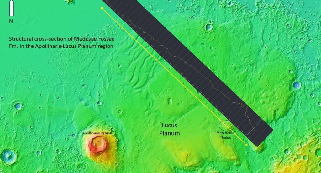
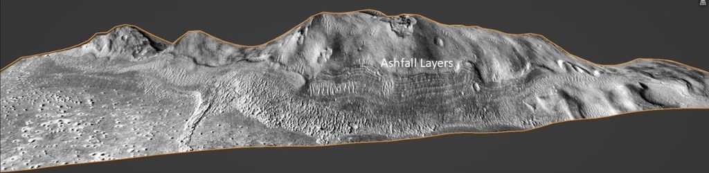
I interpret this to be a multi-layered sequence, with a pyroclastic flow (ignimbrite) at the base, characterized by a brittle style of fracturing, overlain by multiple episodes of ash-fall deposition. The frontal portion of this wedge appears to have slumped in a down-dip direction, resulting in an accordion-like rumpled wedge, indicating possible involvement of an ice core.

With more vertical exaggeration, the slumped and folded frontal zone becomes more apparent, as well as the vertical relief on the volcanic edifice.
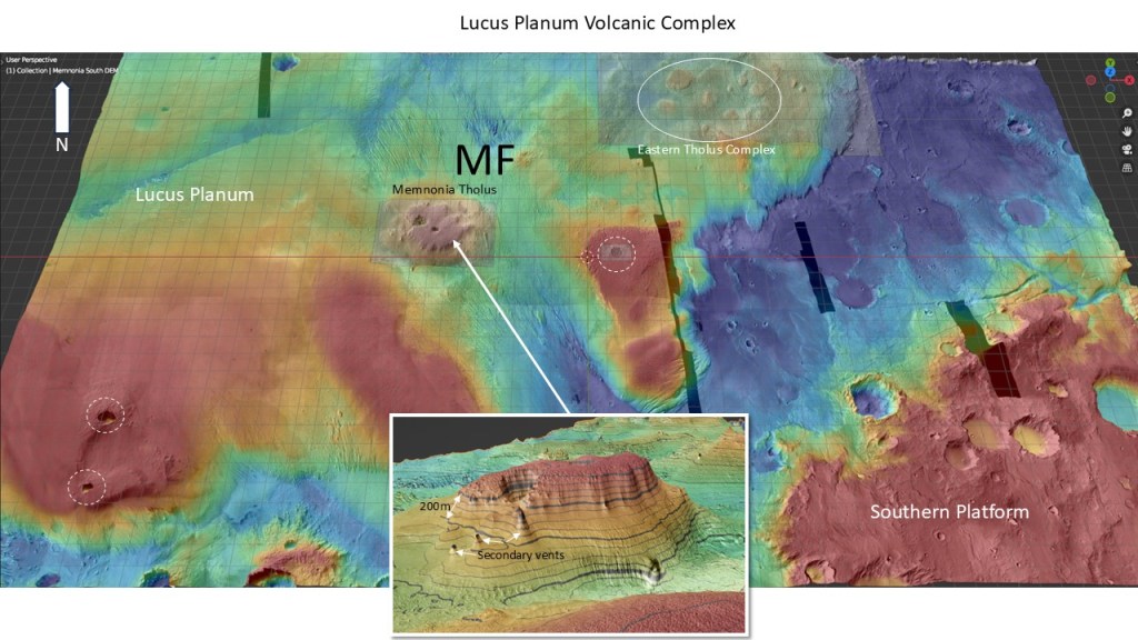
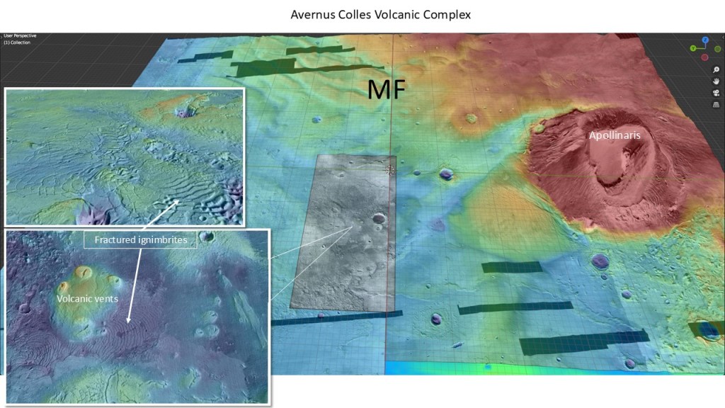
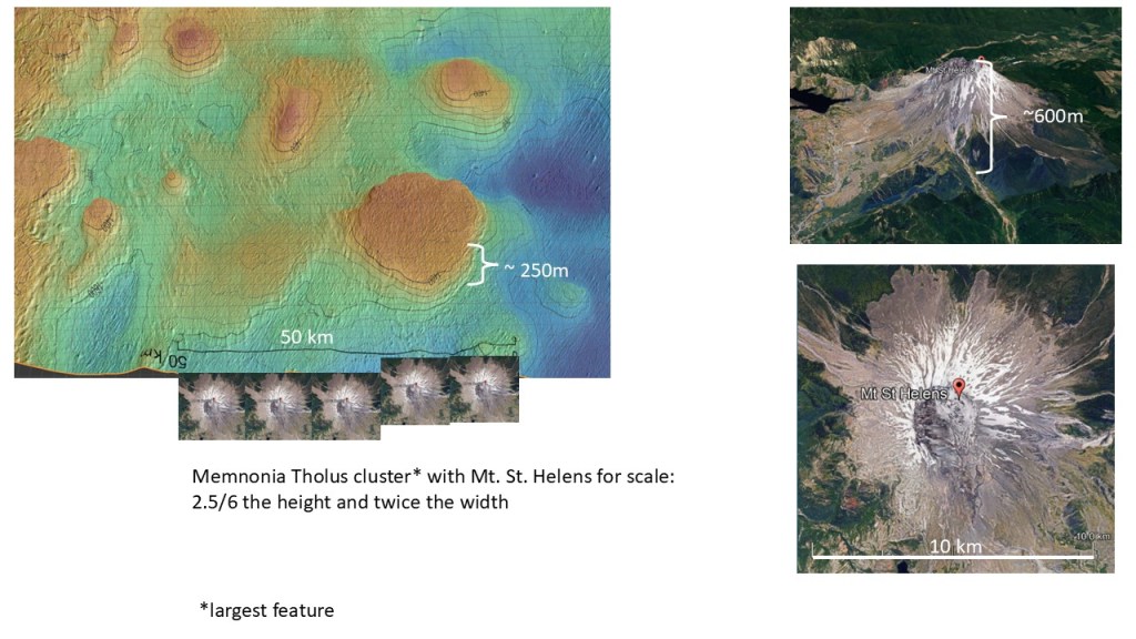
Volcanic sources are plentiful, from the obvious Apollinaris volcano to the various tholi in the Lucus Planum region, and the vents at Avernus Colles.

A close-up of Memnonia Tholus shows the vertical relief, as well as a breached crater wall and several secondary vents.
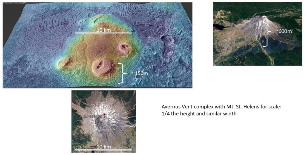
A close-up of the Avernus Colles area, revealing the volcanic vents and the basal fractured ignimbrite.
Comparison between Memnonia Tholus and Mount St. Helens to give a sense of the size of the Martian Volcanoes:
Scaling the other tholi to St. Helens:
And, lastly, the Avernus Colles Vents:
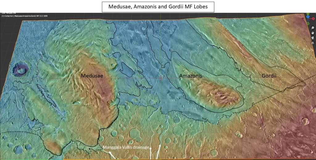
Farther East, several large lobes of Medusae Fossae deposits:
Close-up of the Medusae lobe, covering the Western branch of the Manggala river system:

Oblique view, showing the Manggala River partially covered by (later) Medusae Fossae deposits:
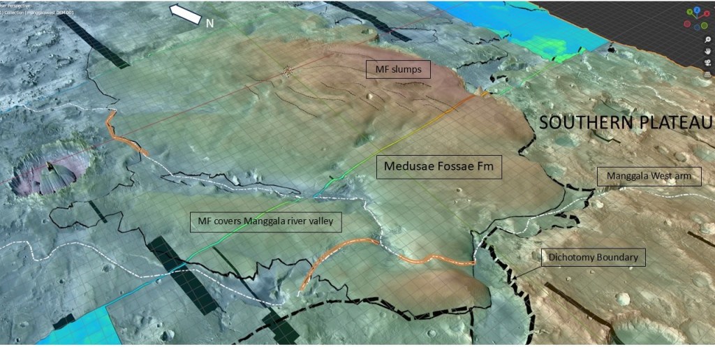
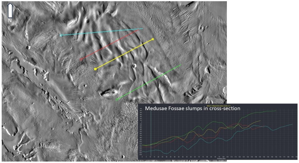
Slump geometries are evident here, just like Avernus Colles, implying a common underlying mechanism:
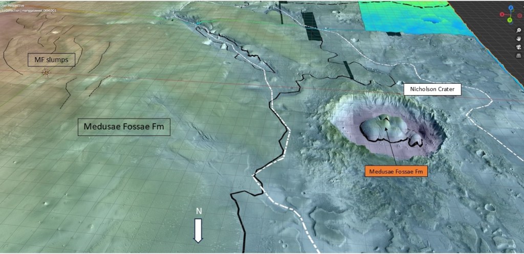
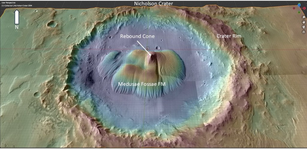
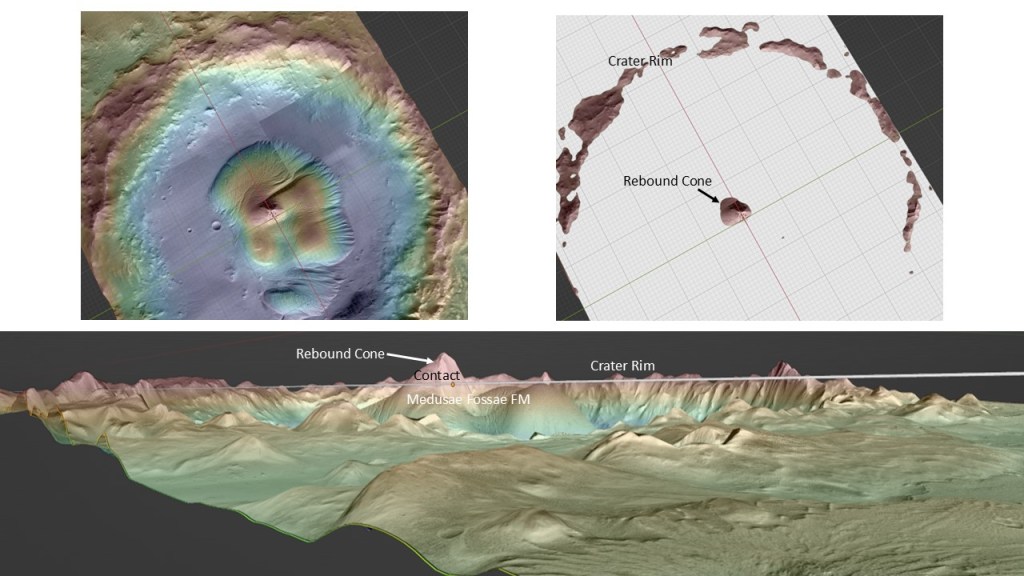
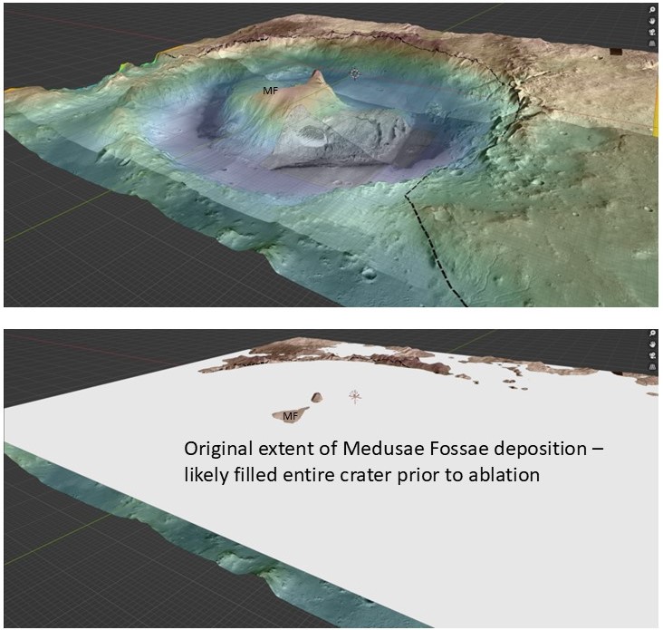
Nicholson Crater
A view of Nicholson Crater, with its central vestige of Medusae Fossae Fm. surrounding the rebound cone:
Close-up view:
A restoration of the original MF deposition prior to ablation:
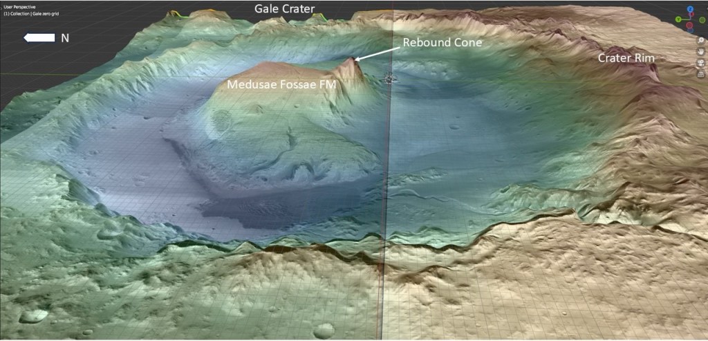
Gale Crater
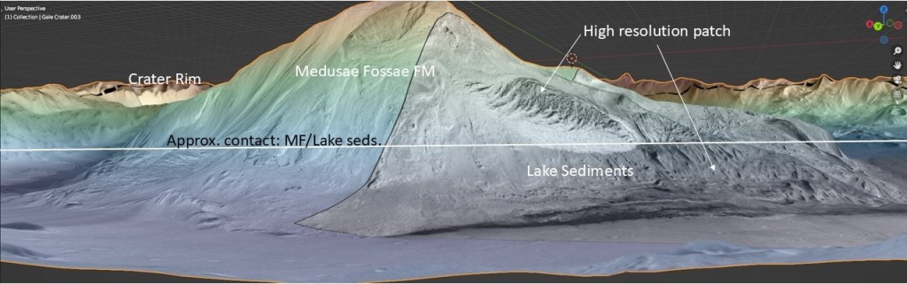
Gale Crater was initially (partially) filled by lacustrine sediments. Following an erosional hiatus, it was later infilled with Medusae Fossae (ash) deposits, then subjected to aeolian erosion, resulting in the present Mount Sharp erosional remnant adjacent to the rebound cone:
Taking the MF/Lacustrine interface as approximately horizontal:
Filling in the purported lake level:
…and extending it to the opposite side of the crater, it conforms fairly well to an apparent delta or fan lobe:
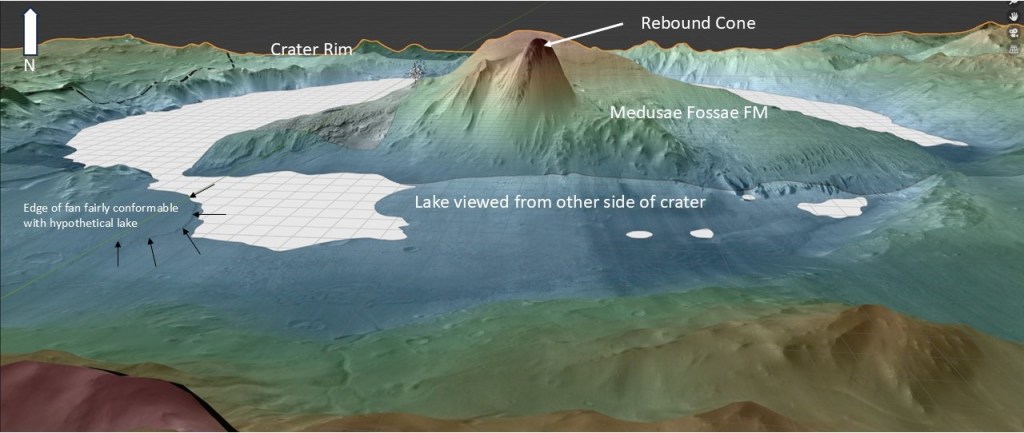
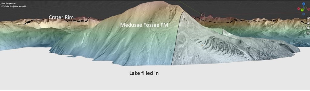
Filling the whole crater to the topmost level of MF seen presently (also conformable with the crater rim):

Before and after fill:
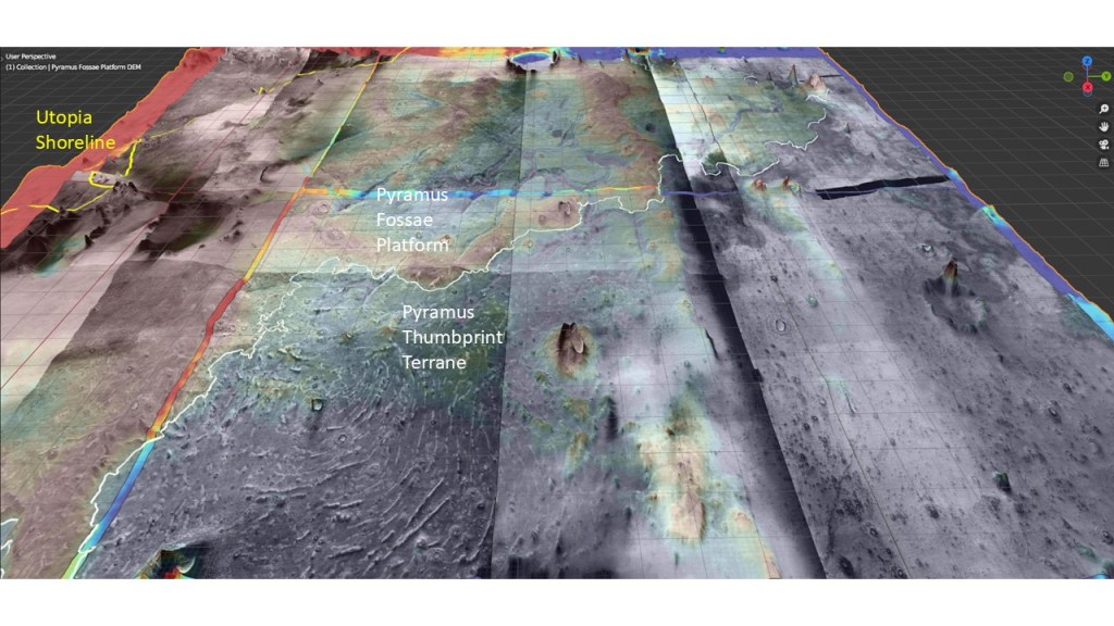
Before leaving the MF and thumbprint terrane story, I’d like to draw attention to some weird phenomena in the Pyramus Fossae and Propontis regions: similar in shape to worm tracks under tree bark, these are elongated rilles with widths of around 3000-3500m and depths of about 30-50m, and thin elevated ridges along the bottom.
Location shown below:
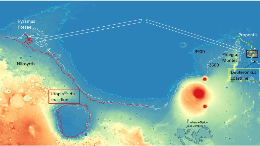
As illustrated below, the Pyramus Fossae are superimposed on a shelf adjacent to the Utopia -3600 shoreline, and are offset by the more conventional thumbprint features on the seaward side:
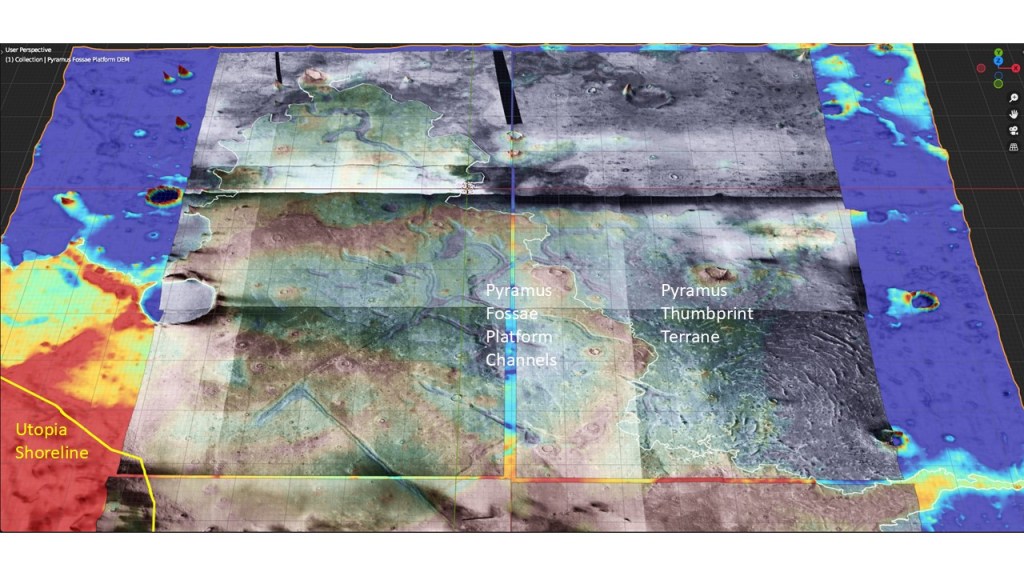
Another view showing the juxtaposition of thumbprint terrane against the PF shelf:
A close-up of the thumbprints illustrating their diapiric character:

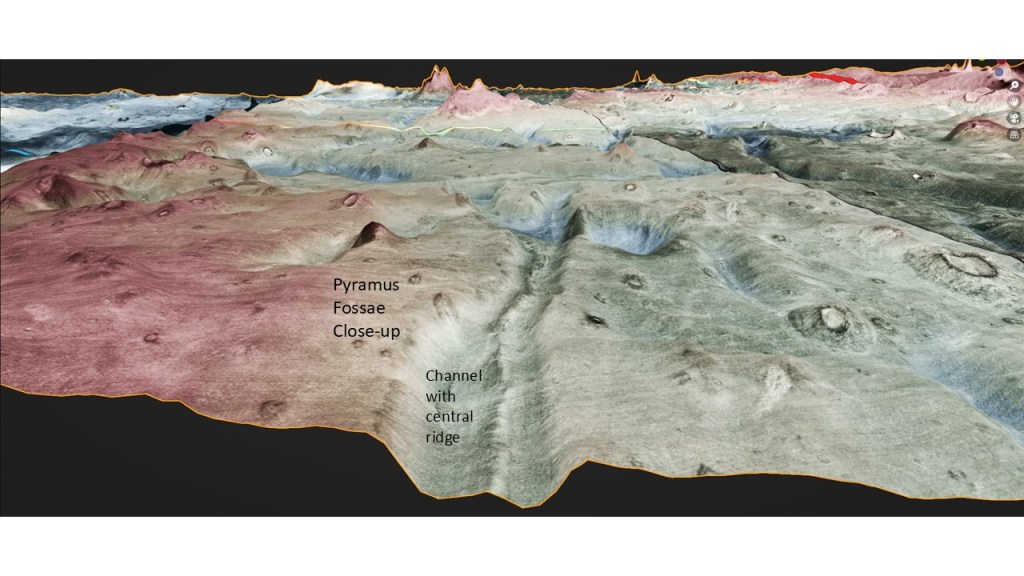
A close-up of a fossa revealing the central (diapiric) ridge:
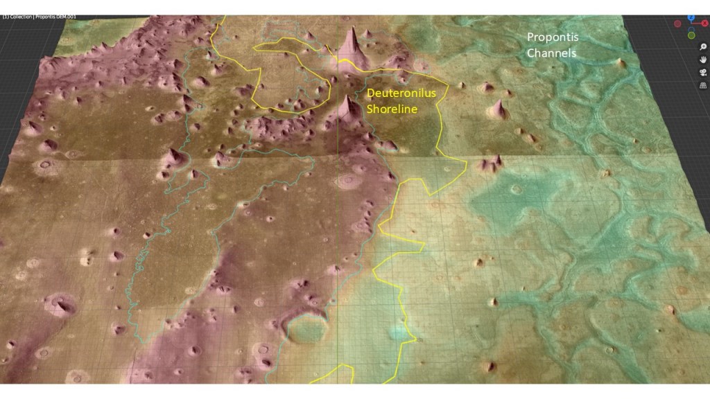
Moving to the Propontis area, the fossae or channels are again found close to the shoreline, in this case, the -3900 Deuteronilus one. Note the change in albedo across this line:

A colour display to enhance the structural relief:
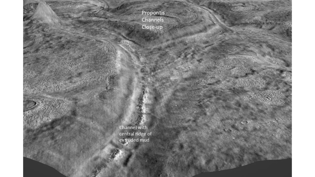
A close-up of the central ridge resolves individual mud volcanoes:
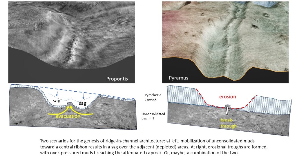
In trying to account for these strange stuctures, I can come up with two possibilities:
- A diapiric upward movement of mud causing evacuation on either side and a sag in the overlying sediments, similar to Gulf of Mexico salt tectonics;
- Erosion of a gulley into the caprock, resulting in thinning and escape of the over-pressured muds along a line of weakness;
- Or some combination of the above.
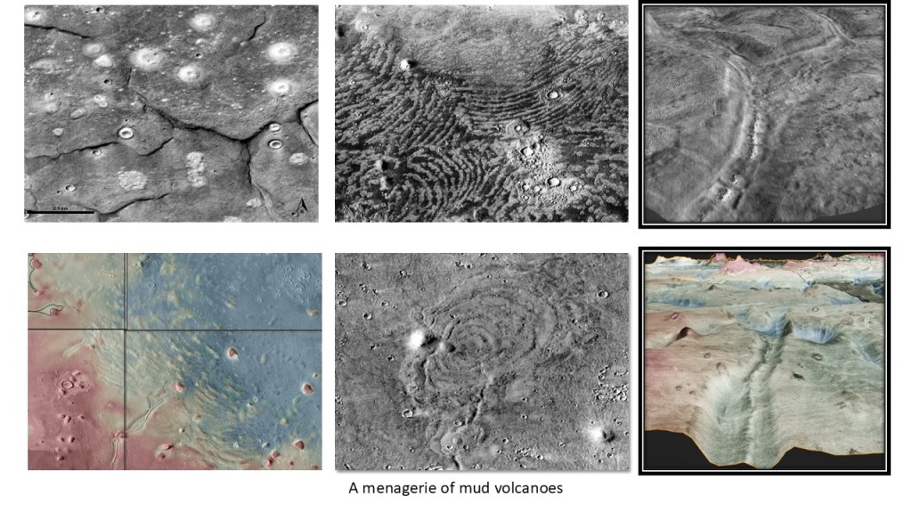
In summary, an atlas of various mud volcano types, depending on the composition of the overburden, and distance from the shore.