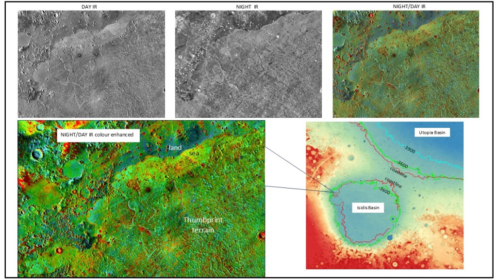
Recognition of shorelines depends on a number of observational criteria, the most basic being simply lines on the planet’s surface that extend over a large distance, at roughly the same structural elevation or equipotential level; changes in albedo or thermal inertia (day to night) on infrared data; occurrence of marine indicators such as mud volcanoes and thumbprint terrain (which is composed of chains of mud volcanoes…this is itself a fascinating topic and will be covered in a separate section); or simply, discrete changes in visual facies (textures) across a boundary.
The source material is Google Earth/Mars and murray-lab.caltech.edu for reconnaissance, JMars 5 for detailed images: layers… Explore Mars, Themis Day IR, Themis Night IR, Themis Night Over Day IR. Additionally, digital elevation models Mars Orbiter Laser Altimeter (MOLA) measured directly; also High Resolution Image Science Experiment (HiRISE) DEM, Context Camera (CTX) DEM wherever calculated photogrammetrically from stereo pairs.
The palette for assembling everything is QGIS, and for 3D rendering, Blender.
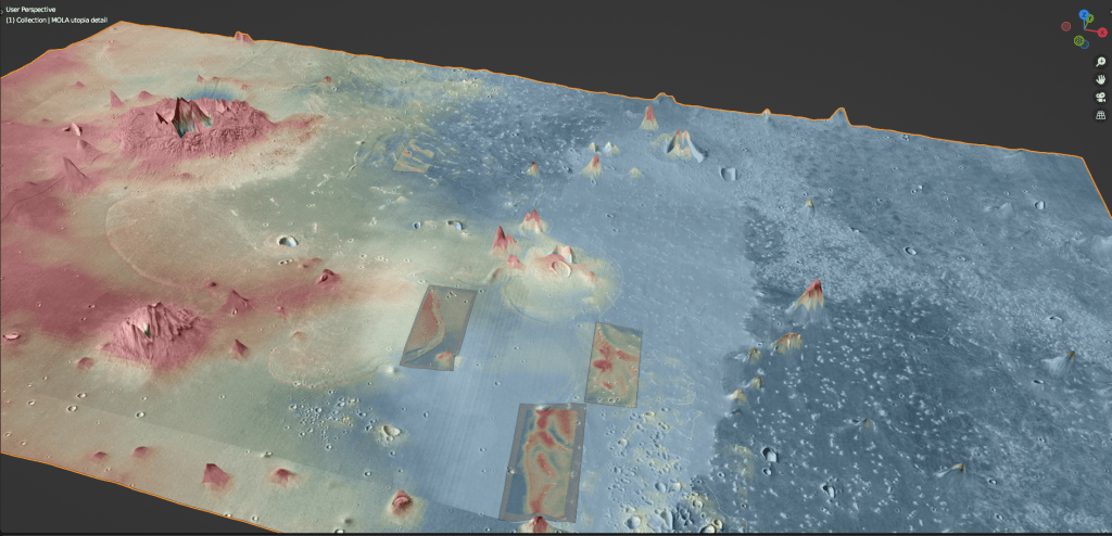
Where it is useful and instructive, the MOLA DEM is displayed in colour, with a translucent overlay of JMars5 high-definition images; this gives the surface texture as well as a feel for the elevation, particularly in Blender 3D displays.
Downloading the images can be a laborious task, and making mosaics on a QGIS map, even more. Trial and error has led me to the following workflow: after download, import the image into Google Mars, and geo-reference it there (easy, with all the craters). Then export it as an ESRI vector file which is easily imported into QGIS. At this stage it’s merely a polygon, so now you have to bring in the raster using interactive georeferencing but this is easy too, just fit it to the polygon. A note on scaling: JMars defines scales as pixels per arc-second. At the latitudes I’m working at, the 4096 scale gives me about 10-12m/pixel. I like this resolution, but don’t want to download that many images and compose them, so I view them at 512 scale and have JMars upscale them to 4096, which is the limit. Often crashes, but with perseverance you get there.
The first illustration is of the North-West portion of the Isidis Basin. A prominent line demarcates the boundary between land and sea, with strong differences between the two on the Night/Day IR display, as well as thumbprint terrain on the seaward side.
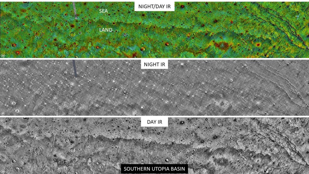
The next illustration is of the Southern reach of the Utopia coastline. In this area the main criterion is a change of albedo across the land-ocean boundary…the Night IR is not diagnostic here.
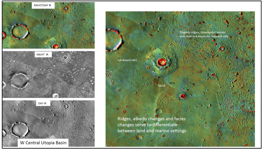
Farther North, we have an embarrassment of riches: ridges, albedo changes, and thumbprints and diapiric structures, attesting to marine deposition.
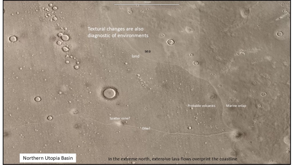
In the extreme North, a facies change is evident across the boundary: volcanics on the landward side, marine deposits on the right.
High-resolution patches (HiRise) on regional (MOLA) model: the coastline is pretty obvious here
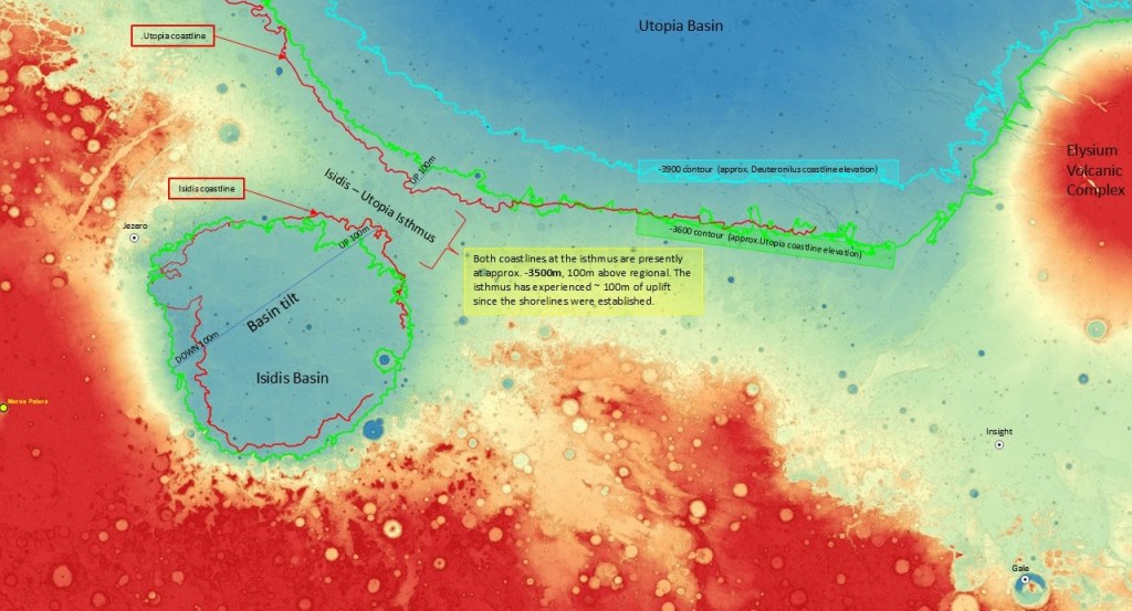
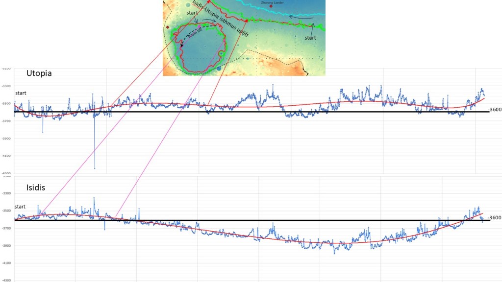
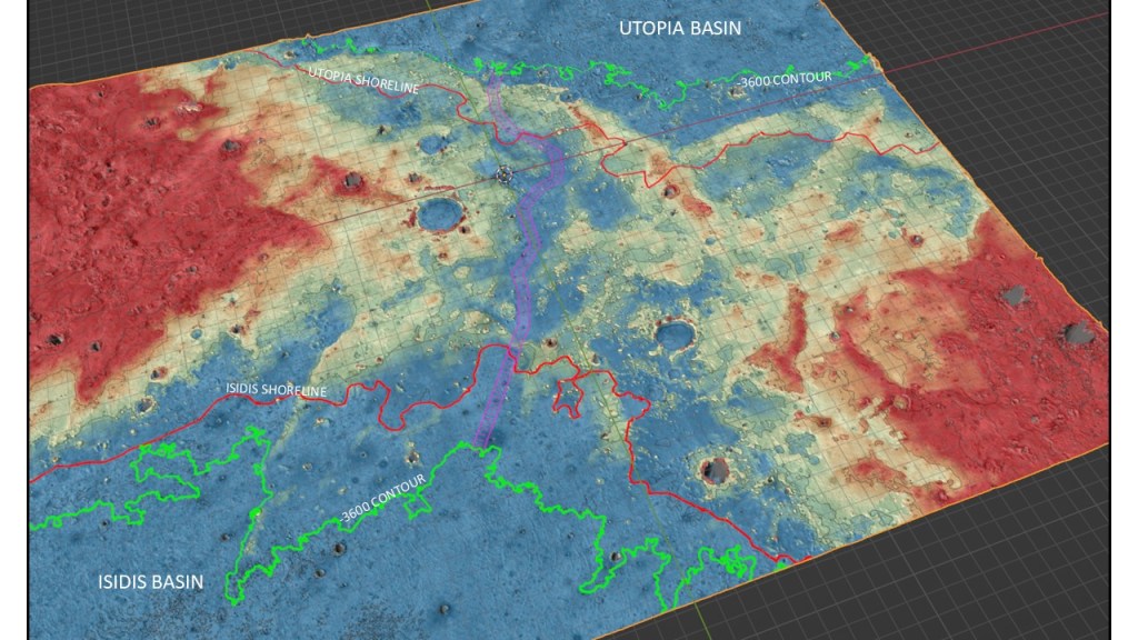
Upon closer inspection, the isthmus between the Isidis and Utopia Basins has a corridor low enough to have provided communication between the basins. I think there’s a good chance they were at the same level initially; cf. Black Sea and Mediterranean. The Isidis Basin appears to have tilted down to the west, and/or the isthmus uplifted over billions of years.
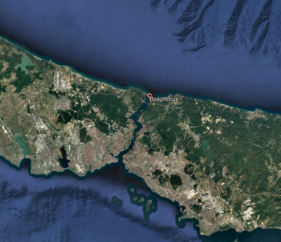
Bosphorus Strait, Med.-Black Sea
The elevation profiles highlight the uplift of the isthmus area as well as the SW tilt of the Isidis Basin