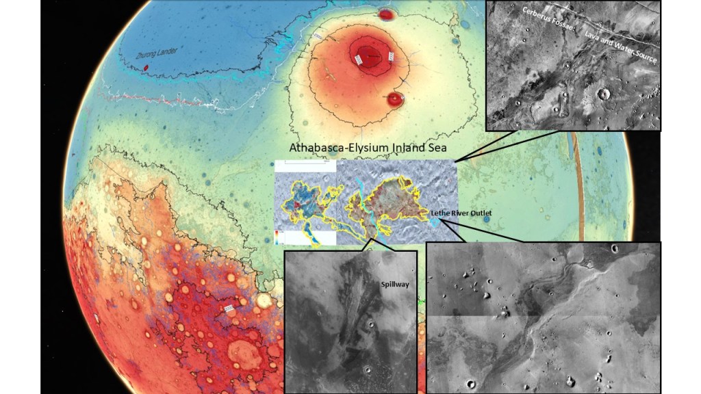
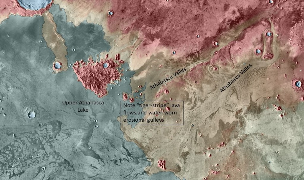
The Cerberus Fossae, located on the flank of the Elysium volcanic complex have been described as faults, dikes, or a combination of the two. In any case, they have exuded huge volumes of lava and water, to judge by the morphology of the flow paths (lava rafts, water-worn channels, contoured islands). All of this extruded material seems to have been pooled down-dip in a large, now flat, area which may be referred to as an inland sea, being far inland of any documented Boreal Sea shorelines.
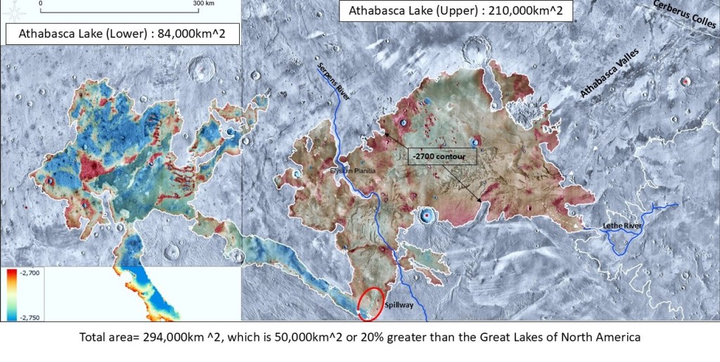
For convenience I’ll label this as Athabasca Lake, upper and lower, illustrated by the elevation colours below:
A close-up of the Cerberus Fossae source of the discharged material:
Same, with more stand-off:

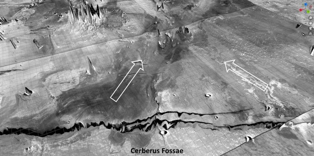
An oblique view showing the detailed geo-morphology of the drainage system. Here I’ve given the “lake” a translucent blue colour:
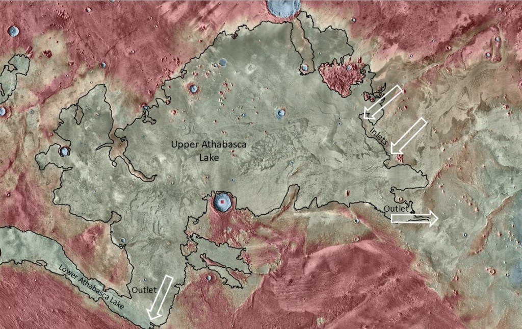
A step back to show where the influx and the outlets are located:
Top-down view of the Lethe river drainage, with the river mouth, a crevasse splay/washover lobe and a cataract in colour:
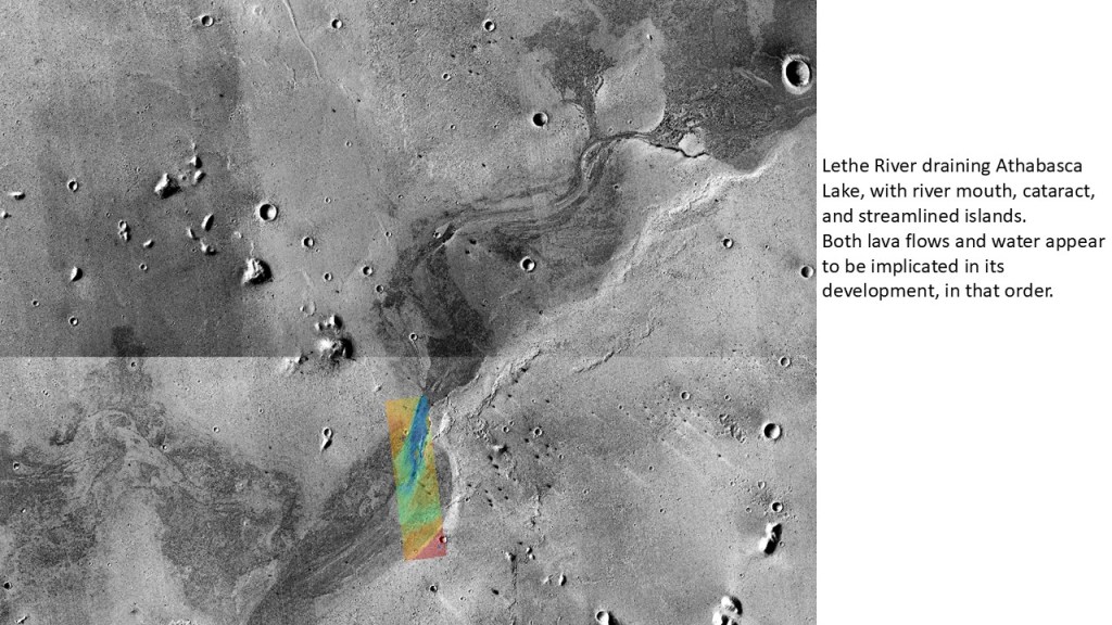
Close-up of the river mouth:
Tilted view illustrating the extreme flatness over a large area:
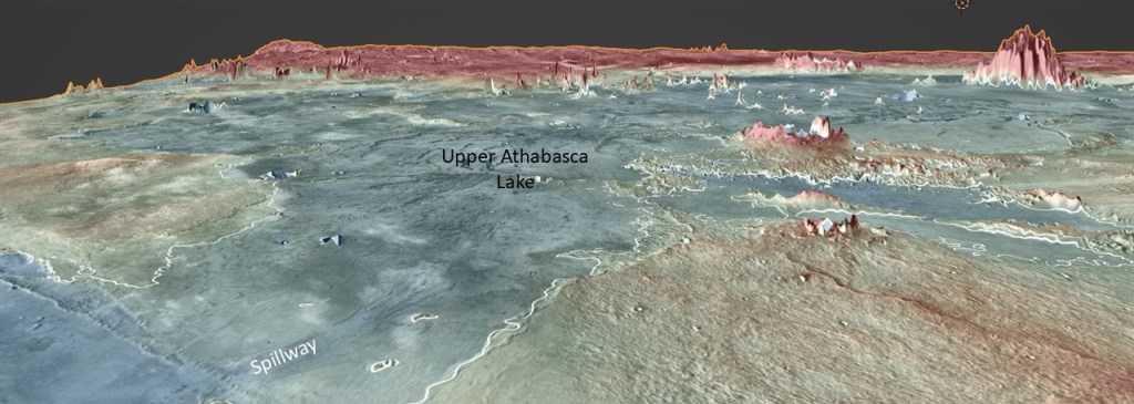
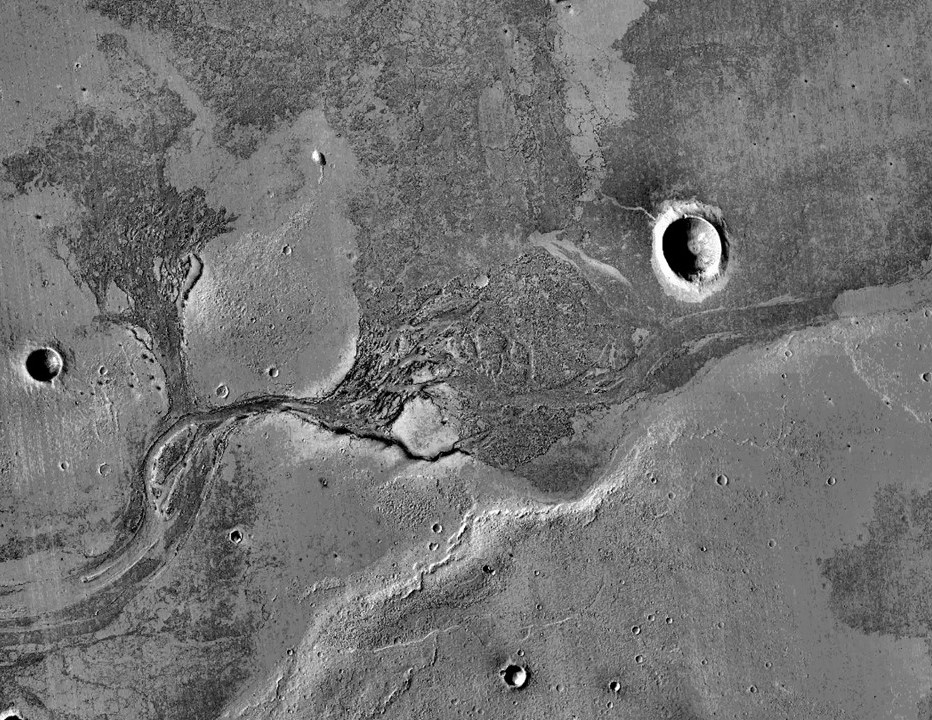
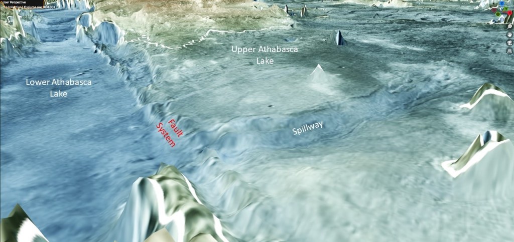
Close-up of the spillway from the upper to the lower lake. My guess is that the lakes were originally at the same elevation with a lava floor, then faulted down to the left, followed by water erosion forming one major and several minor gulleys.
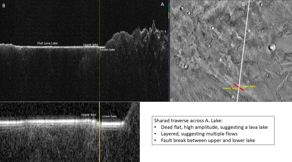
A radar transect of part of the lakes emphasizing the flatness of what was apparently a lava lake, formed by several distinct flows. The fault between upper and lower lake can be seen on the enlargement.
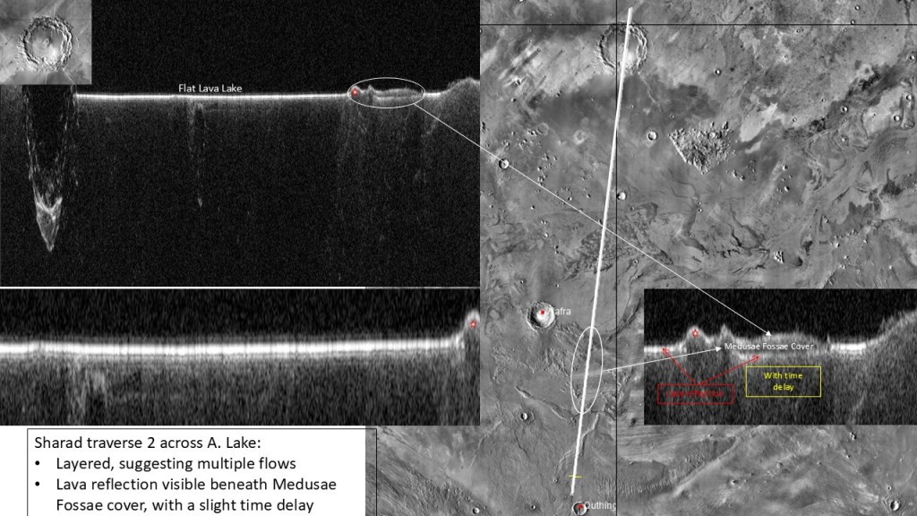
Another transect with one end crossing a Medusae Fossae erosional remnant, causing a time delay of the underlying lava reflection.
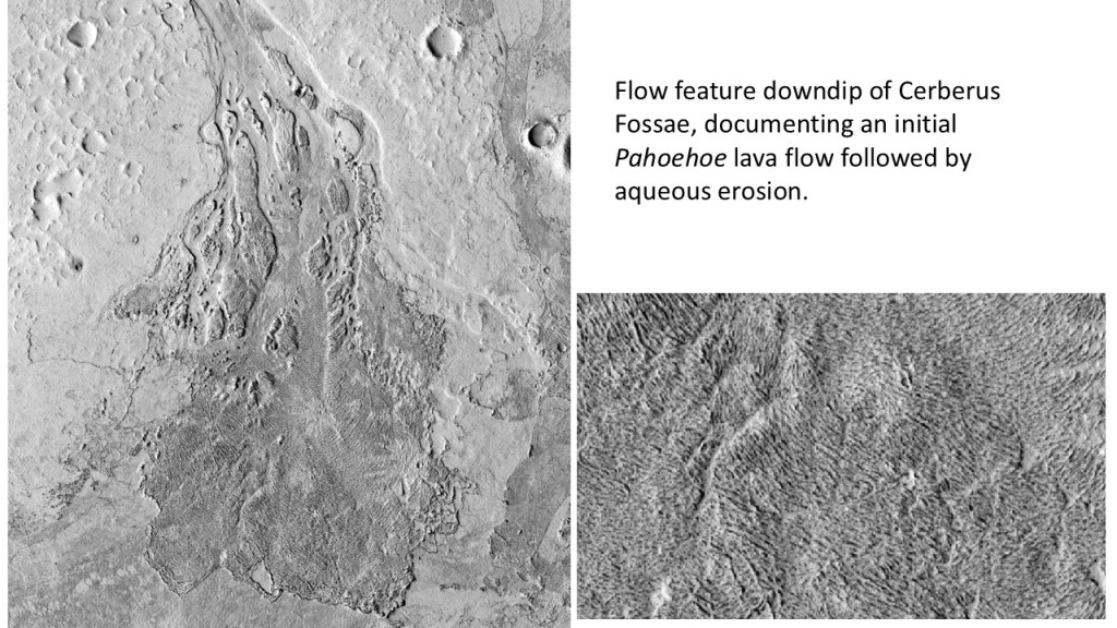
And finally, an example of the dual lava/water nature of these flows: a classic Pahoehoe type flow followed partial water erosion.