There have been a lot of different ideas for human habitation on Mars: tunneling into the side of Tempe Mensa, making bricks from Martian regolith, coaxing fungi to produce building materials, or crawling into lava tubes; the main challenge is to find the most energy-efficient way to escape the radiation and dangerous chemical environment on the surface, not to mention the extreme cold and relative lack of atmosphere. The lava tube idea has frequently been put forward, most candidates being on the sides of the great shield volcanoes, with evidence ranging from chains of pit craters to actual skylights and a visible floor. These tend to look like ant-trap spider’s nests and would require a winch or lift to negotiate the vertical drop of tens of meters. A more attractive proposition would be to find a similar edifice at ground level, and I think I may have seen just that in the heart of Deuteronilus Mensae.
Proving this is going to be a challenge, as most of the academic community has a different interpretation of these landforms: my postulated lava tubes are considered to be expressions of compressional deformation between two lobes of converging ice-cored debris aprons, and my lava flows are interpreted as mantling deposits composed of a thick layer of dust and ice. So I have a steep hill to climb, but I’ll try…
To begin, a look at the context with some introductory maps:
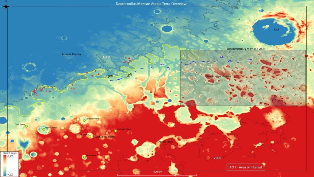
The first shows the general Arabia Terra-Deuteronilus Mensae area, with the giant Lyot Crater in the NE corner; the -3600(blue) coastline, the -3900(yellow) coastline and the big mud-flows circled in red. The area of interest is within the box on the right.
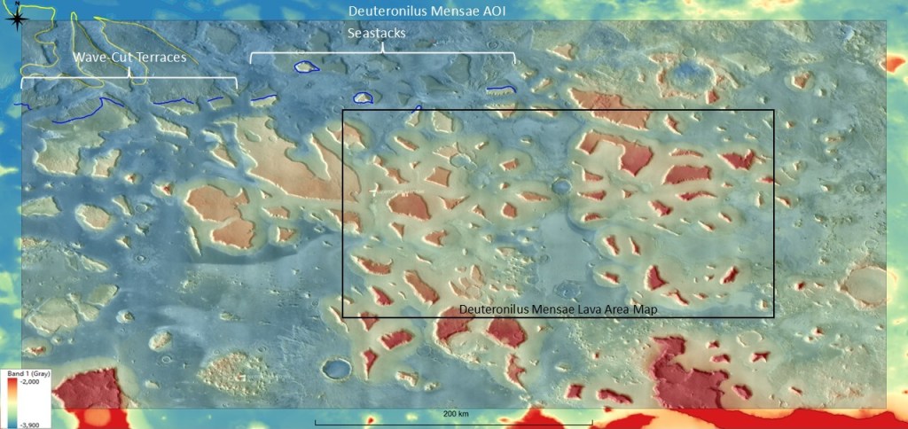
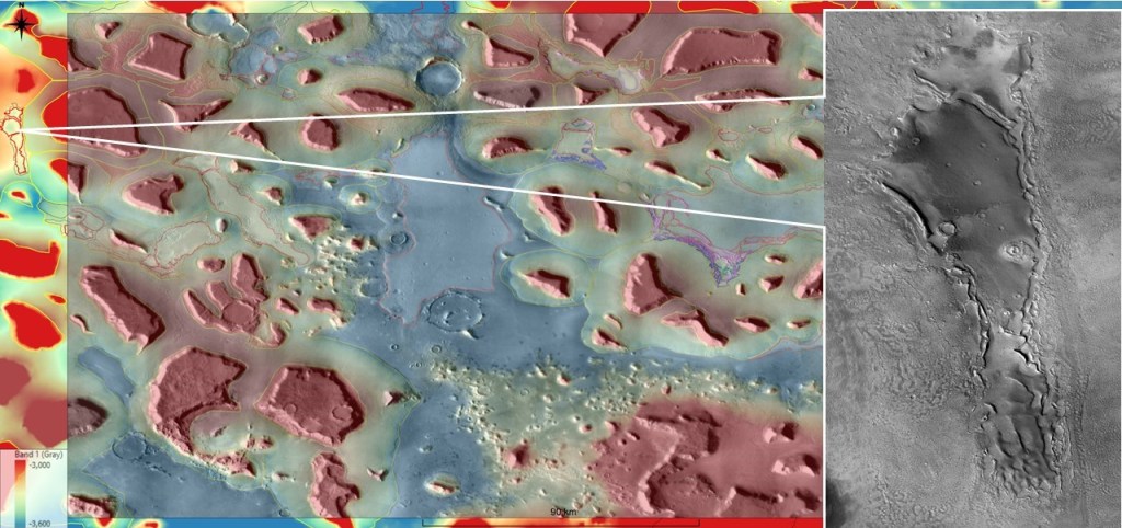
Zooming in to the AOI below: note the transition between the sea-stacks and the wave-cut terraces to the north, and the main mesas which give the place its name; and in the center of the box, just above the midline, a large crater which will be relevant to the lava flow discussion:
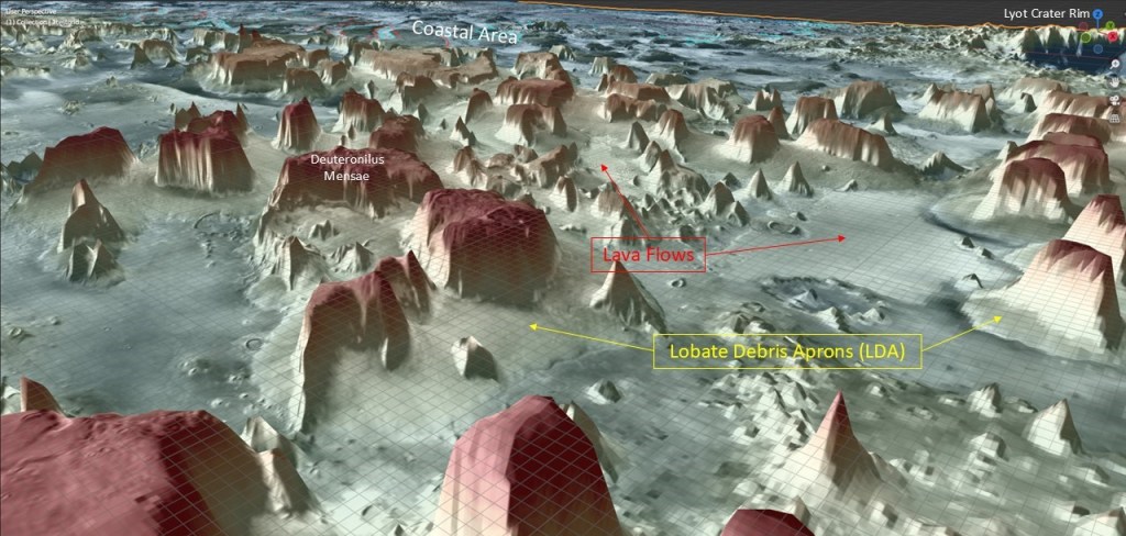
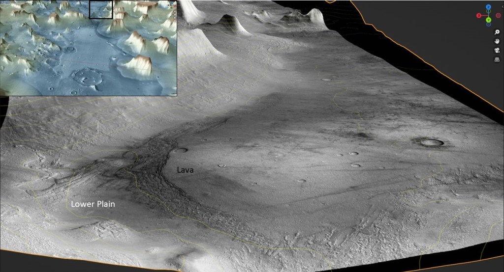
The following is a 3D rendering of the general area. I put it in because I think it’s a cool picture.
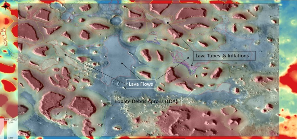
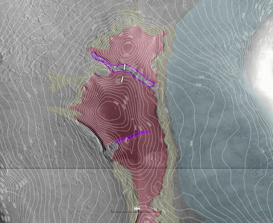
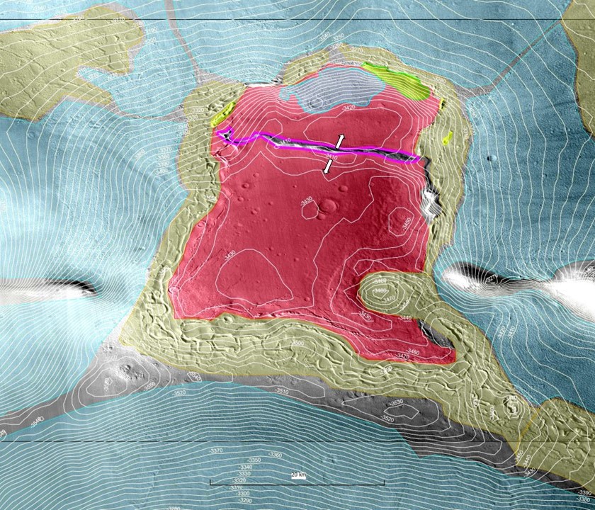
The more detailed map below outlines the proposed lava flow areas in red: (the lava tubes are too small to be resolved here).
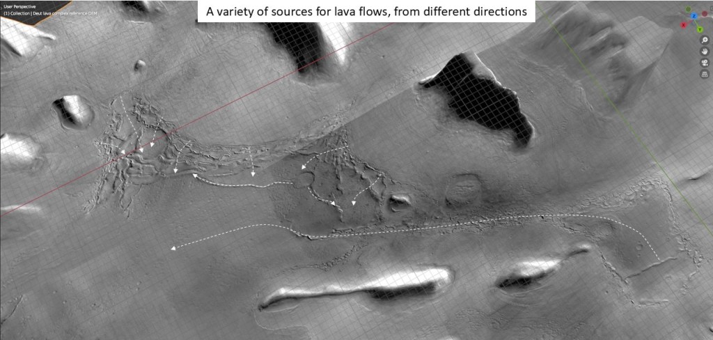
To back up a bit: I will be trying to make a case for lava tubes and inflations. For that I need lava. For lava I need magma; and to get the magma to the surface I need a mechanism. Enter the Lyot impact:
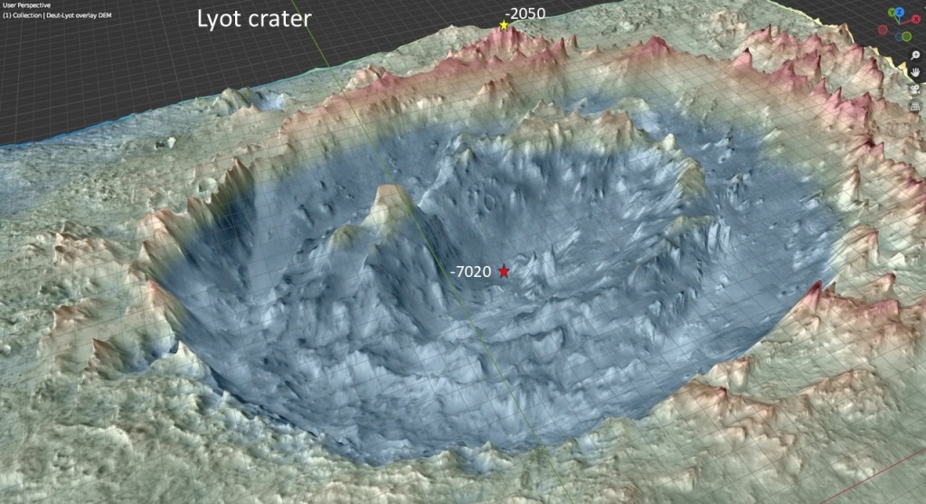
Lyot is a monster of an impact crater: ~230km in diameter, and ~5km from highest rim point to the bottom which is the deepest point in the northern plains. It is called a peak ring crater because it has a double ring where most craters have a single rim and a central peak or cone resulting from the rebound. I am suggesting that the energy from this impact was sufficient to bring magma to the surface and cause eruptions from fissures and fracture systems in old impact craters.
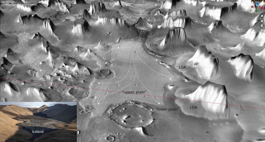
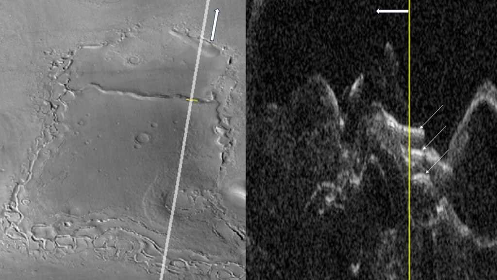
The image above shows an extensive lava flow emanating from the old impact crater previously mentioned. It has a well-defined flow direction and edges. In the literature, it is referred to as “upper plain”, composed of mantling material, which is described as air-fall dust or ash mixed with ice. Closer inspection shows the edges of this body to be quite distinct and abrupt, more consistent with a lava flow interpretation than a mantling layer which ought to be more wide-spread. The following sequence is a 3D rendering of CTX images giving a close-up view of the lava edge. (the CTX scans come with a lot of black space which causes them to obscure adjacent images)

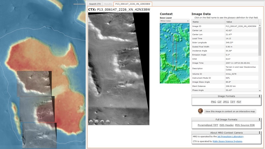
As an aside, on one CTX image, occasional gas (ice crystal?) plumes are visible:
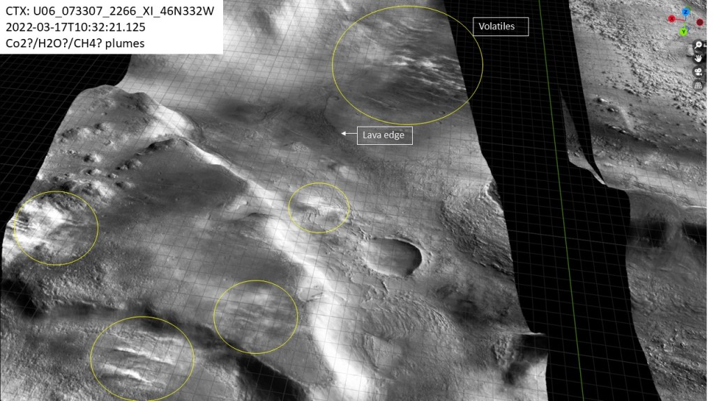
And closer:

Lobate Debris Aprons
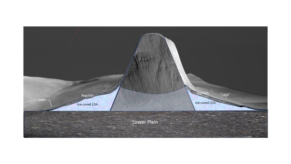
The eponymous mensae in the Deuteronilus Mensae area are mesas of various sizes, with steep to near-vertical sides, and flanking debris aprons. The latter are thought to be largely composed of ice, and capped by talus or regolith sourced from the mechanically weathered mesas. A schematic cross-section is shown below:
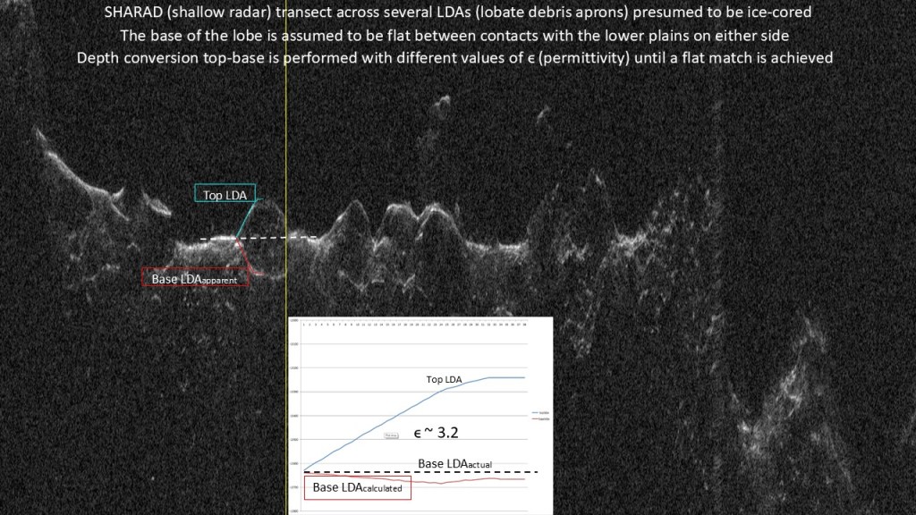
A shallow radar (SHARAD) transect, with top and base of the LDA picked. Much like in a seismic depth conversion utilizing interval velocities, the radar delay time can be used, with a range of permittivities, to calculate depth to the base reflector. The permittivity that gives the closest match to a flat base turns out to be about 3.2, consistent with water ice.
The genesis of these icy LDAs begins with a thick, extensive ice sheet, which is covered by debris (regolith) from the mechanically weathering mensae.
As the ice sheet melts or sublimates, the regolith moves downslope and covers it around the mensae, protecting the underlying ice.
At a late stage, most of the ice sheet has disappeared, leaving behind donut-shaped lobes surrounding the mensae.
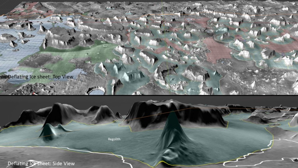
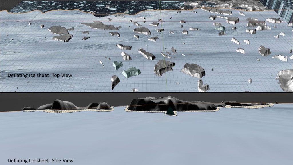
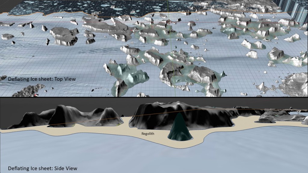
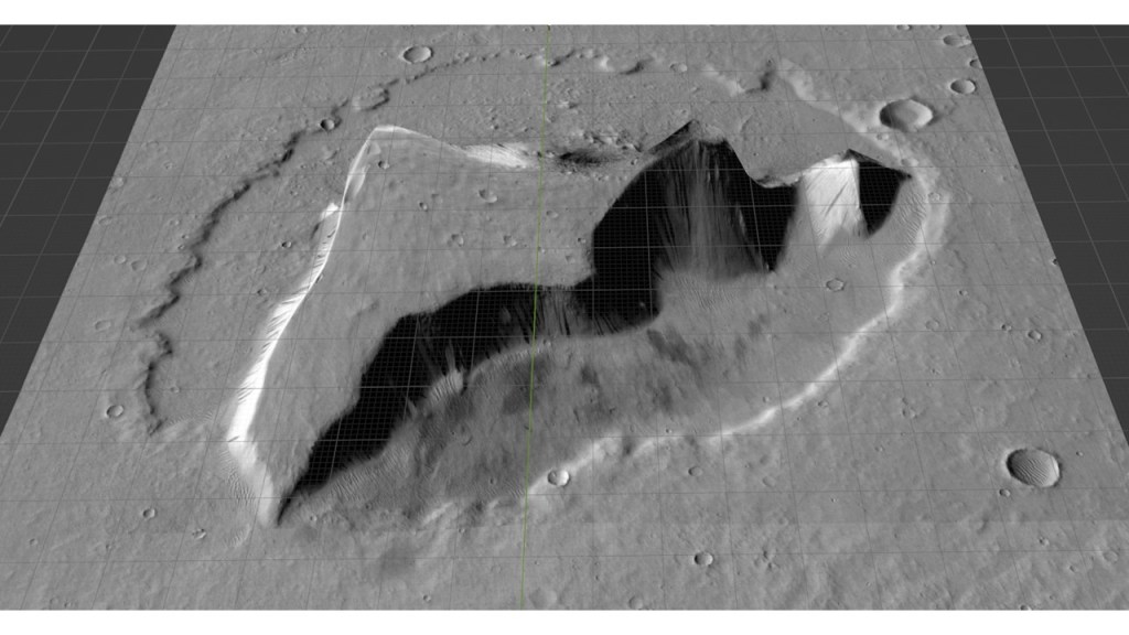
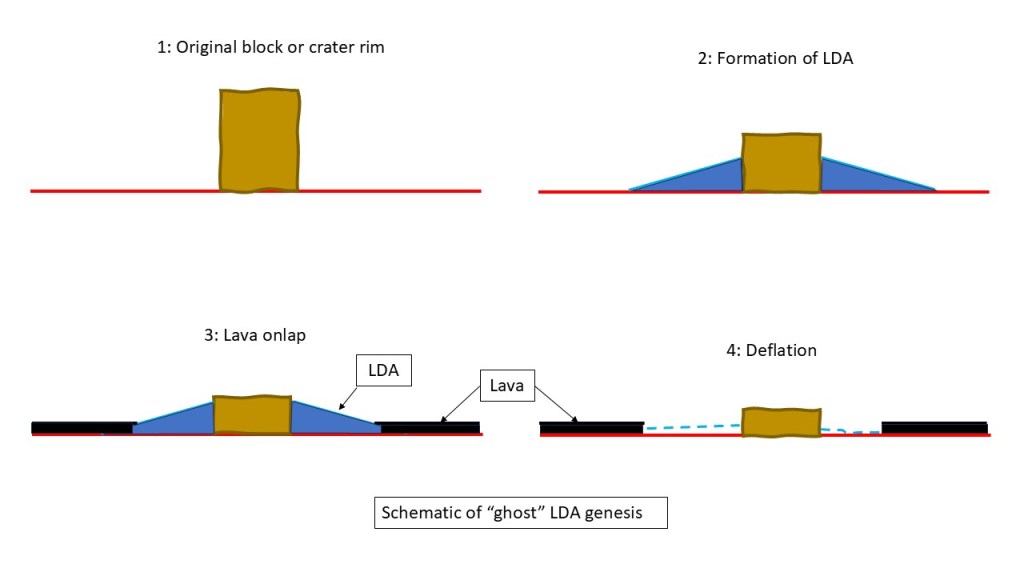
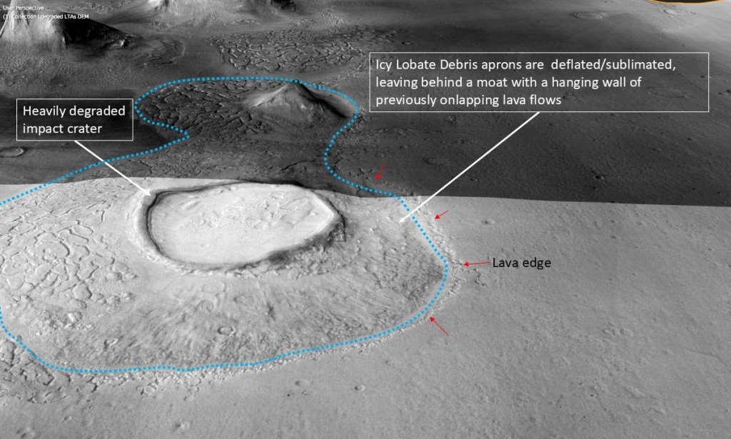
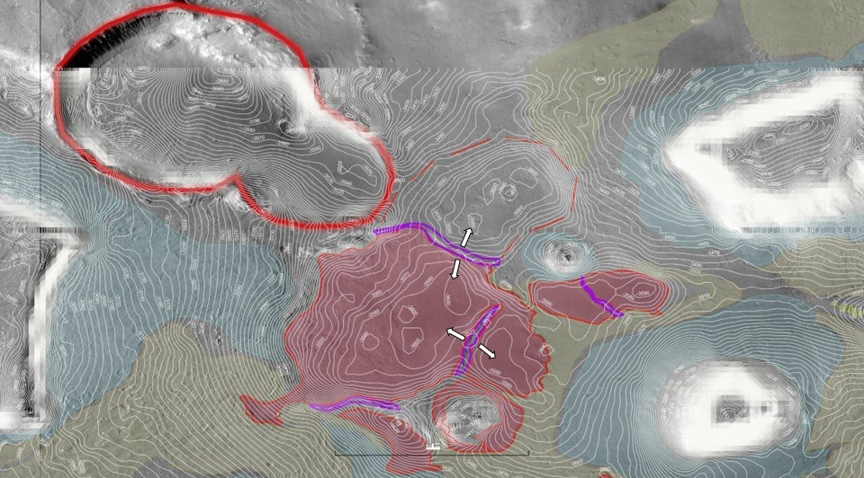
An interesting paper I just came across makes a convincing case for relict or “ghost” Lobate Debris Aprons in the Kasai Valles region. The hypothesis is that LDAs, being ice-cored, are subjected to sublimation and deflation over time, especially in equatorial regions. In Kasai Valles, extensive lava flows took place, onlapping these LDAs, and upon their deflation we see a moat bordered by a wall of lava. A couple of illustrations follow:
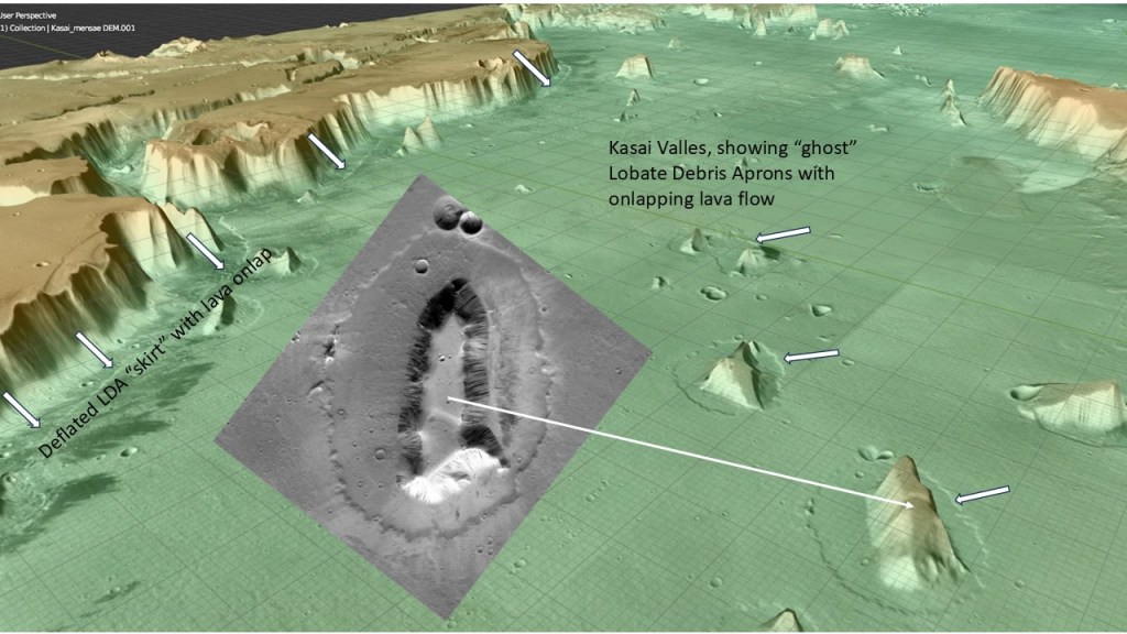
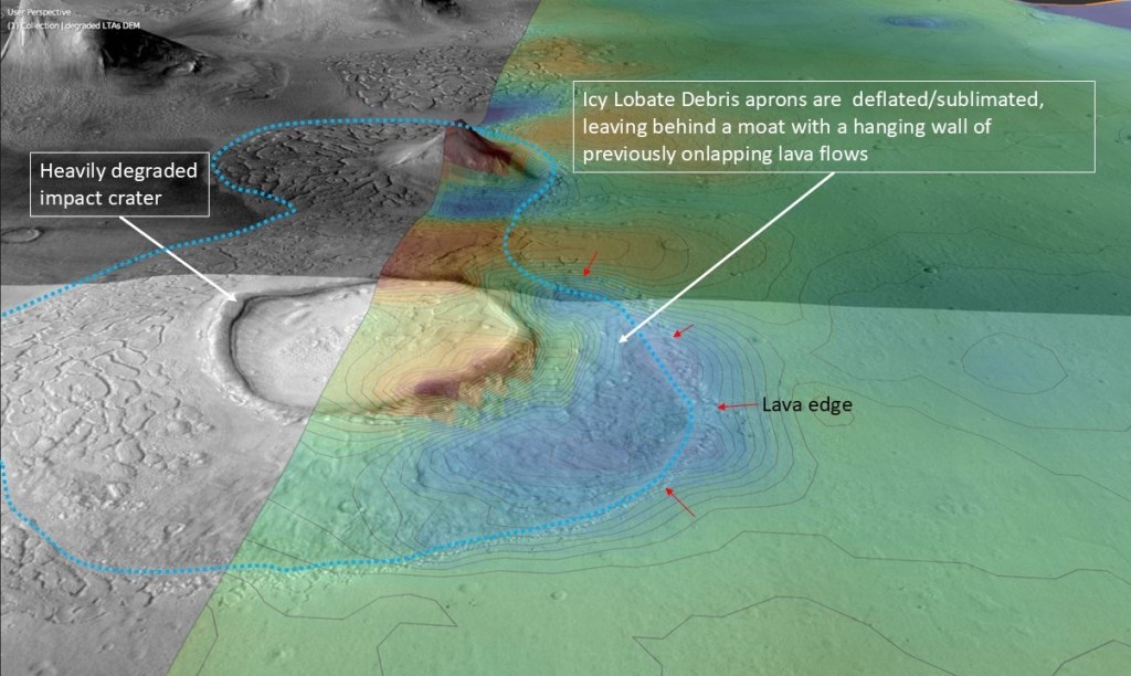
Another, oblique view:
Journal of Geophysical Research Planets – 2008 – Hauber – Geomorphic evidence for former lobate debris aprons at low latitudes
on Mars: Indicators of the Martian paleoclimate
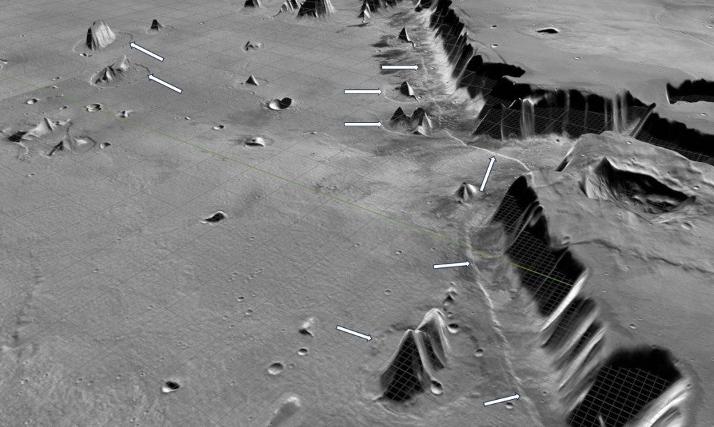
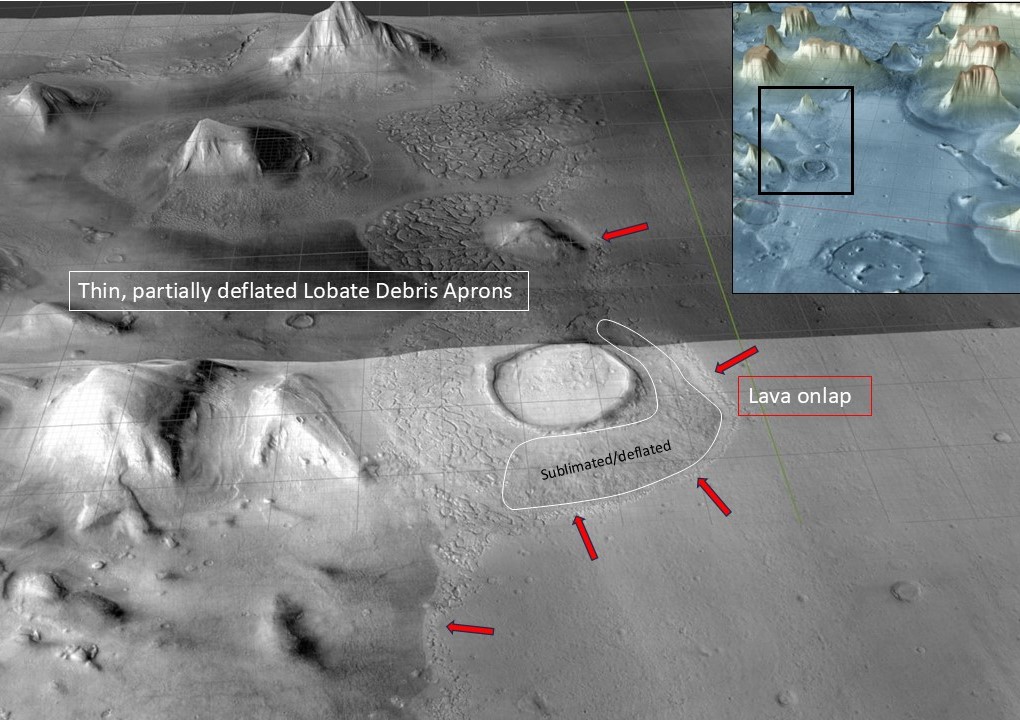
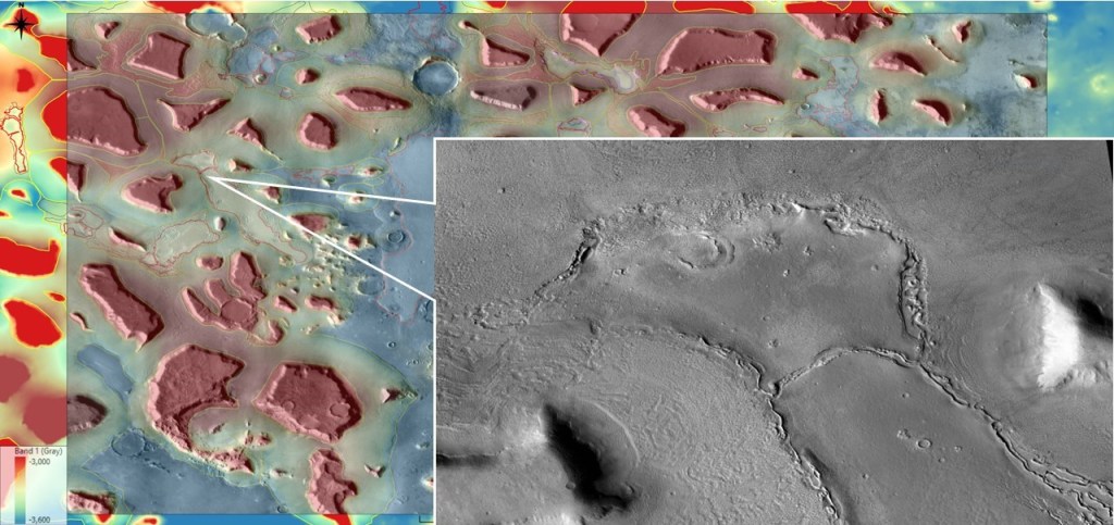
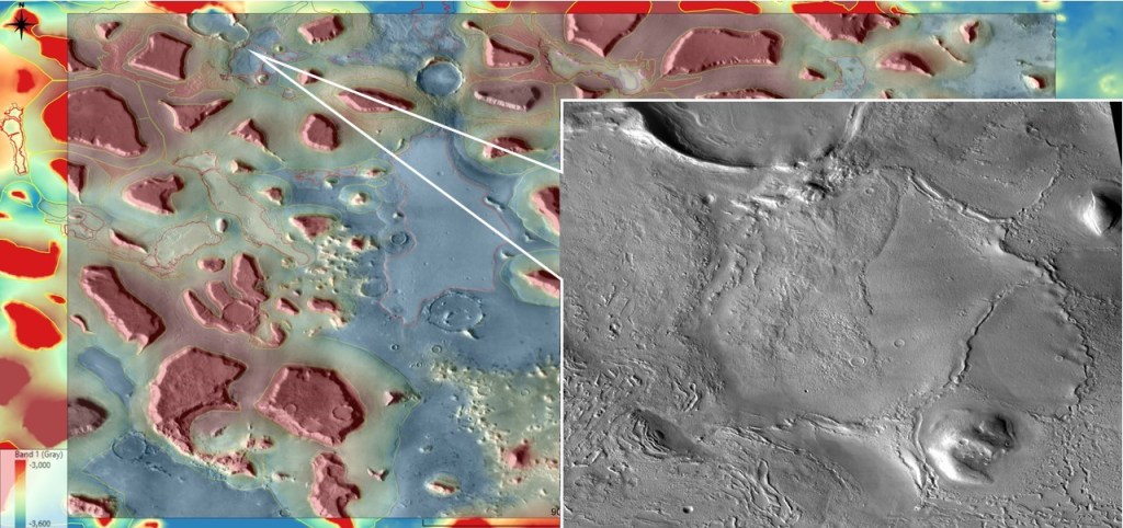
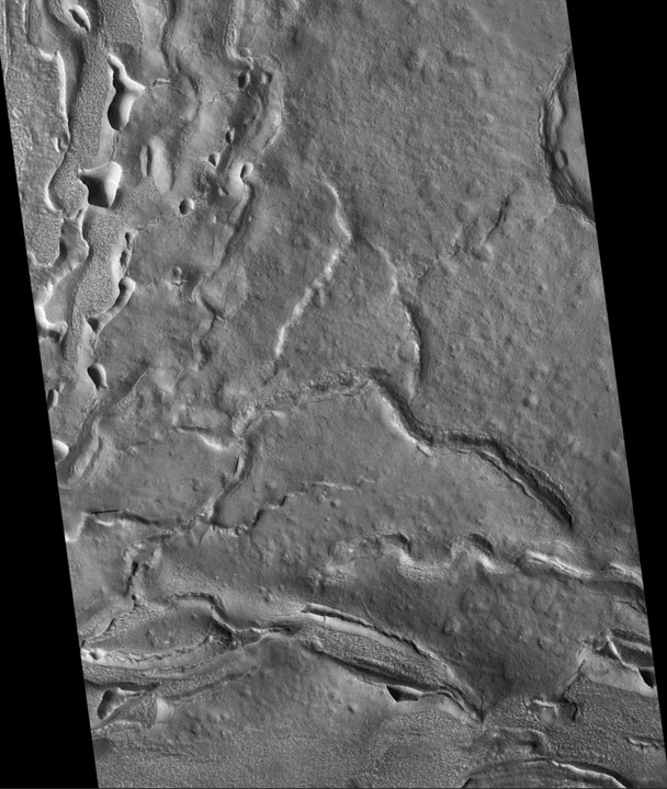
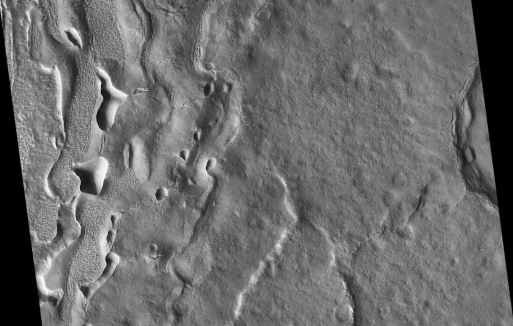
Turning to Deuteronilus Mensae, a similar pattern is seen. Although this is in a more northerly setting, and most of the LDAs are relatively intact, some of the thinner ones have been, at least partially, deflated (probably because the lower crater rims and mounds did not source sufficient regolith to effectively insulate the underlying ice) :
Lava Flows
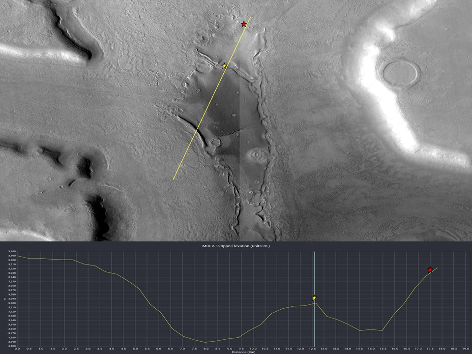
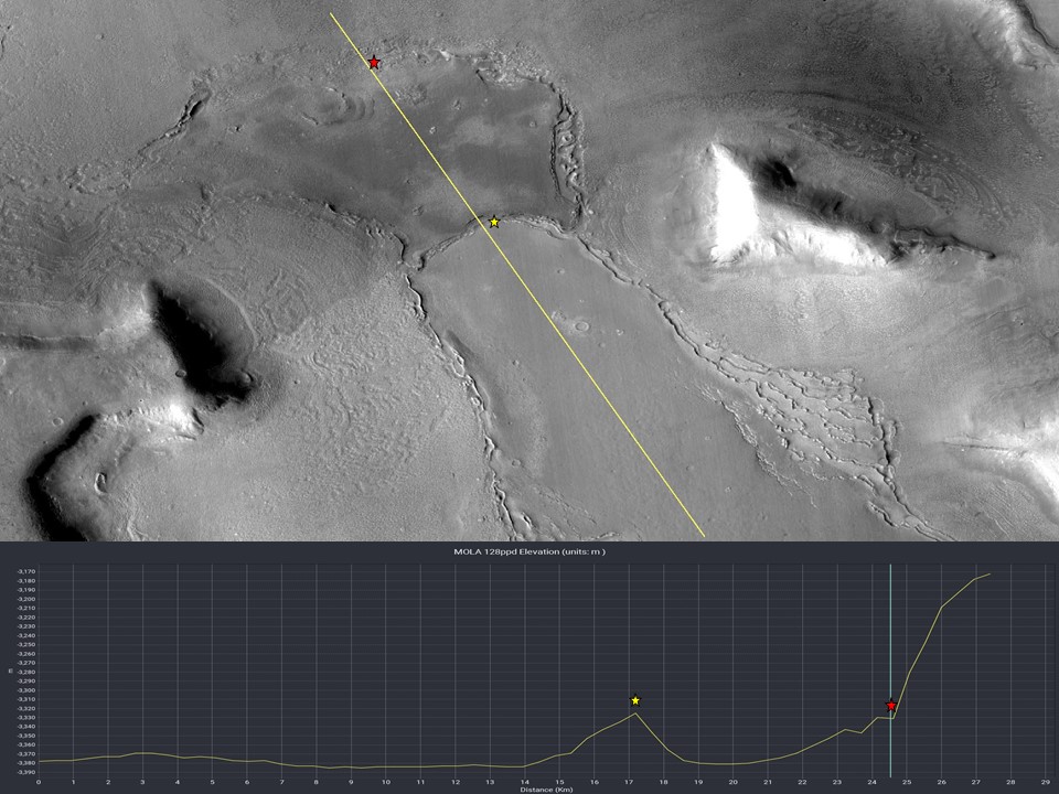
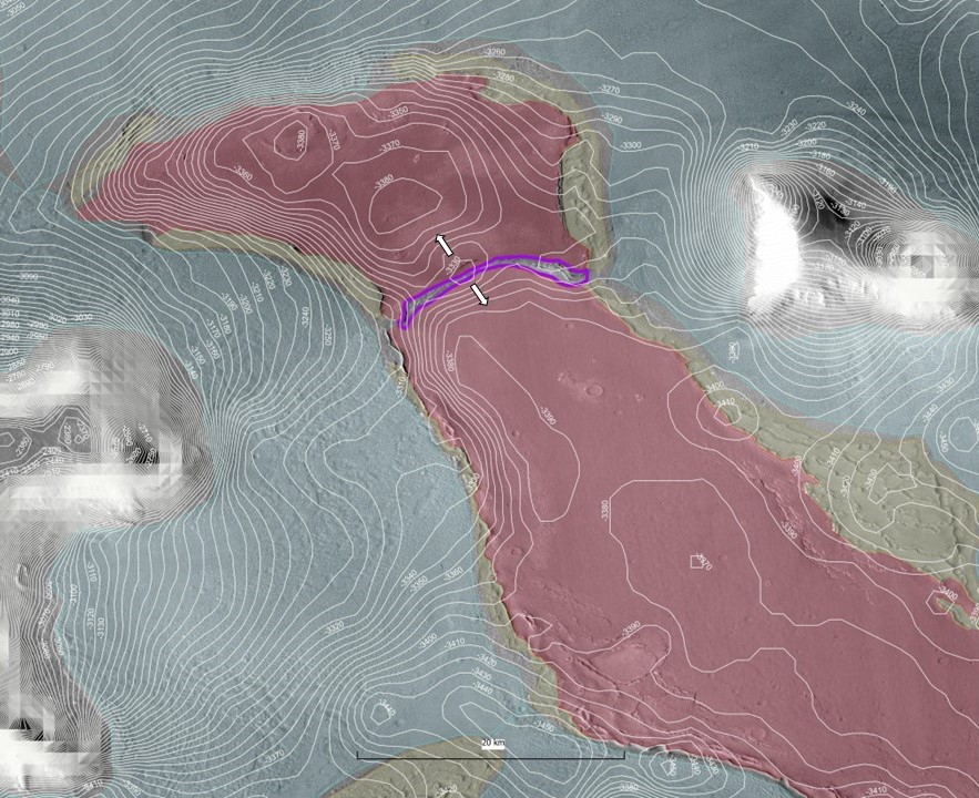
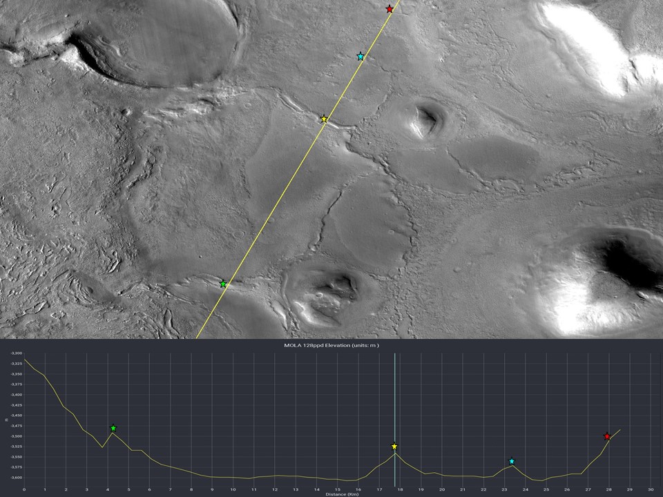
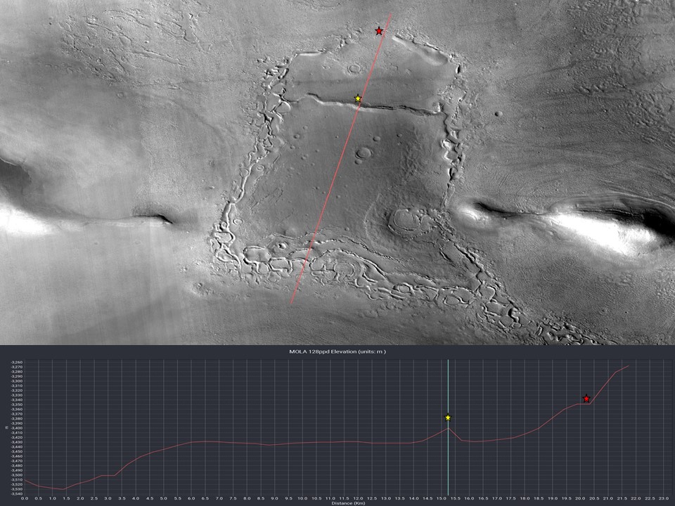
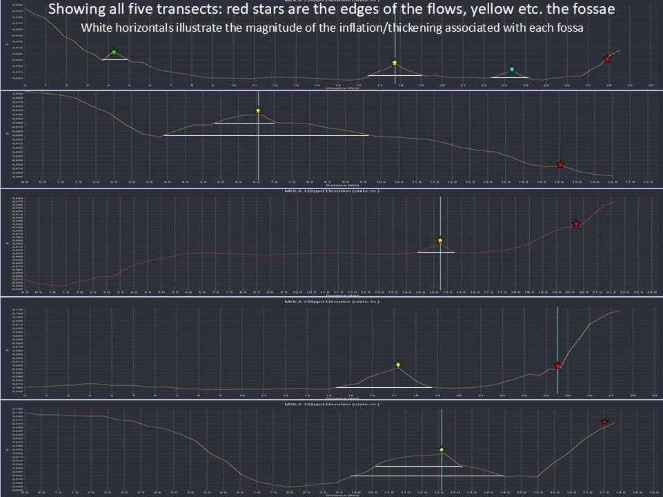
The following is a regional catalogue of lava patches across the Deuteronilus area, with location maps and elevation cross-sections for each
Patch#1:
Patch#2:
Patch#3:
Patch#4:
Patch#5:
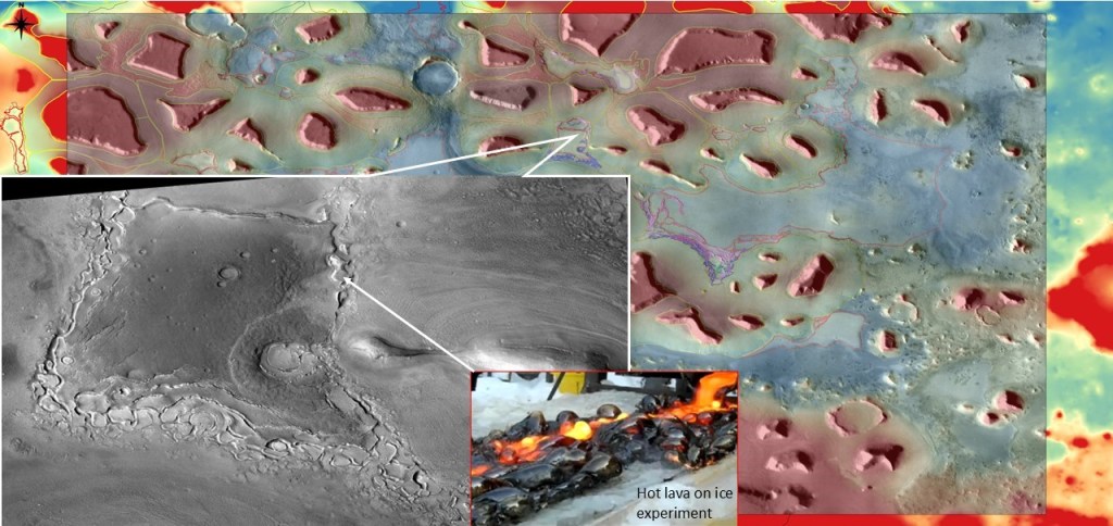
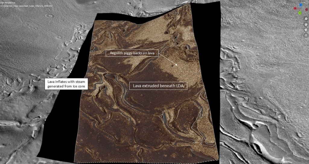
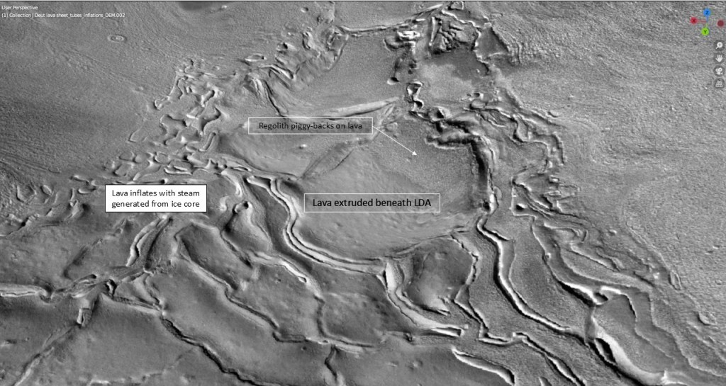
(The insert shows what happens when molten basalt meets ice; the steam generated inflates the lava into bubbles and/or breaks it up into shards or rafts. This could explain the fretted nature of the lava-LTA interface)
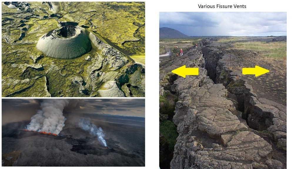
The common feature in each of these patches is a linear gash located on a ridge, interpreted to be the fissure vent which extruded the lava sheets.
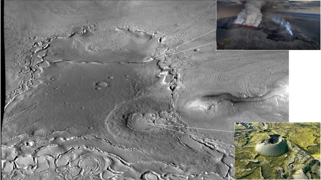
The circular buildup may be an eroded cinder cone, or simply a secondary lava flow from a fractured impact crater.
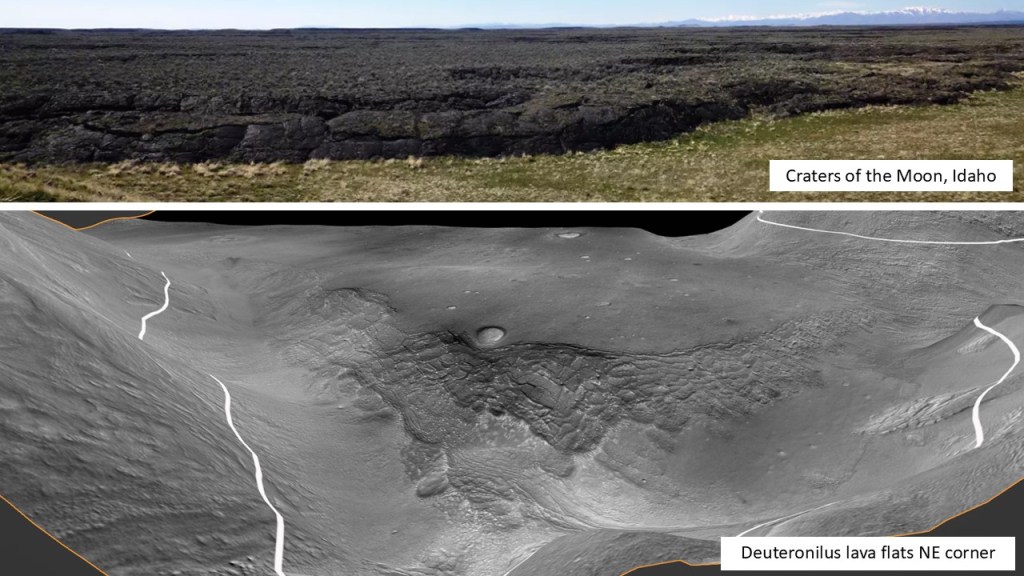
This is the basic analogue
Another oblique view for detail:
A summary of all of the fissures:
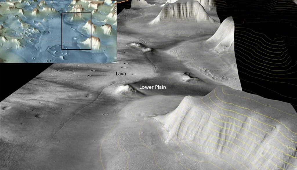
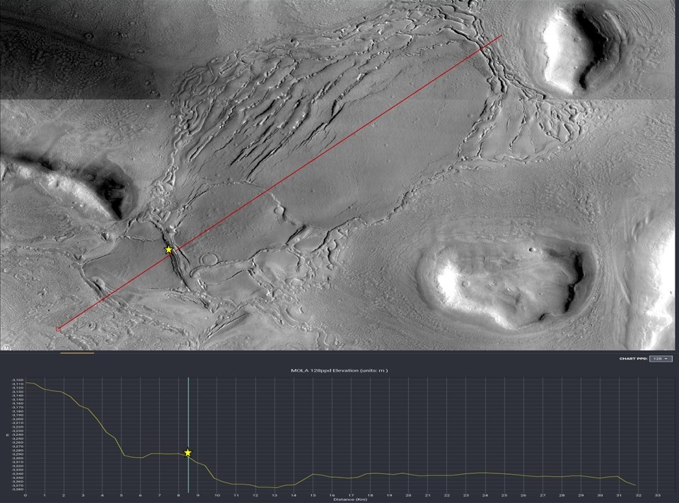
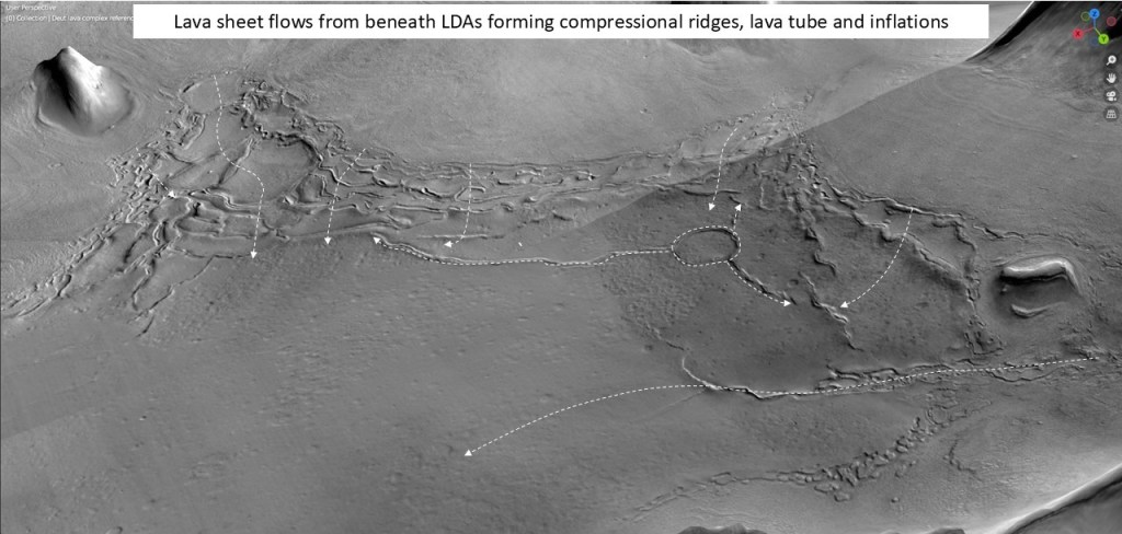
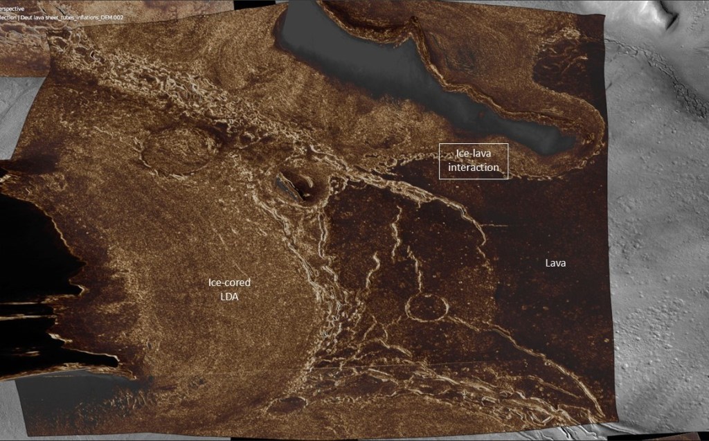
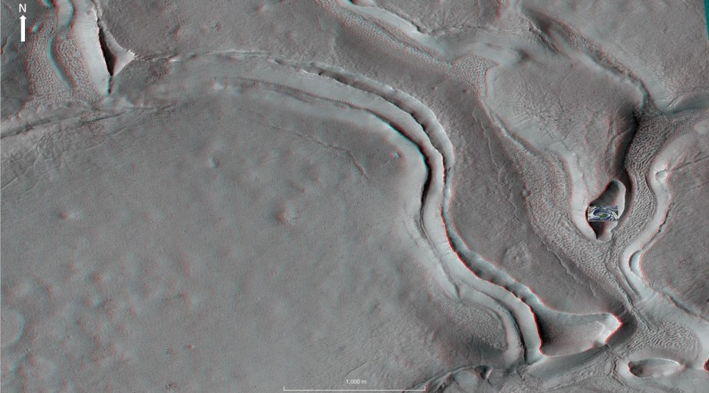
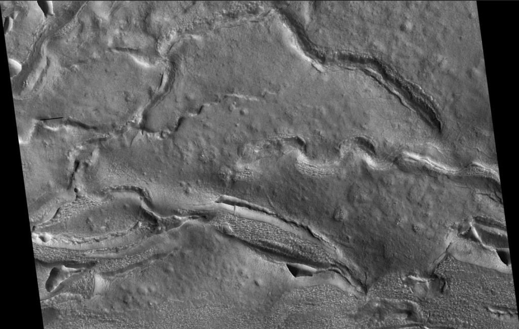
The model as presented, of sheet flows emanating from visible fissures, is a bit of an over-simplification. Using the shallow radar (SHARAD) data, a more complex picture emerges. Possibly multiple flows:
…and sheet flows emanating from beneath Lobate Debris Aprons:
Closer look:
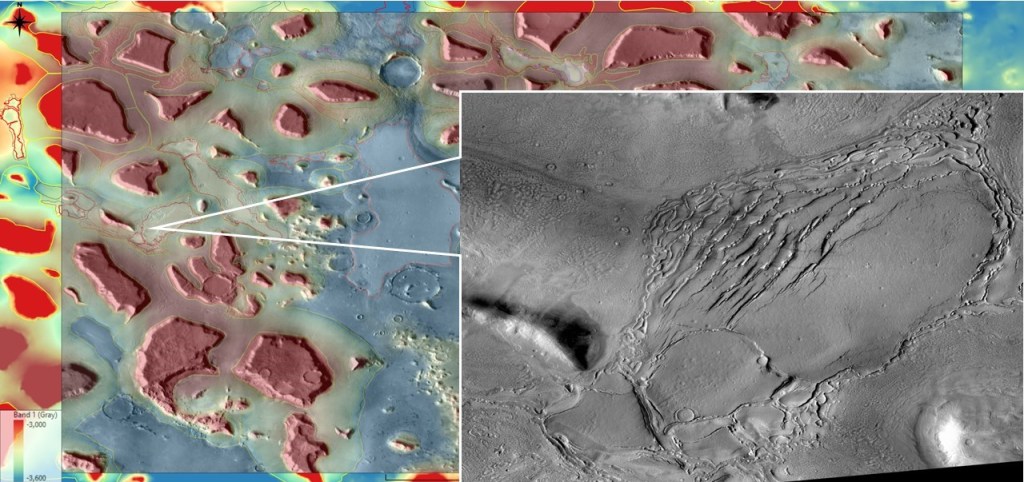
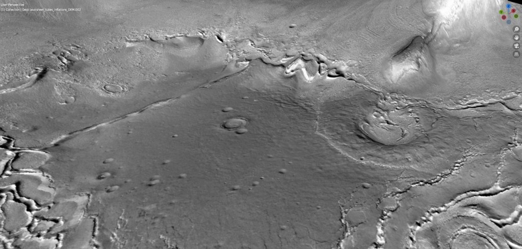
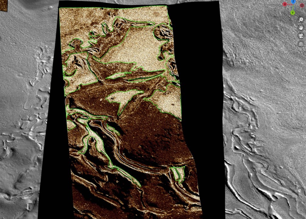
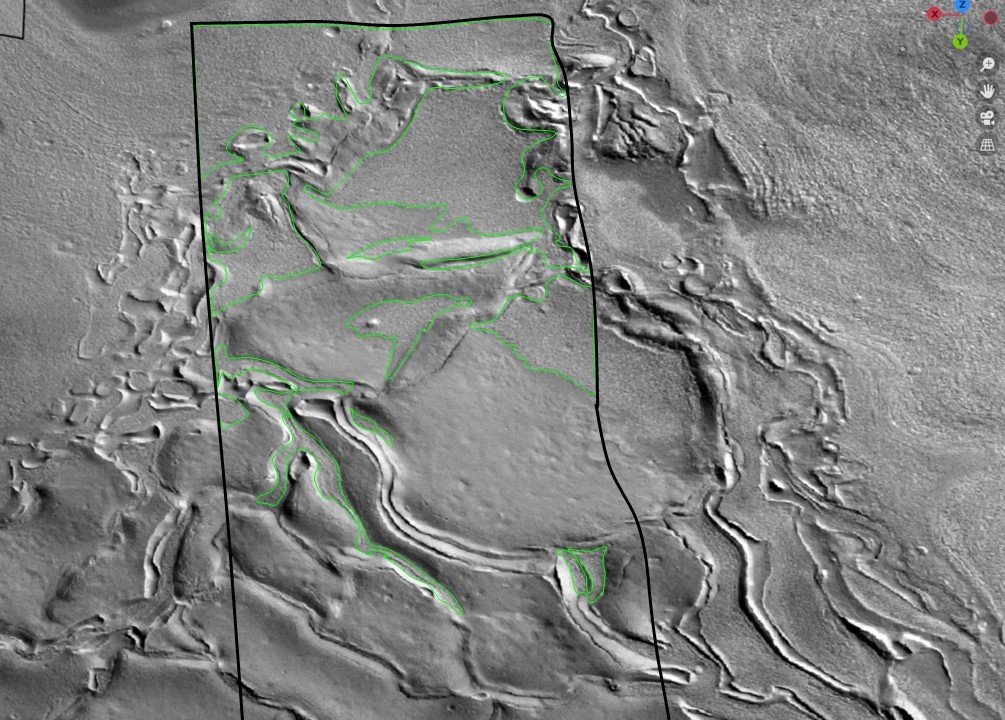
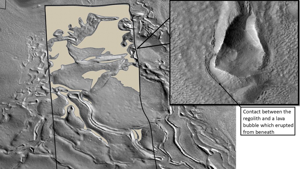
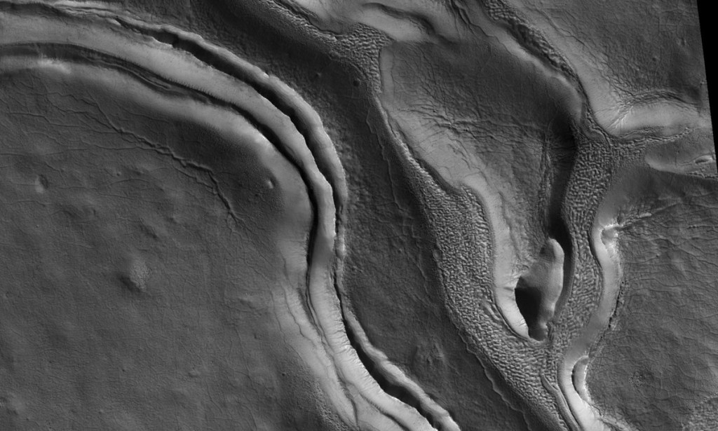
To aid in the distinction between LDAs and lava, some image processing for texture and edge enhancement:
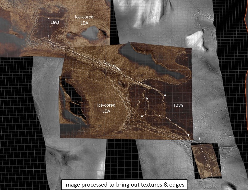
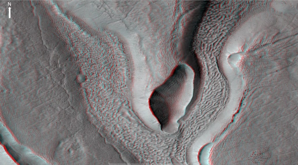
Looking at the detailed stratigraphic relationship between the LDA regolith and the lava it is apparent that the regolith is on top of the lava. In places, penetrated by the lava. This certainly does not look like a mantling layer, but rather, a layer that flowed out from beneath the LDA, inflated by the steam resulting from the lava-ice contact.
And again:
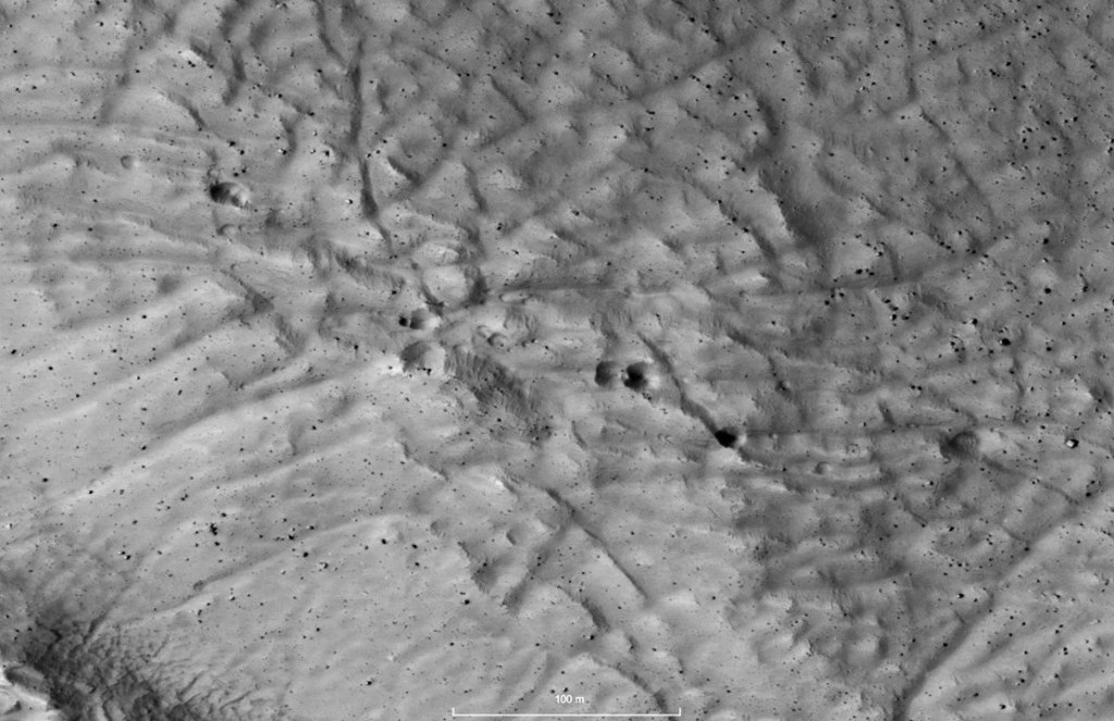
Zooming in on some of the inflation structures:
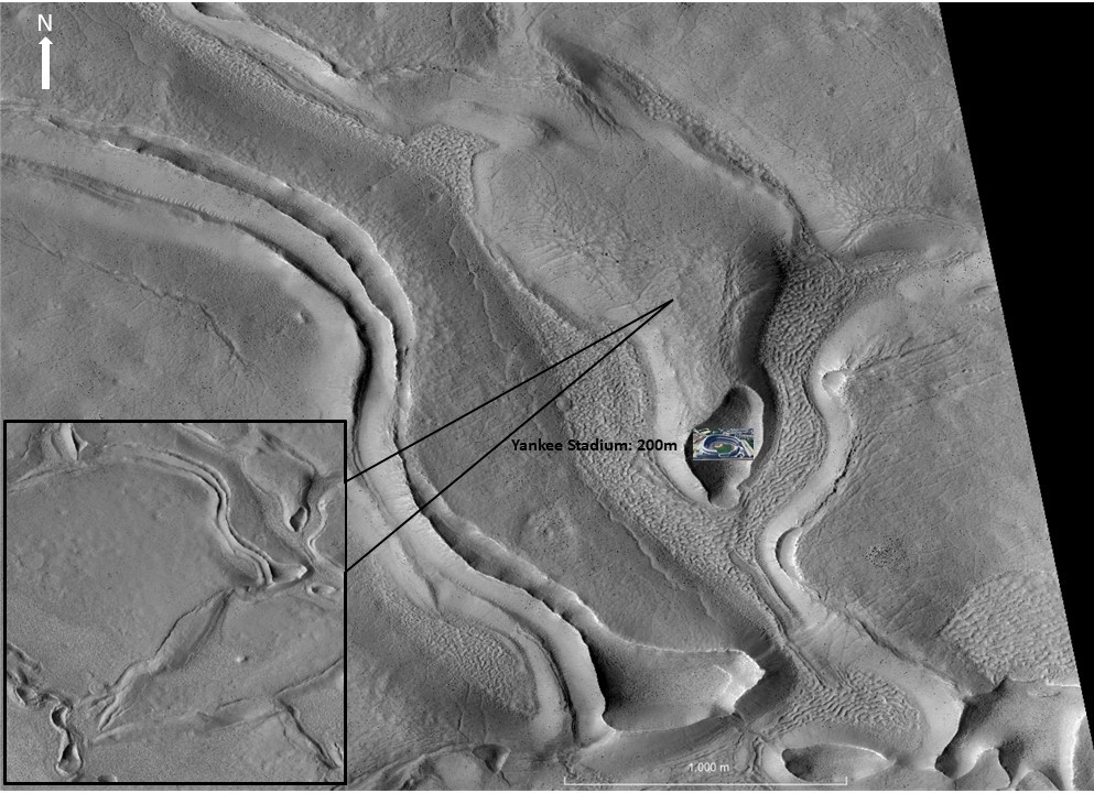
There’s obviously some quite large structures here, and if they are inflations and hollow (even if backfilled with windblown sand and dust) could provide shelter for scientific bases, after some excavation. Note Yankee Stadium for scale.
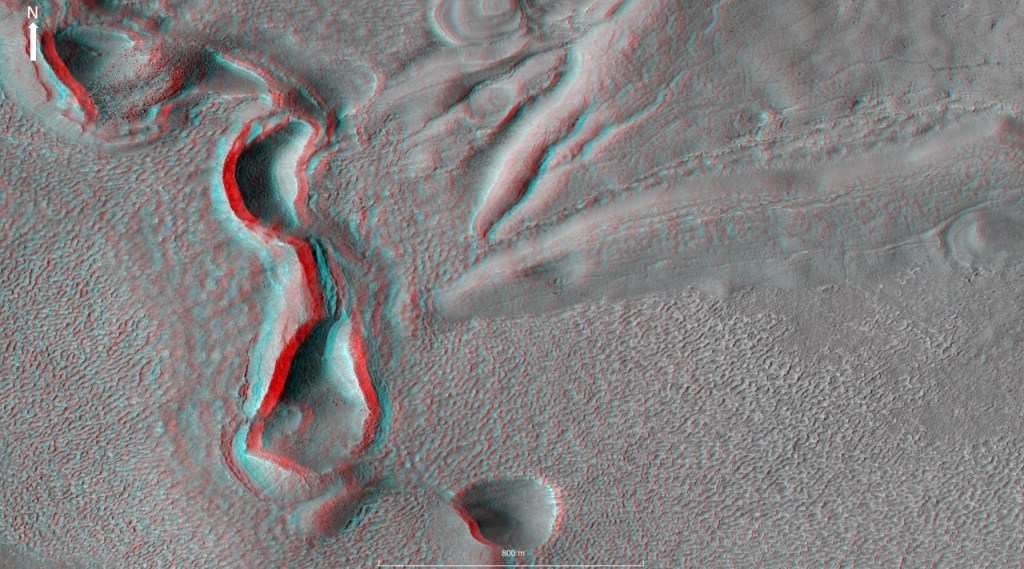
Another shot, this time an anaglyph from a stereo pair. You need red-blue glasses (blue right) to see the stereo effect.
A little closer:
If you don’t have stereo glasses, the following high contrast image will help with the depth perception:
I had requested a stereo pair and a calculated DTM on the citizens’ HiWish app, and this is what I got. With the low sun angle and a bit of contrast it does a pretty good job anyway. It would be good to have a DTM derived from the anaglyph pair, to get some firm data on the height of these structures.
An interesting feature on this structure is a number of conical pits, 15-20 meters across, in the roof. Could they be de-gassing vents, blowing off the steam that inflated the structure? Note the boulders too.
Speaking of boulders…
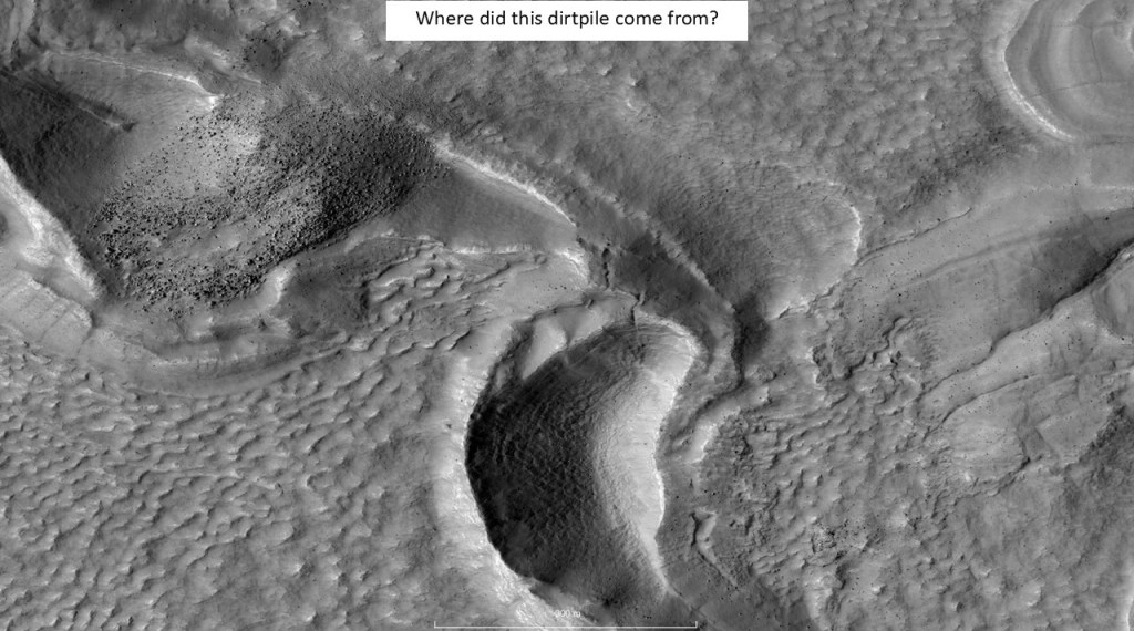
With a dump truck for scale:
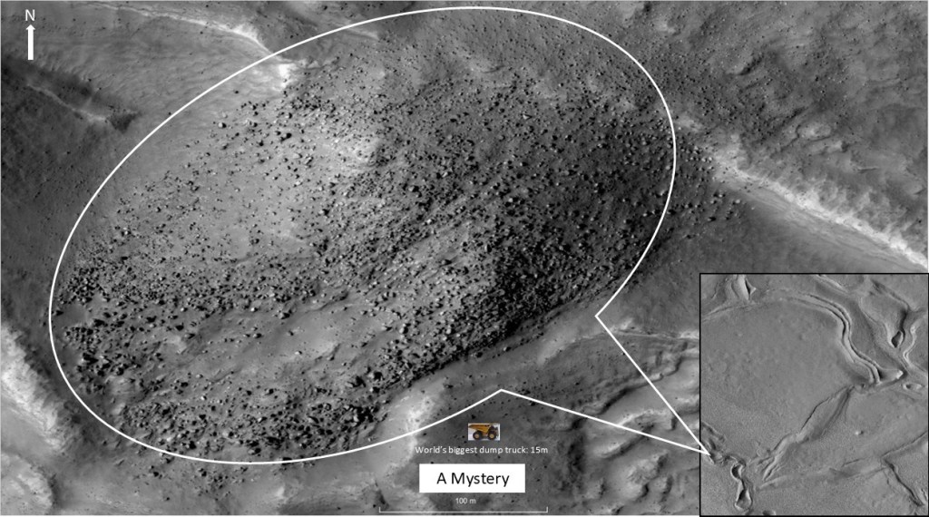
No obvious provenance for this pile of boulders; perhaps it’s glacial till left over from a snowball Mars episode.
A 3D rendering:
Moving out to the bigger picture, and the contrast between the regolith (r) and the volcanics:
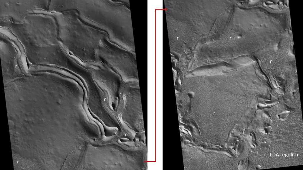
Up close, the “regolith” poses another mystery: it appears to be composed of shark’s teeth and ridges, ~20m crest to crest, and several meters high; it is reminiscent of the nieves penitentes found in the Andes, ice formations like exaggerated suncups. Perhaps the ice underlying the veneer of regolith underwent partial melting due to heating by the lava, and formed the sags between ridge-tops, with subsequent lithification preserving the structures. In any case, traversing this terrain would be problematic: either by dune-buggies sneaking through the labyrinth, of giant ARDCO-buggy like vehicles going over the tops.

To complete this section, another area of inflations (with skylights), lava tubes and half-tubes:
Detail:
And
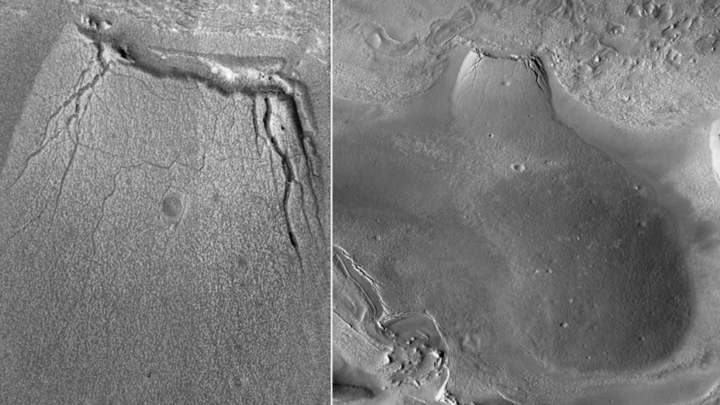
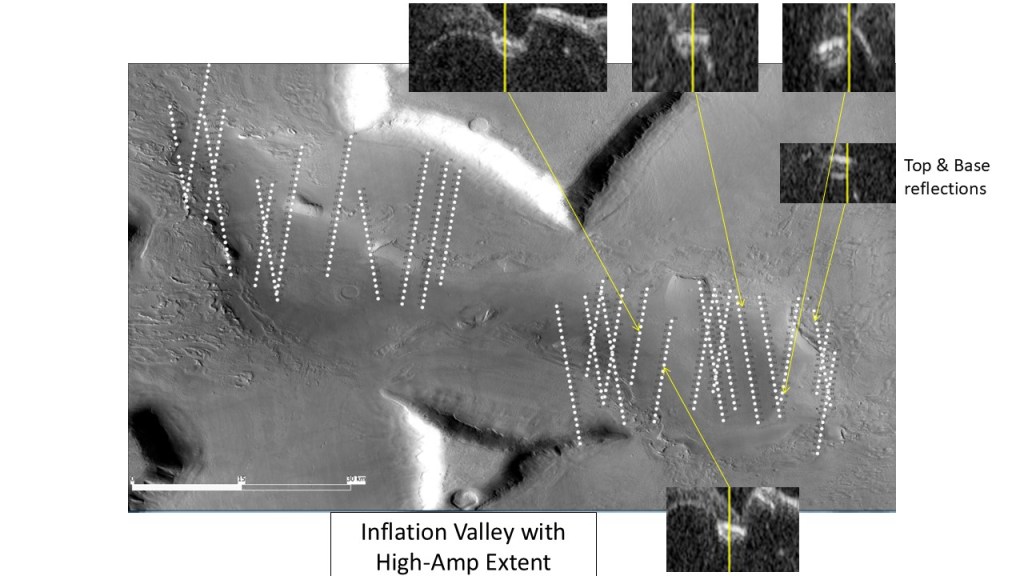
Saving the best for the last, the big Kahuna, looking like a beached whale, in inflation valley:
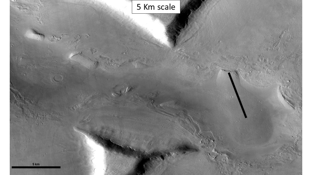
An examination of SHARAD profiles reveals numerous high amplitude events, some of which appear to have a top and a base, suggesting a void space. If this is borne out by further geophysical surveys (GPR, seismic or gravity) the potential for human habitation is great as the structures are pretty large. I had requested a HiRise stereo pair over this structure, but the Mars weather didn’t co-operate, as shown on the next slide:
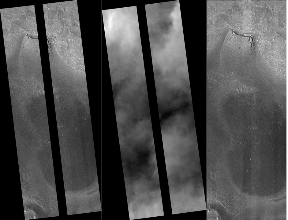
I got some detail on the “mouth” but that’s it
Here’s a summary of the SHARAD profiles:
…and a few off to the West:
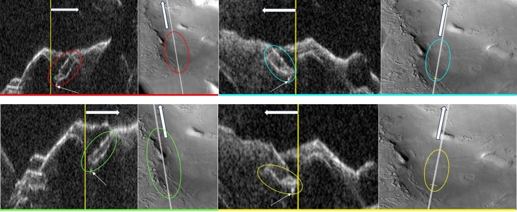
(The small arrows are pointing at small features that may represent feeder dikes)
The bottom line is: lots of interesting structures needing further study. The area would be good for a research station, with the possibility of caves for shelter, and the proximity of ice for water/oxygen/synfuel needs. It is also about 200km from the coast, and some of the oldest rocks on the planet. In addition, the mud volcanoes may be a good place to look for evidence of ancient life.
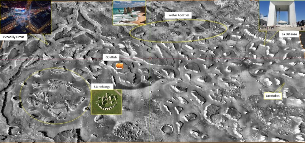
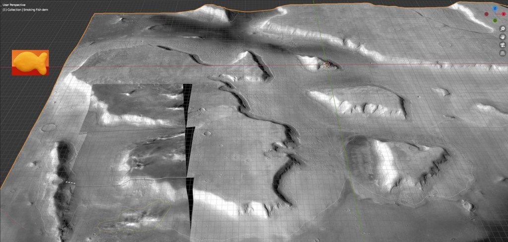
Before leaving the Deuteronilus Mensae area, let’s look at one more fun spot, “The Fish”, so called because it resembles the cheesy goldfish crackers sold in supermarkets:
Another smoking gun on a CTX image. This one is quite clear, and obviously emanating from ground level (not some high altitude cirrus cloud). Whether water ice or CO2 ice crystals, it would be interesting to investigate if this is related to any recorded atmospheric conditions (temperature, barometric pressure…). We’ve seen it in two places now, separated by more than a decade; perhaps an AI could be trained to scan all the CTX data for similar anomalies.
To wrap it up, I’ve made a map of some of the landmarks in the DM area. For the sake of orientation it’s sometimes useful to pick out easily recognizable shapes and name them when confronted with a visually complex area: