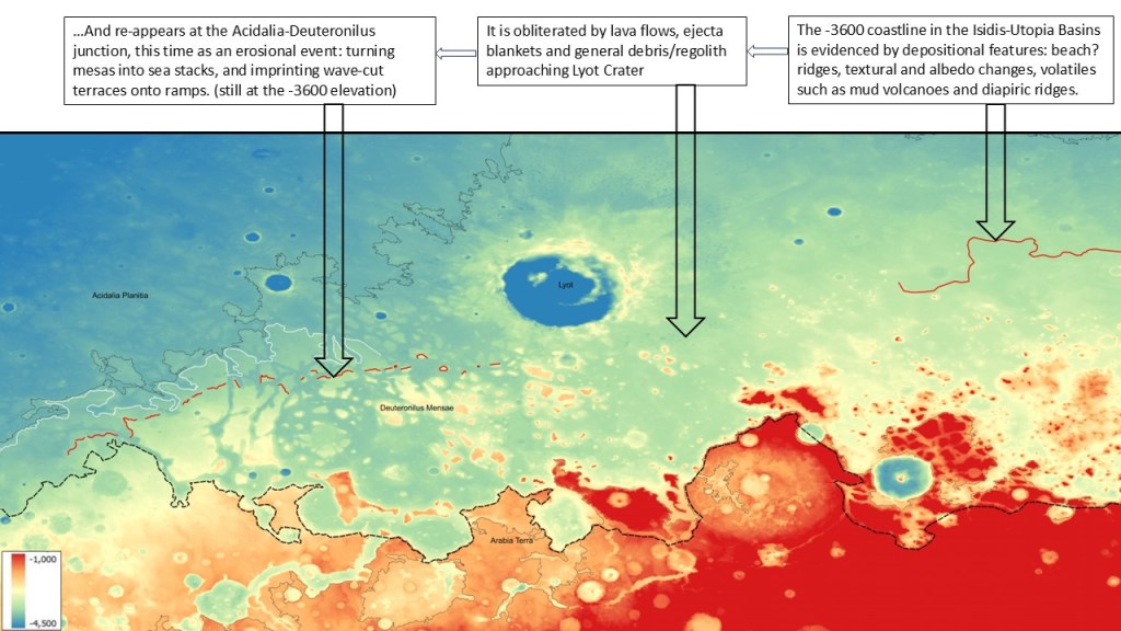
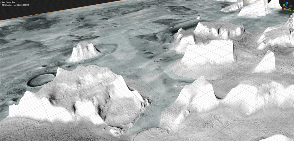
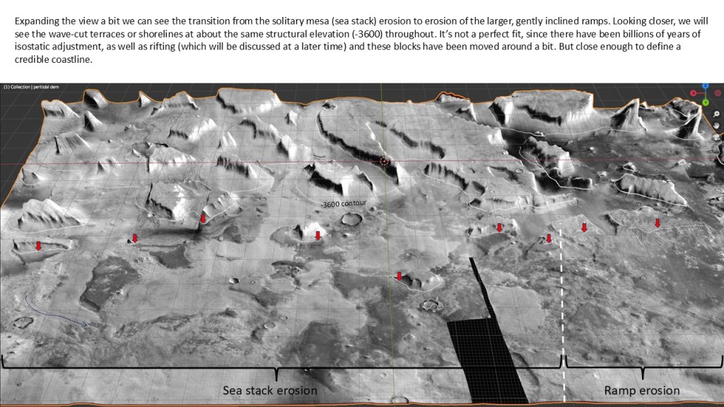
Proceeding in a Westerly direction, the coastline disappears under lava flows and ejecta blankets. However, at Deuteronilus Mensae, it can be seen as an erosional event, carving mesas into sea-stacks and terraces onto the big north-west dipping ramps.
But first a look at the geology of the northern DM area:
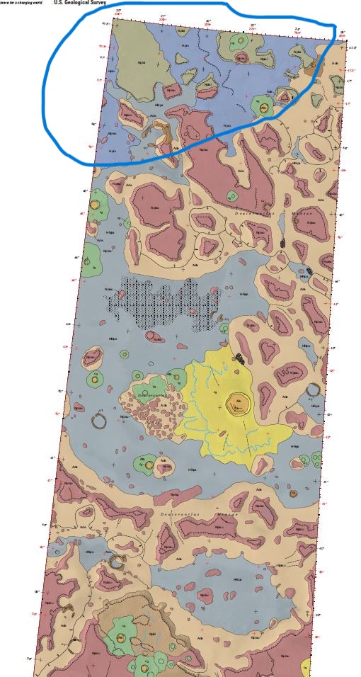
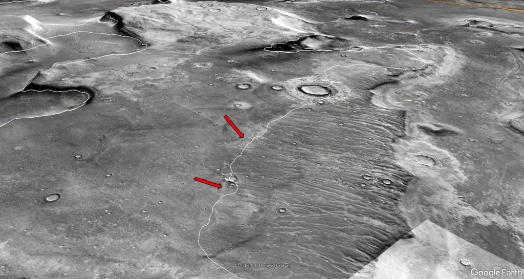
Taking the northern portion of the map, and relating it to the images:

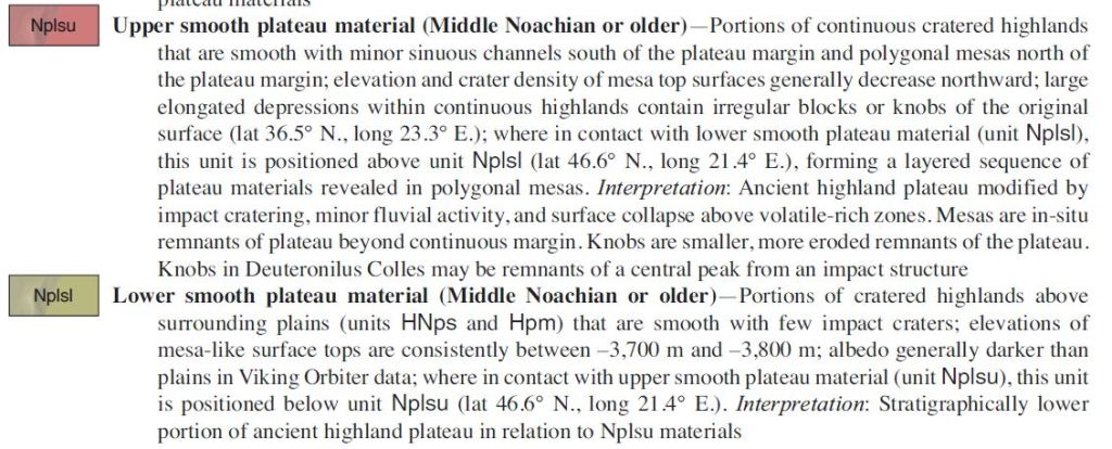
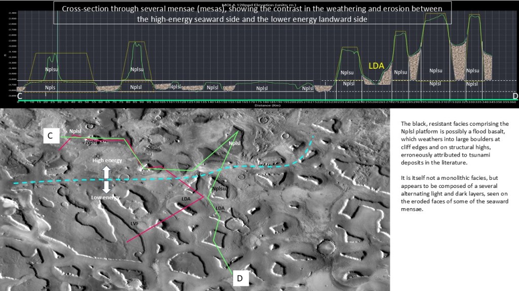
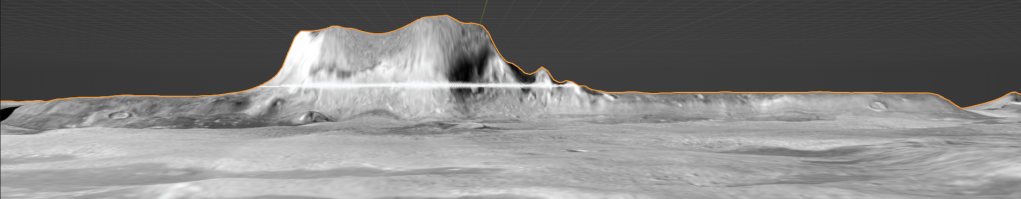
The yellow line indicates the regional boundary between the upper and lower mesa units; to the north of the line the white mesa has been eroded, revealing the lower black mesa.
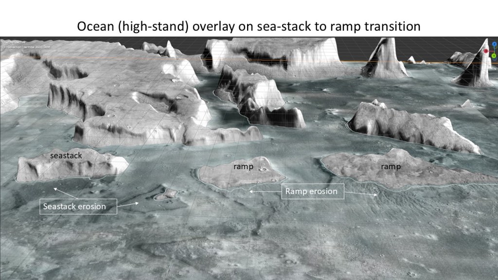
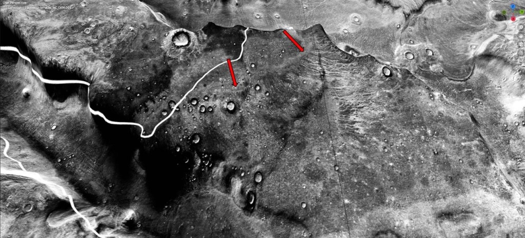
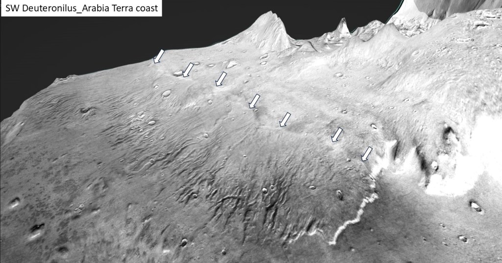
The following illustrations employ JMars5 images draped over a MOLA digital elevation model, rendered in the Blender 3D modeling app. The model here is of coastal erosion of the upper (felsic) mesas down to the level of contact with the lower (mafic) platforms. The contact is at approximately -3600m. The upper, less competent rocks are undercut by wave action, broken up, and dispersed as detritus on the sea floor. The lower, more resistant basalts remain largely intact as platforms whose outlines likely represent the outlines of the pre-erosional mesas. The style of erosion/weathering changes in the inland direction to mechanical weathering, with debris accumulating as lobate aprons up against the mesas.
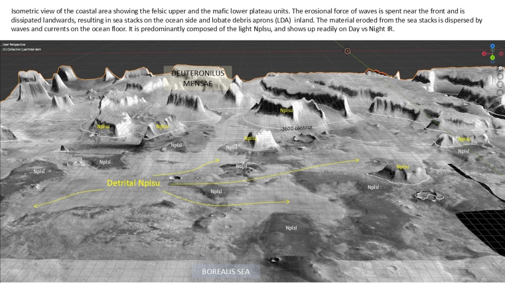
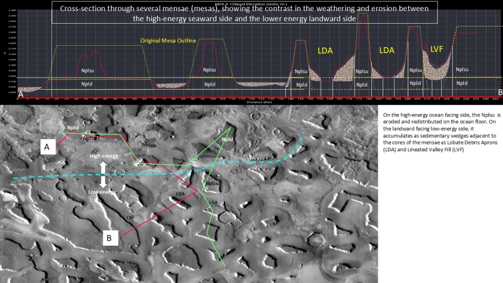
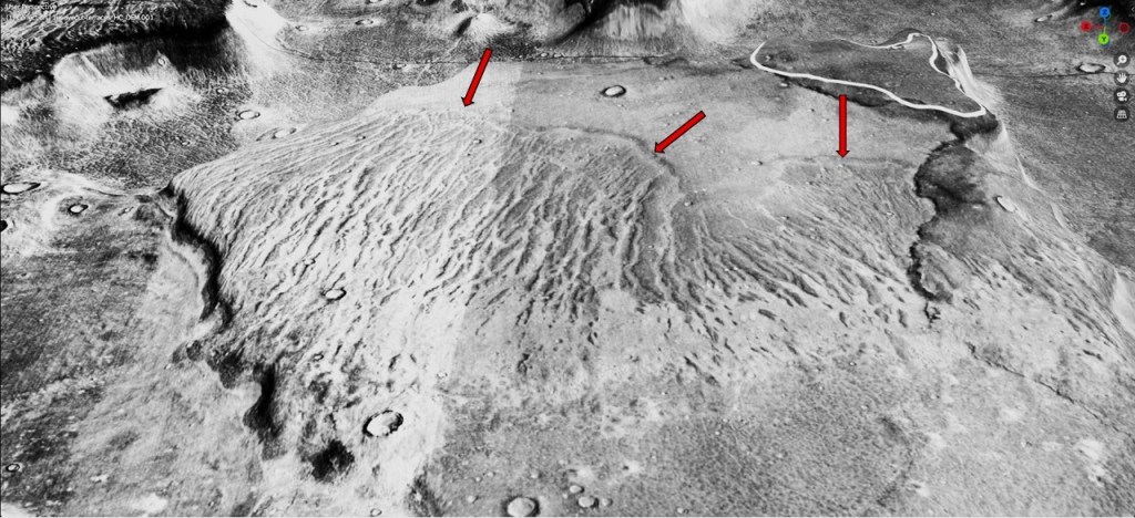
The following two illustrations show the difference in the weathering/erosion between the seaward facing mensae and those situated farther inland. The former are undercut and eroded by high-energy waves and the resulting rubble deposited and distributed on the adjoining sea floor. The inland mensae, on the other hand, are subject to mechanical weathering (mainly warm/cold cycles), and the rubble ends up adjacent to the source mensae as Lobate Debris Aprons (LDA) thought to be cored by ice. Adjacent to elongated mensae, they form Lineated Valley Fill (LVF)
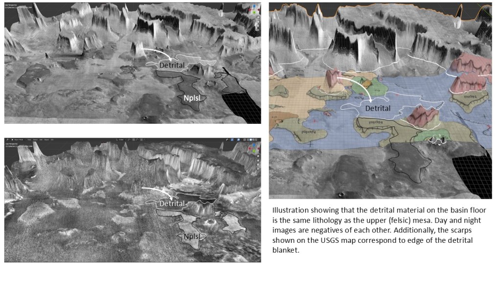
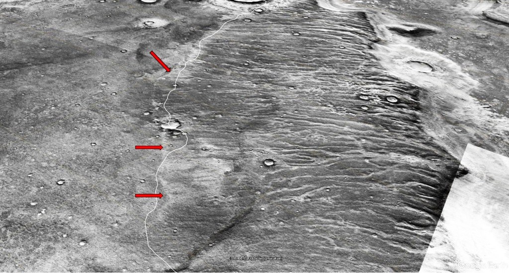
Day and night images showing the association between the upper mesas and the detrital material:
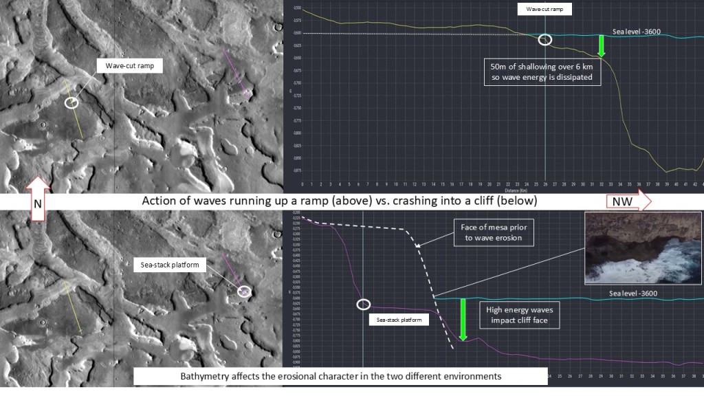
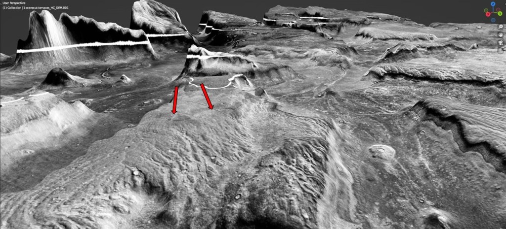
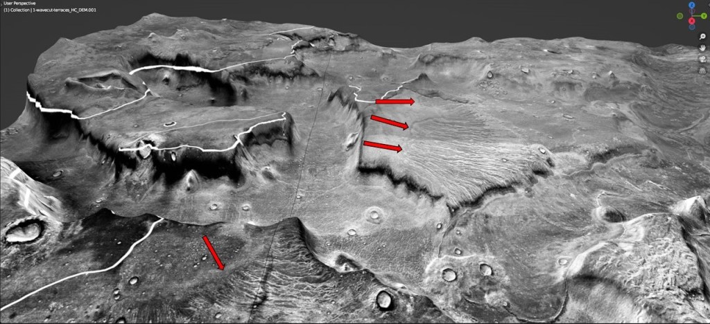
The mechanics of coastal erosion: shown below are two transects, the upper one down a ramp, the lower, a sea-stack on a basal platform. Waves ascending the gradually shallowing ramp are attenuated by the time they impinge on the shoreline, and create a small terrace. Waves approaching the sea-stack (cliff) undercut it and create a platform at wave base.
Side view with the hypothetical -3600 ocean: note the peneplanation of the lower platform to about 50m below sea level, the presumed wave base:
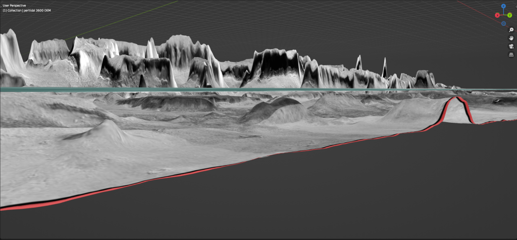
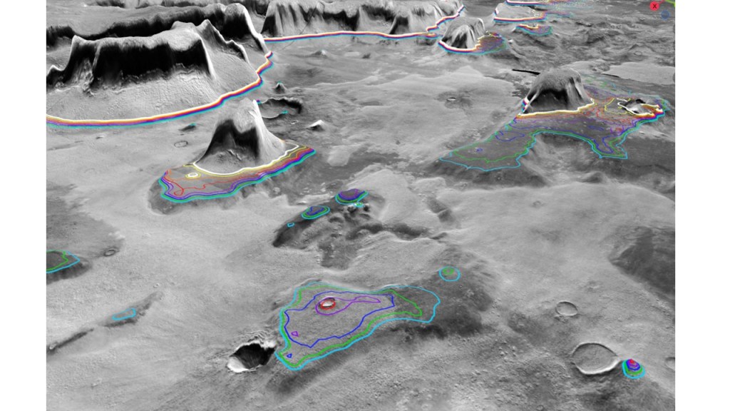
To put a finer point on it, an image showing contours, at 10m intervals, from -3600 (presumed sea level) to -3670. This 50m-70m wave base might give some clues about the sea state, wind strength, and ultimately, the atmosphere when combined with other kinds of data.
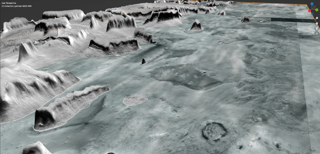
Another image, with a translucent ocean showing the -3600m coastline and the dark lower mesa shoals:
Beachfront property:
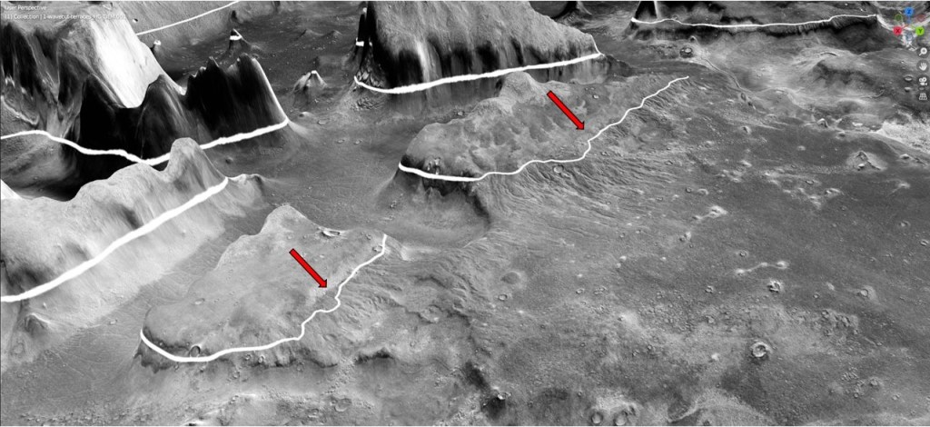
Extending this erosional interpretation along strike to the sloping ramps, we see a horizontal cut at the same elevation:
“
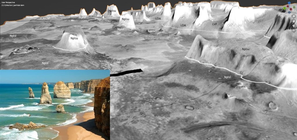
On the view along the coast, note that all the erosion is happening on the seaward side; the basic model is shown here, with the water line represented by the white -3600 contour. The insert is an analog, “The Twelve Apostles” from Princetown, Victoria, Australia.
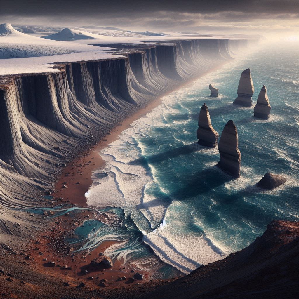
An artistic rendering by DALL E:
That takes care of the sea-stacks. Moving on to the wave-cut terraces, these are arranged along strike, heading SW:
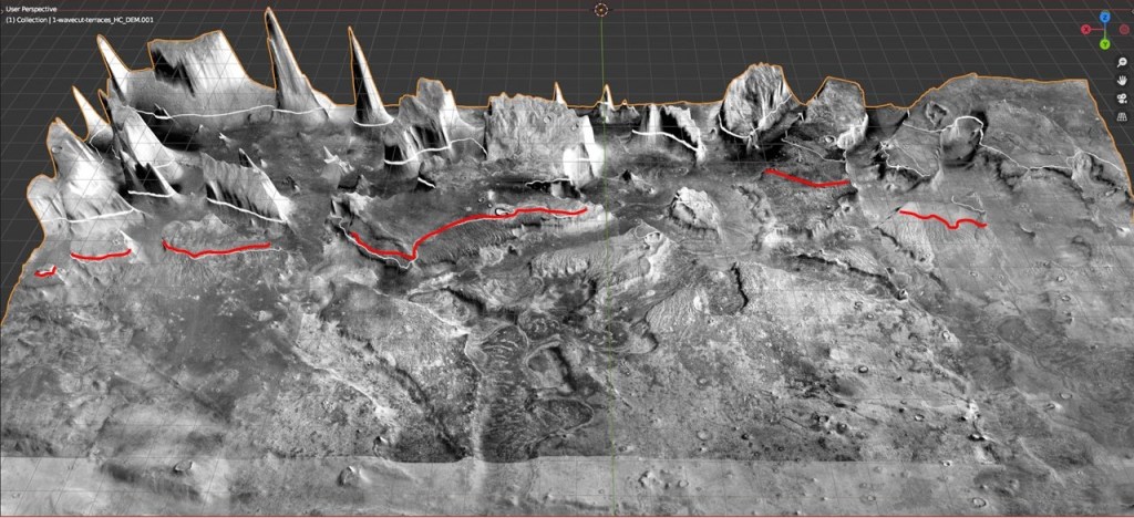
Ramp close-up:
(Heading SW, the wave-cuts drop somewhat below the -3600 contour, indicating movement on the blocks, possibly isostatic adjustments after the ocean emptied out; also, horizontal movement due to rifting, to be discussed later.)
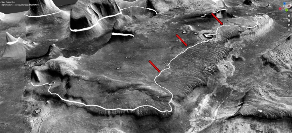
It will by now be apparent that there are two major erosional features here: one following the regional strike roughly parallel to the -3600structure contour, the other in a dip direction, following a drainage. How to account for both of these?
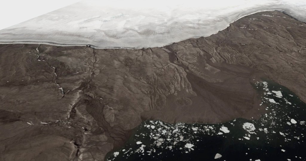
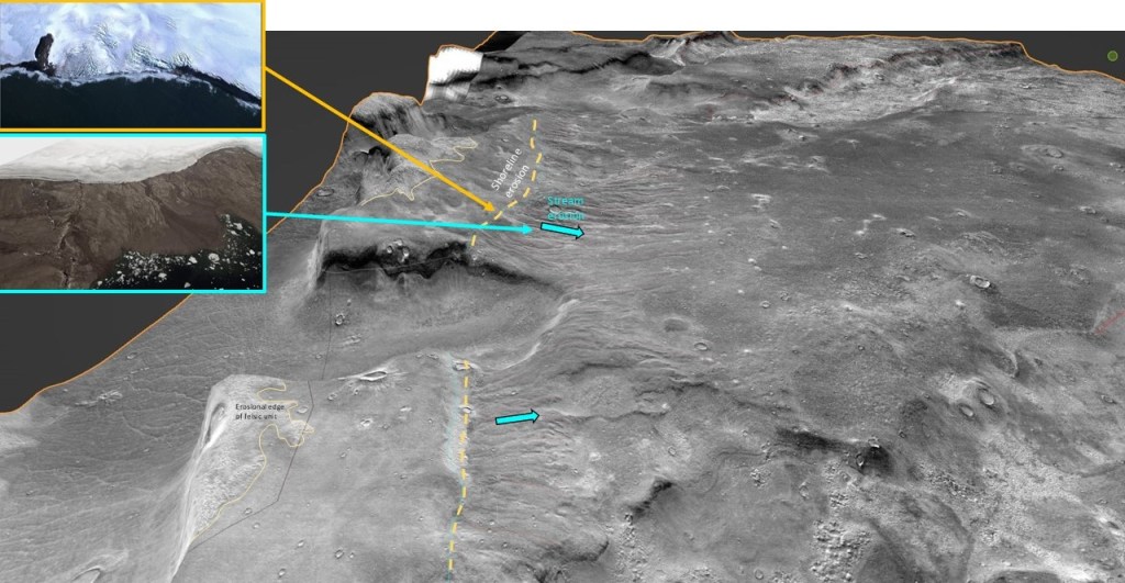
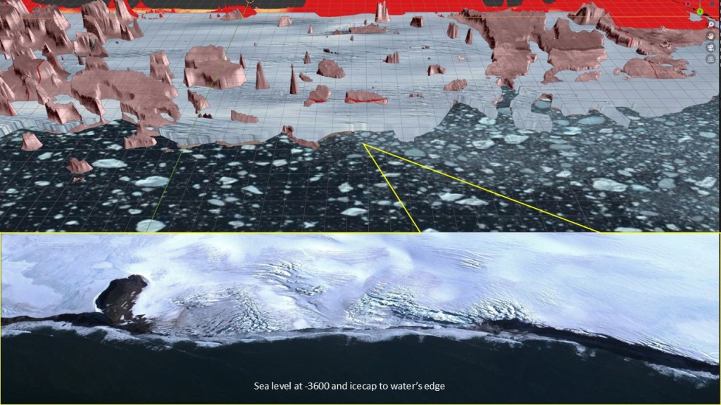
For the first, imagine an ocean at high-stand for a very long time, cutting into the shoreline; for the second, an ice-cap right up to the water’s edge, remaining after the sea recedes, melting from the bottom due to crustal heat flow, and eroding the newly exposed foreshore. As an analog, take Bouvet Island in the South Atlantic.
An analog of the meltwater erosion shown below is from Danmark Fjord in Northeast Greenland:
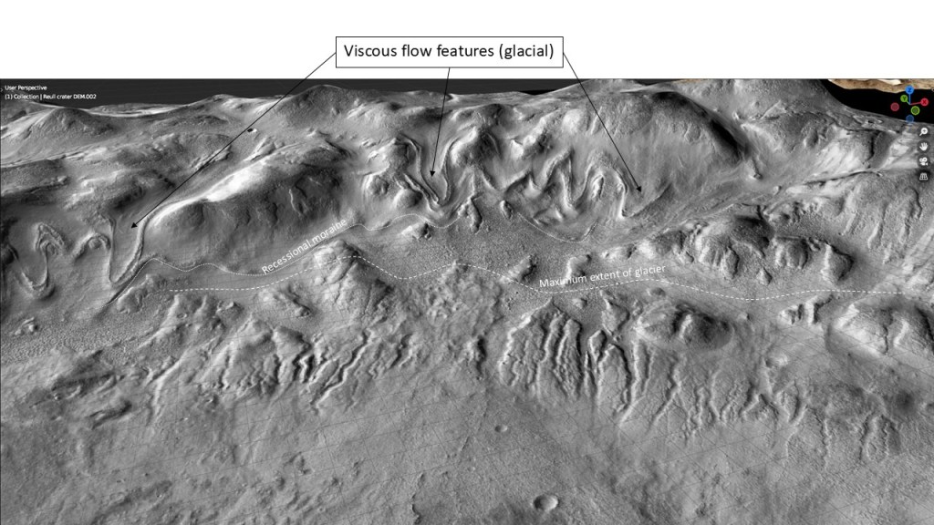
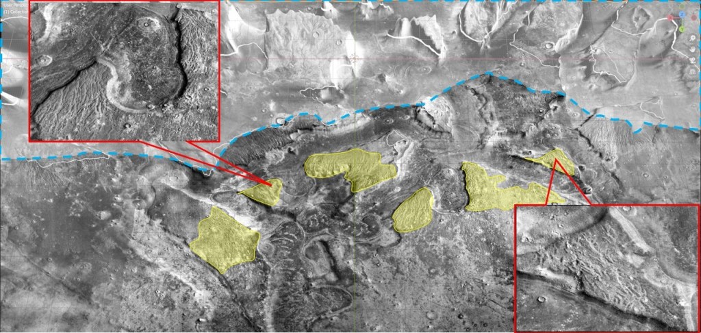
Another example, from a Reull Vallis crater, showing erosion below a glacier (now retreated):
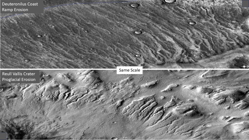
Enlargement of the Deuteronilus and Reull Vallis scours, at the same scale:
To summarize: shoreline erosion at highstand, dip-oriented (stream) erosion after sea level drop.
I’ve made a model of an icecap and an ocean at -3600m for illustration. At this stage, the wave-cut terrace is incised.
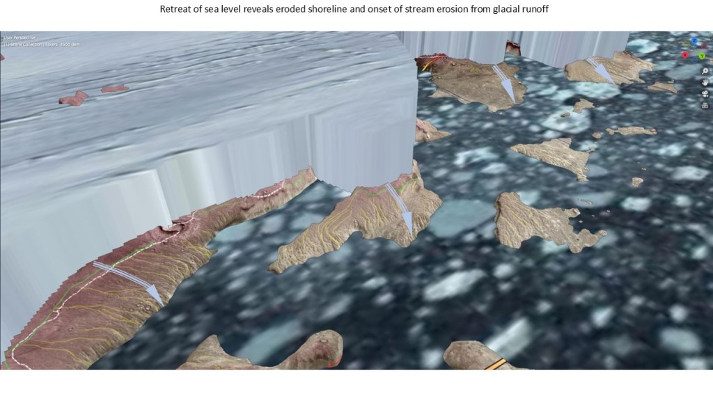
Dropping sea level 50m initiates the process of (dip-oriented) erosion. The ice acts like a cohesive stationary body in a low gravity, low relief setting, melting at the base as a result of crustal heat flux.
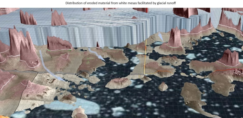
In addition to eroding the ramps, the glacial meltwater also re-distributed the detrital material as the ocean receded as seen in the following two slides:

We still need to account for the detached, eroded “islands” which have no communication with the icecap and its meltwater? One possibility is that they have moved out since the erosional event, and no longer represent the original configuration.
How these islands moved from their original positions is the subject of the next section.
