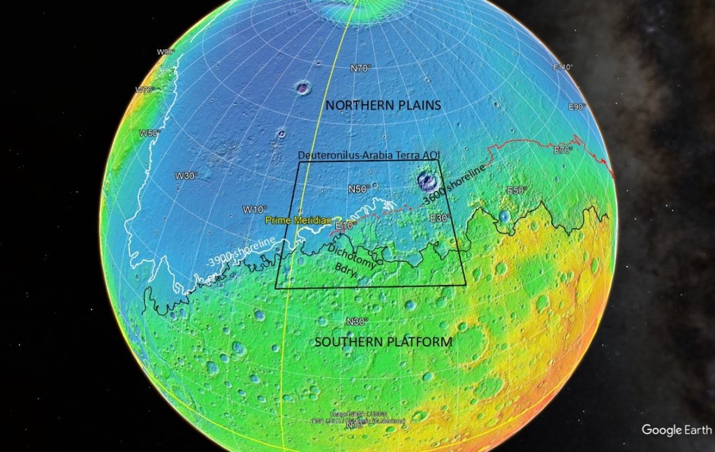
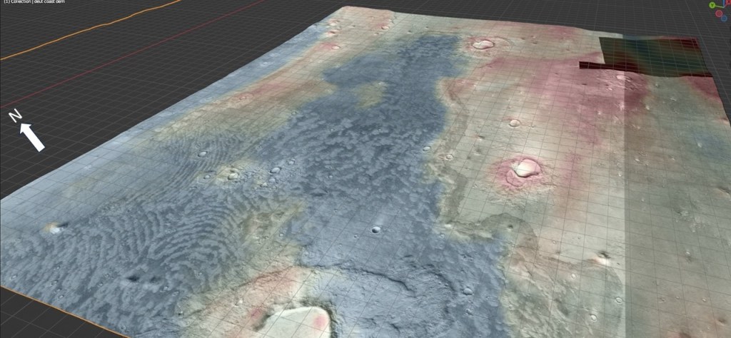
Referring to the map shown below:
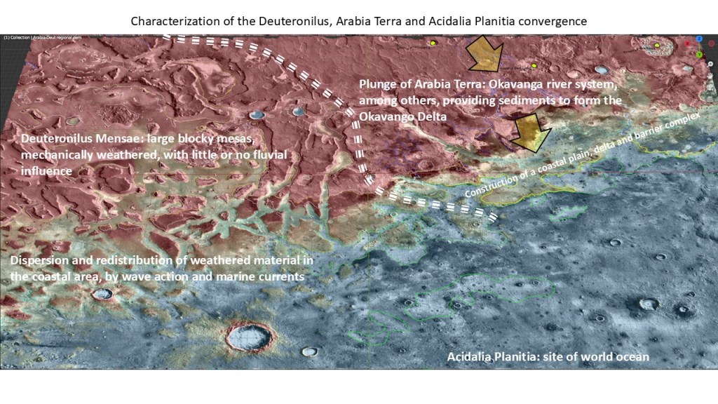
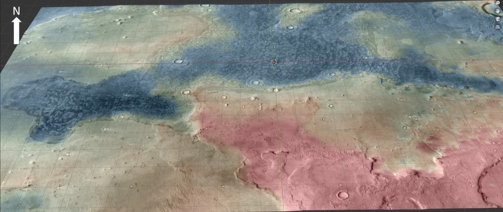
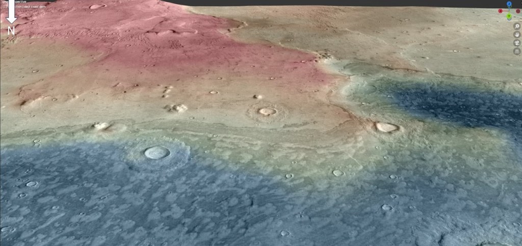
A cursory look at the transition from Deuteronilus Mensae to Arabia Terra reveals a marked difference in the respective terranes: DM is composed of a multitude of blocks (mensae) of different sizes, from mesas to ramps, whereas AT is a simple monocline of plateau rocks dipping down to the northern basin. The former is discontinuous, and shows little or no evidence of fluvial influence; the latter has the extensive Okavango Valles fluvial system at its head.
The DM area is exclusively characterized by erosion of bedrock; the AT area by sedimentary processes. The Okavango River system has all but obliterated the older -3600m shoreline, but compensated by imposing a fluvio-deltaic system with the -3900m shoreline of the younger Ocean39.
Highlighting some of the geo-morphologic features:
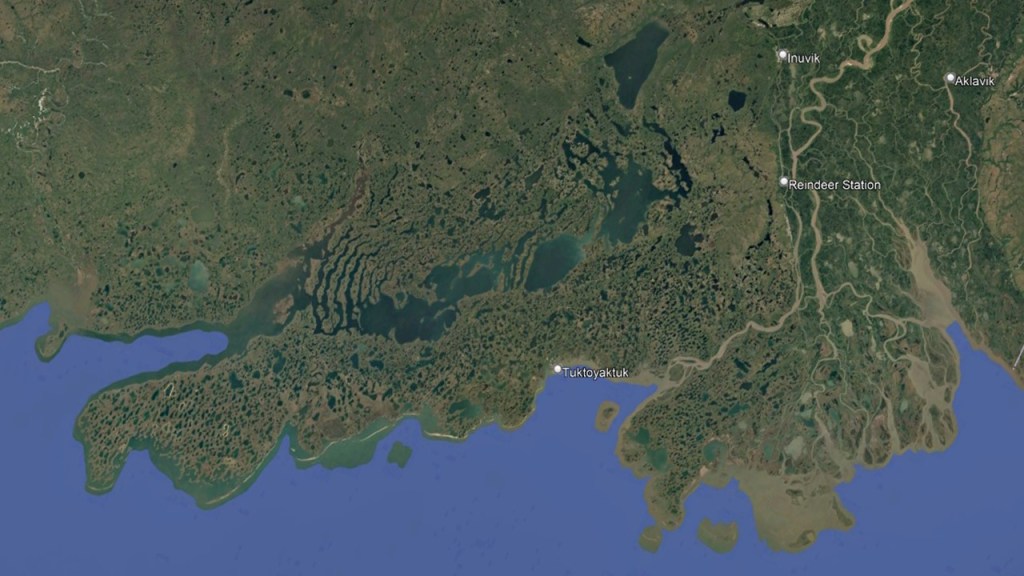
Mackenzie Delta Analog
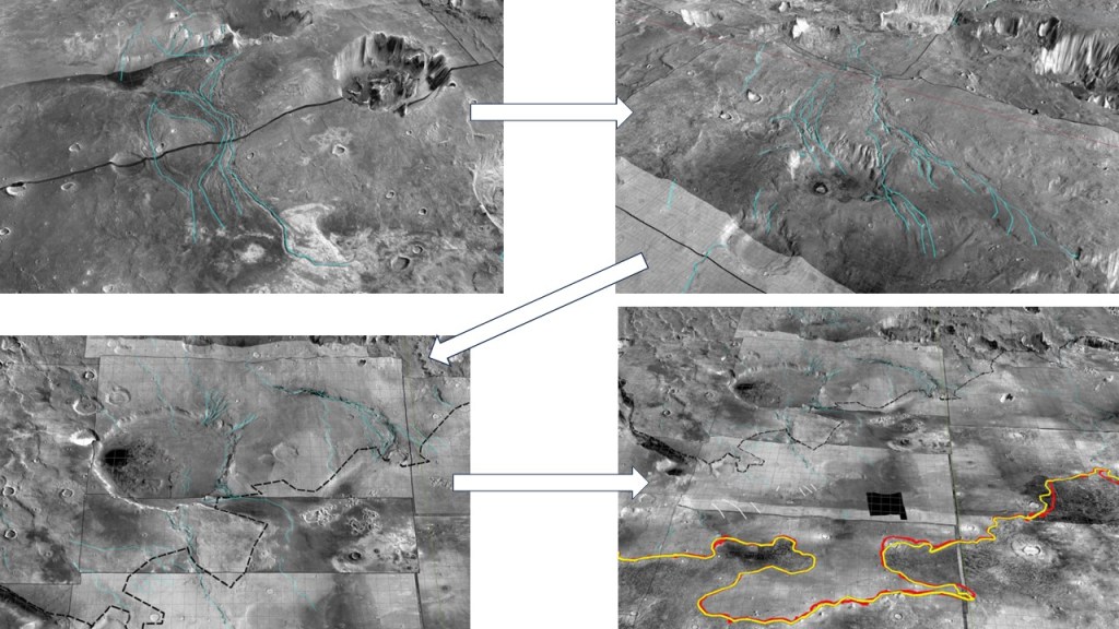
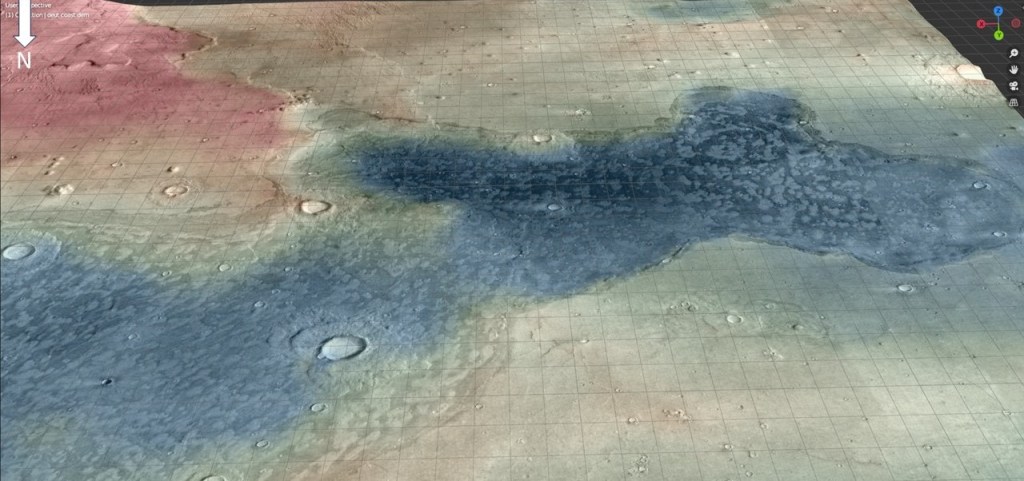
The extensive Okavango River system (too long to fit into one image)
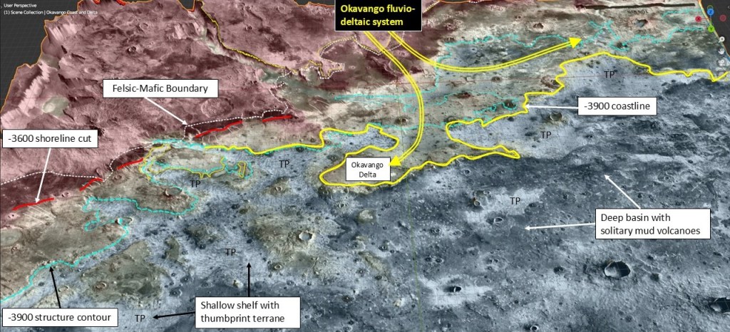
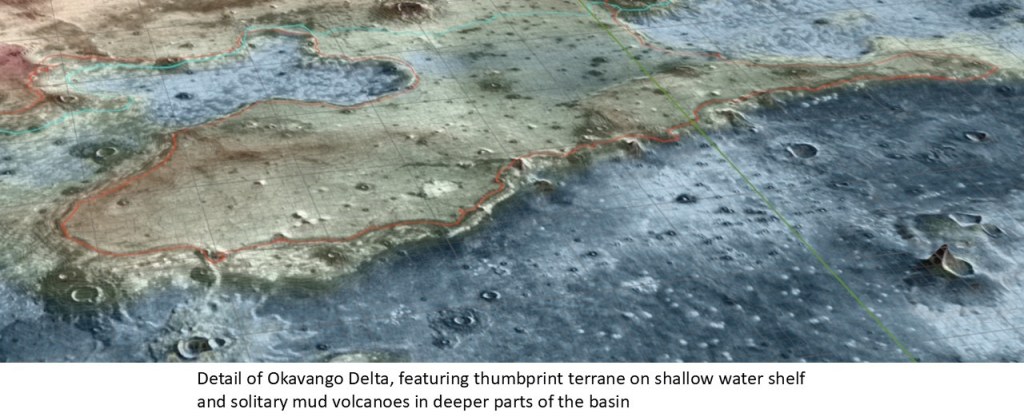
A snapshot of the NE end of Okavango Delta showing land, a shallow shelf with mud volcanoes and thumbprint terrane, and a pronounced shoreline
A closeup of some thumbprint terrane:
A closeup of a shoreface sand
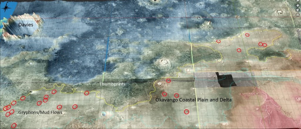
A view across the Okavango Plain and Delta, the shallow shelf exhibiting thumbprint terrane, and the deep embayment with the solitary mud volcanoes; red circles onshore indicate gryphon-type mud flows which will be discussed in a later section.
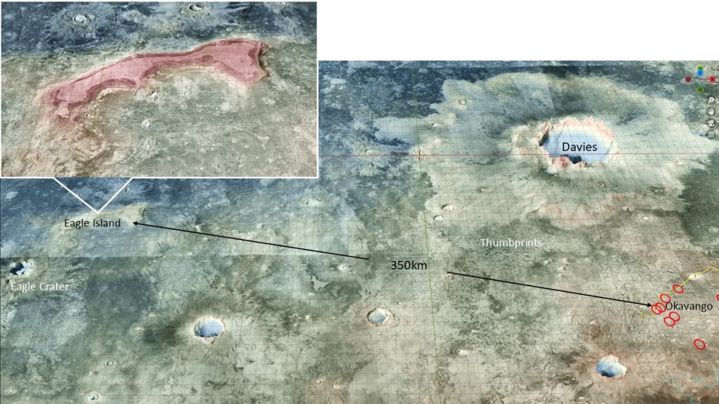
…and to the West, an offshore island, adjacent to Eagle Crater:
That is probably as good as it gets for a definition of a shoreline. Now I’d like to enter into a lengthy digression to some other marine indicators, namely extruded over-pressured muds. Following that, the Ocean39 shoreline discussion continues.
