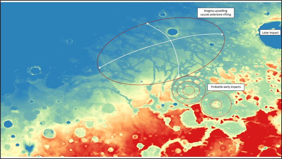
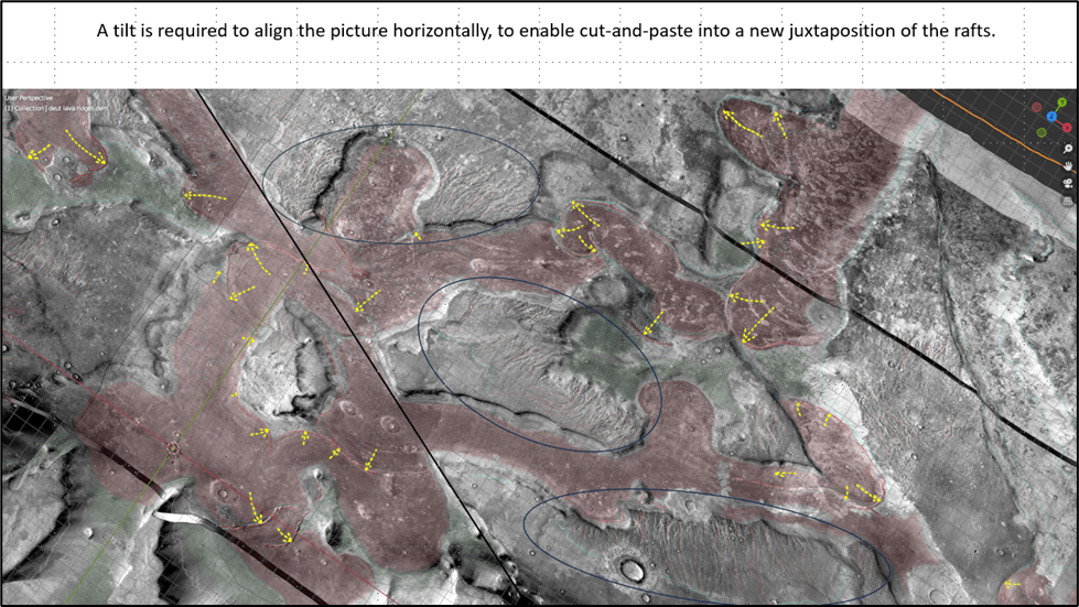
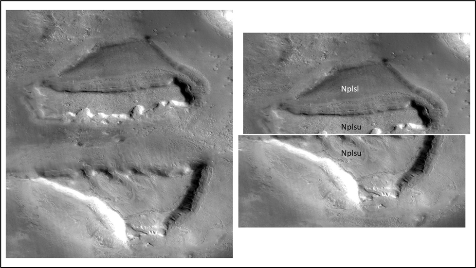
A bird’s-eye view reveals a pattern of rectilinear rifts which have broken up many of the mesas and ramps in the area, likely as a result of thermal (magmatic) uplift. Some suggestions have been made that these are glacial valleys, but neither are they U-shaped, nor is the terrain steep enough for glaciers to have moved much so I think rifting is the better model. The best explanation for this extensional rifting is a regional thermal doming:
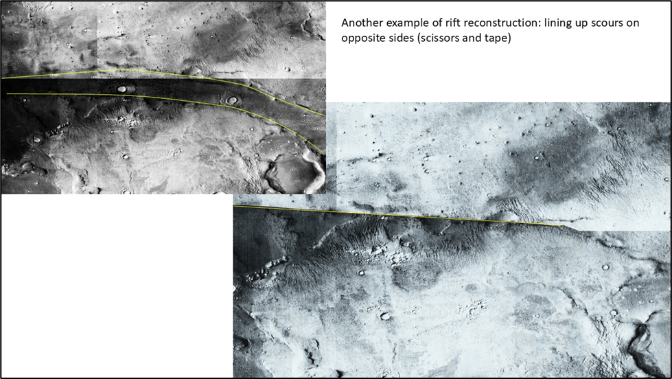
To restore the scoured rafts to their original pre-rift position would mean to simultaneously narrow all the rifts and juxtapose the opposite sides. A monumental task which could perhaps be undertaken by an AI-directed tiling program. Failing that, one might just try some “easy” cases, to prove the point.
One area where there is a chance of success is shown below. The method employed is crude and simplistic but seems to make sense: determine the apparent direction of some of the rifting, cut up the image along the rift edges, excise the rift, and paste it back together.
North is up
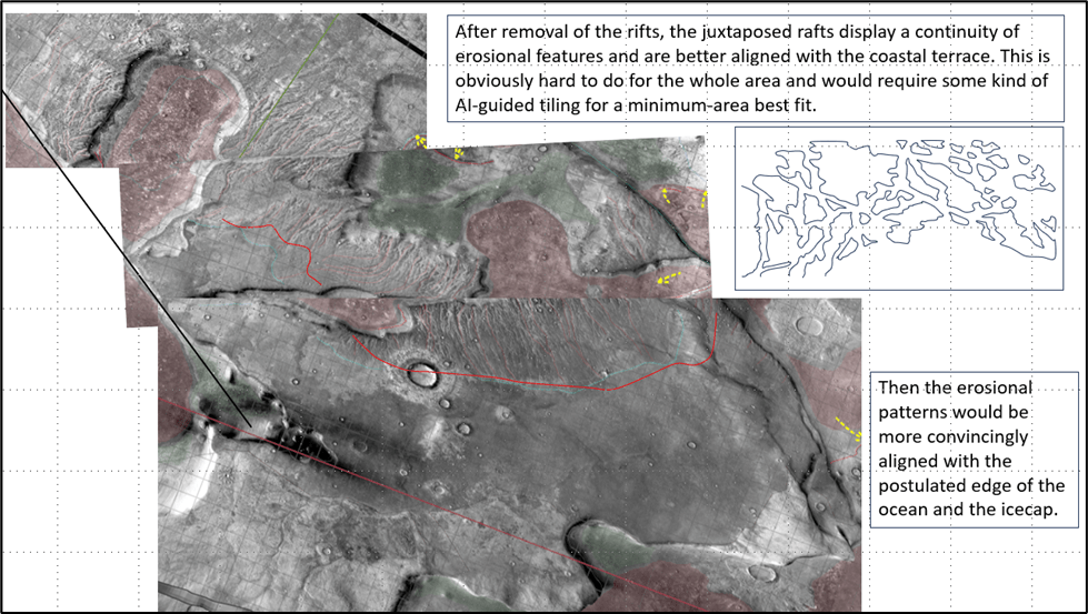
(I’ve recently taken another look at the restoration issue, using line drawings rather than images. Polygons are easier to move around and they don’t overlap at the edges like images do)
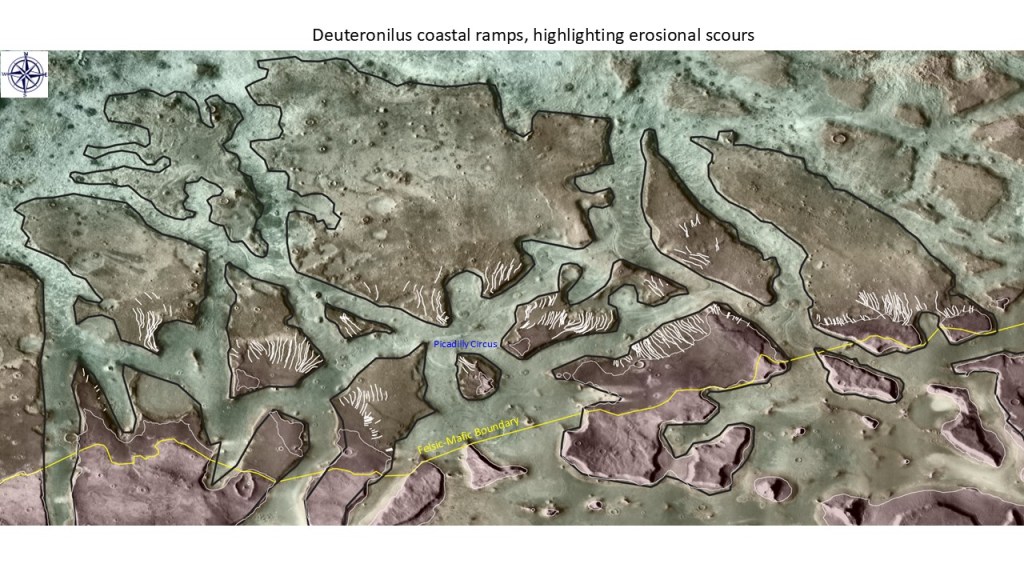
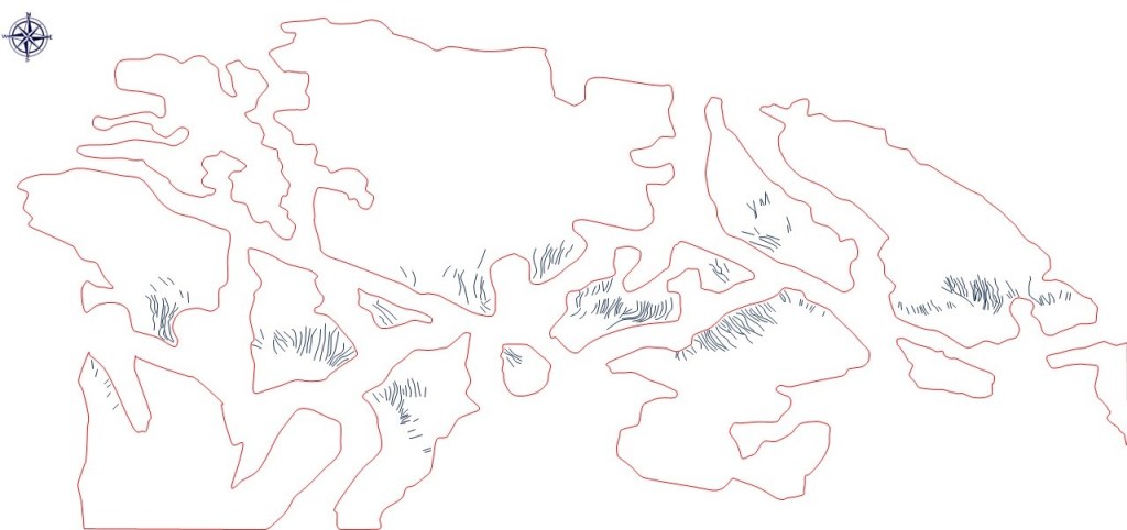
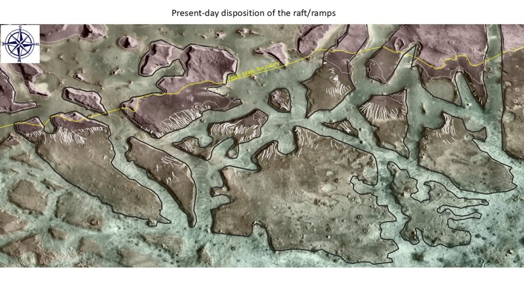
The first slide shows the heart of the scoured rafts area with polygons outlining the rafts and line drawings, the main scours:
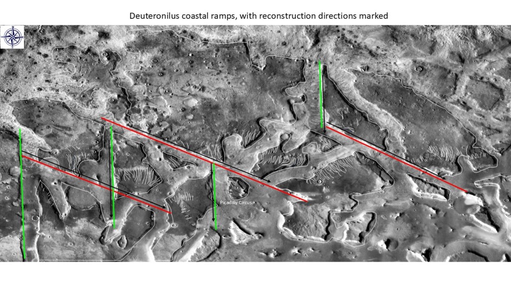
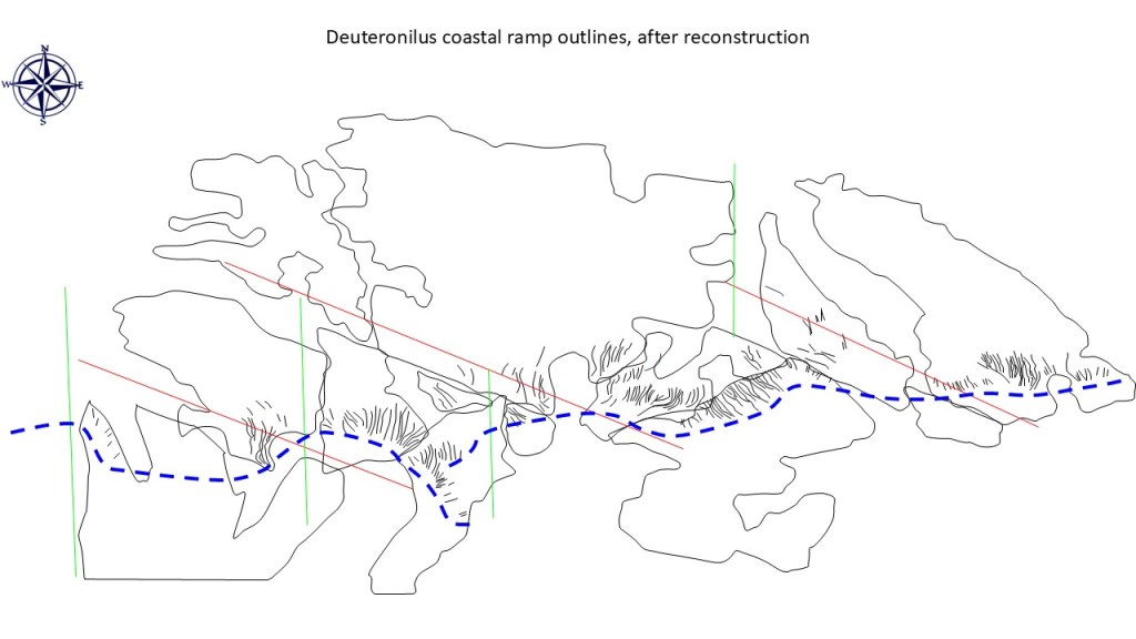
The main directions of restorative movement are shown on the next slide:
Next, the graphics are extracted from the image:
The result of the restoration, imperfect but not unreasonable:
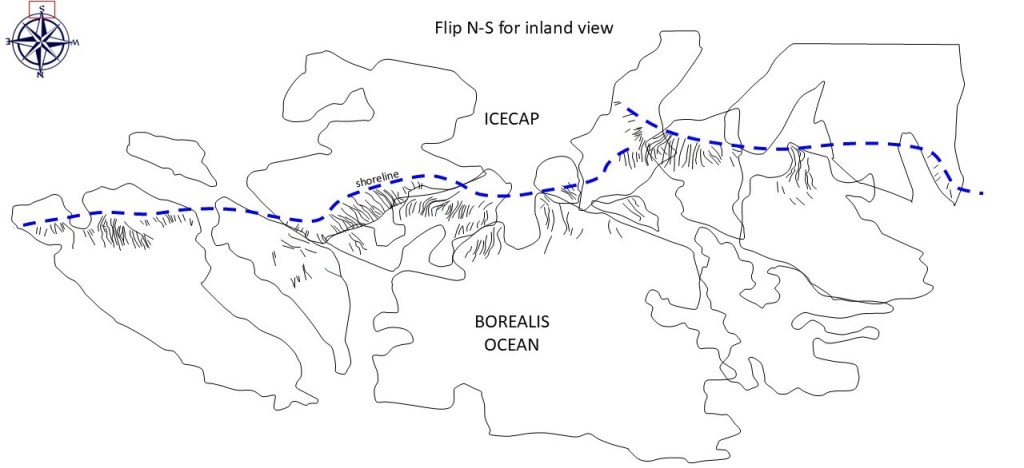
Next, flip the image N-S for a better onshore view:
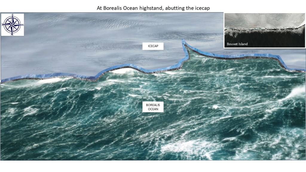
Now, fill in the graphics for the icecap and ocean:
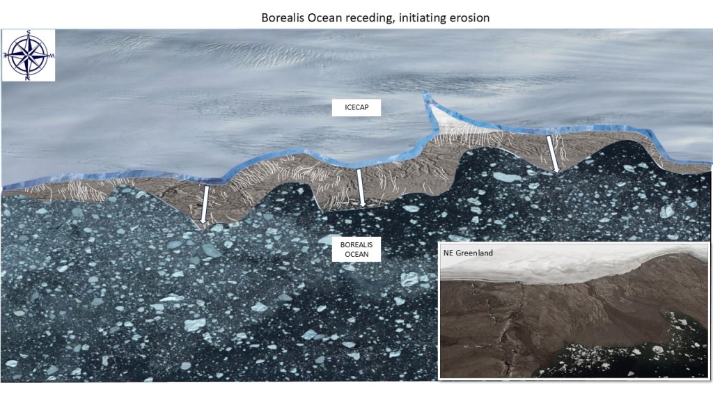
Lastly, drop the sea level to initiate the erosional scouring:
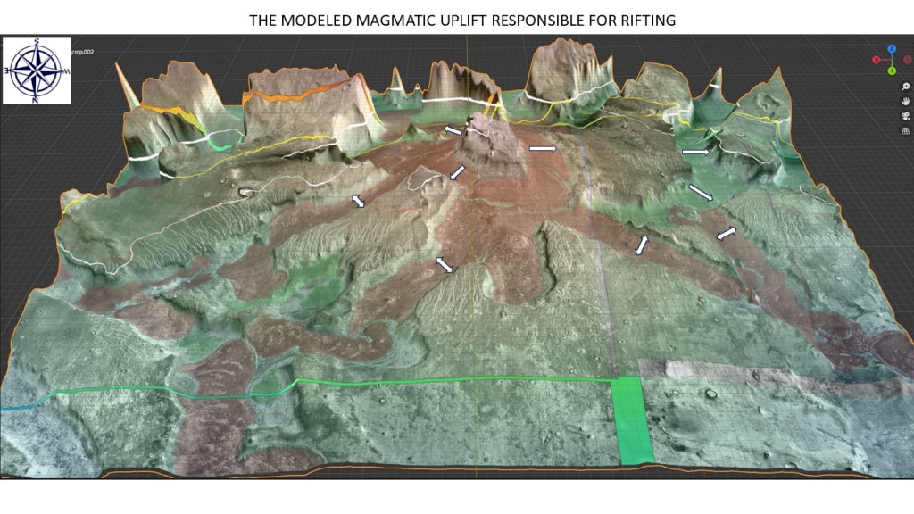
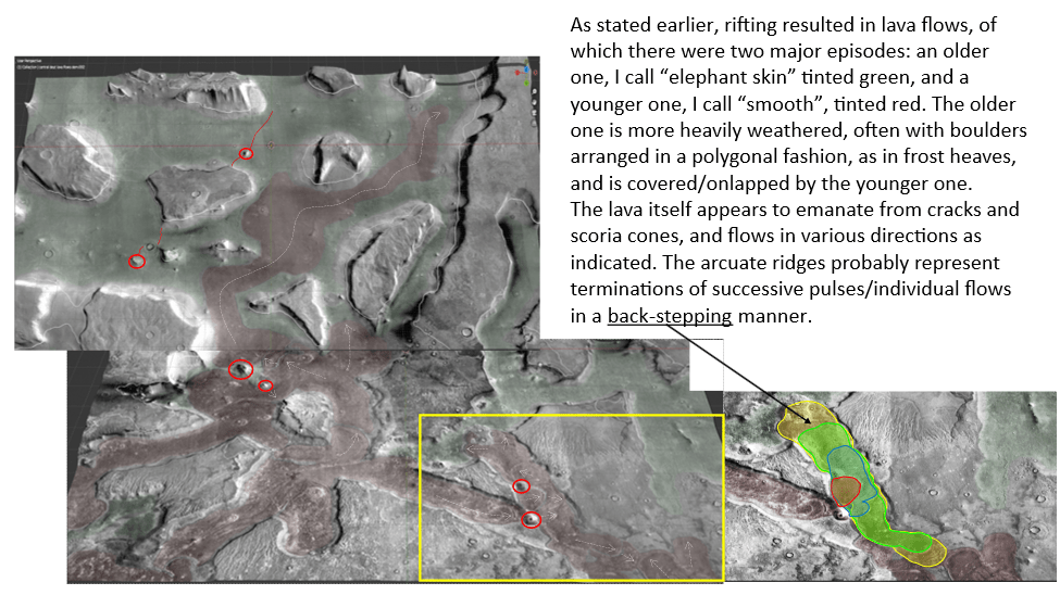
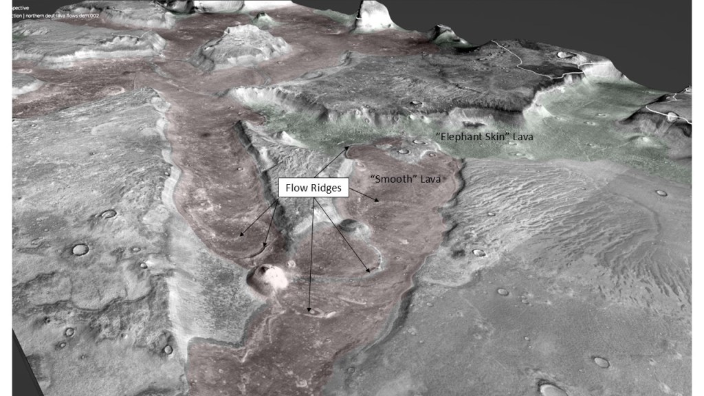
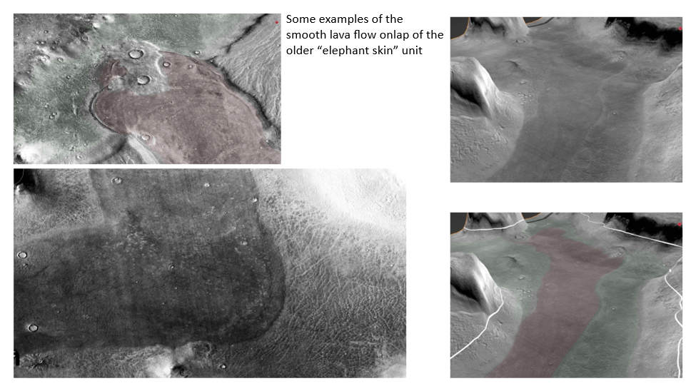
Rifting was likely initiated by an uplift, such as by a mantle plume; this also gave rise to lava flows as evidenced by arcuate ridges and apparent cinder cone as will be shown in the next section.
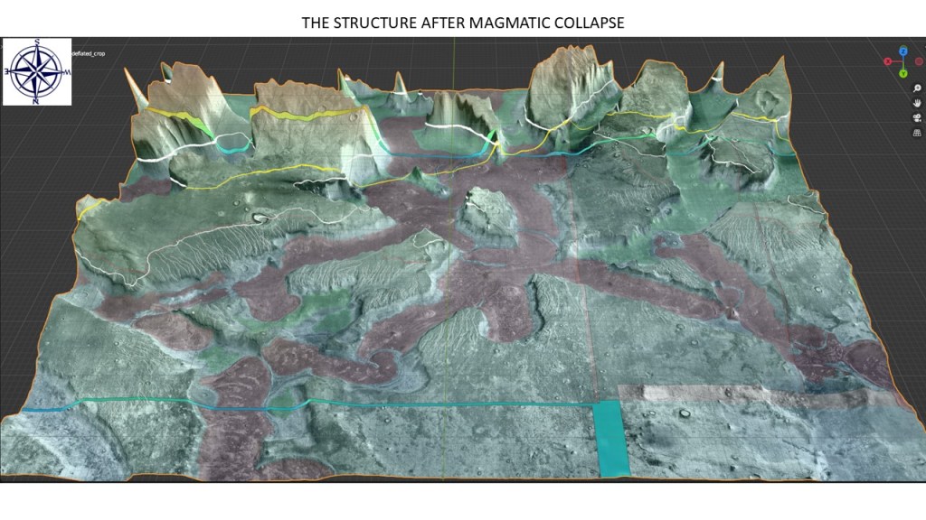
Collapse of this arch gives the present-day structure:
And finally, the post-breakup view after removal of icecap and ocean:
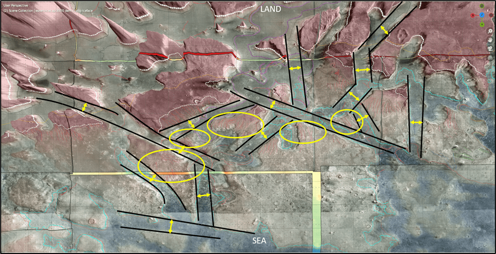
Farther west towards Arabia Terra:
And again, a long rift passing though the middle of a mesa, cutting it in two:
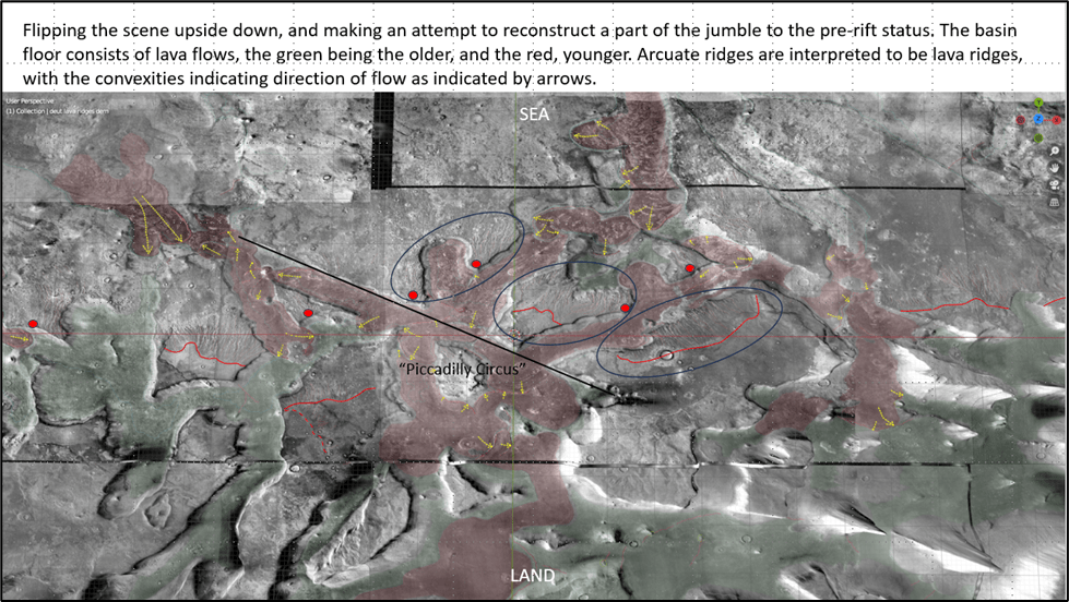
…and a reconstruction of the dissected mesa:
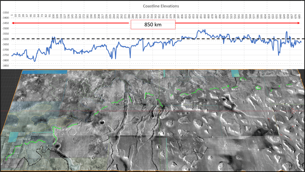
Given that a reconstruction of the ramps/raft would give a fairly linear shoreline trend I think that the icecap model best explains a collection of erosional patterns that extend along strike for upwards of 850km, at roughly the same elevation.
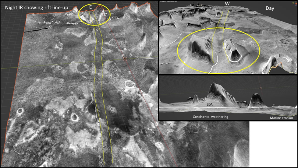
An oblique look into some of the canyons:
(Flipped again, south is up, looking landward)
Hint: the relief sometimes gets inverted when one looks at it. The best technique is to look at what is obviously a crater and then force oneself to see it as a hole rather than a button. (A bit like an Escher drawing)
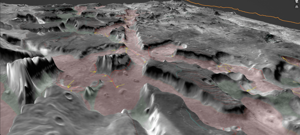
Some examples of scoria cones:
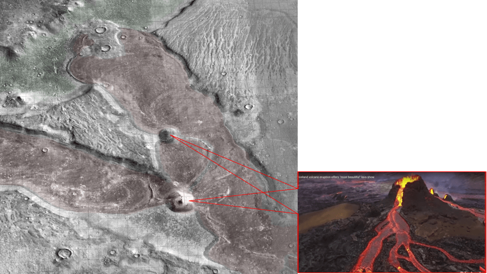
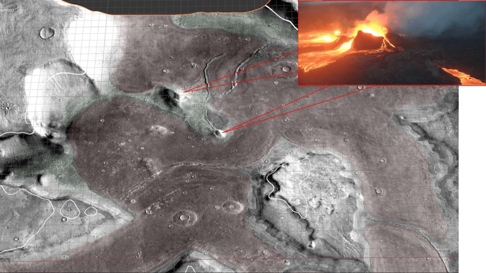
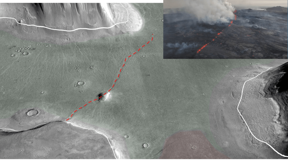
…and of fissures and dikes sourcing the lava:
To sum up the story so far:
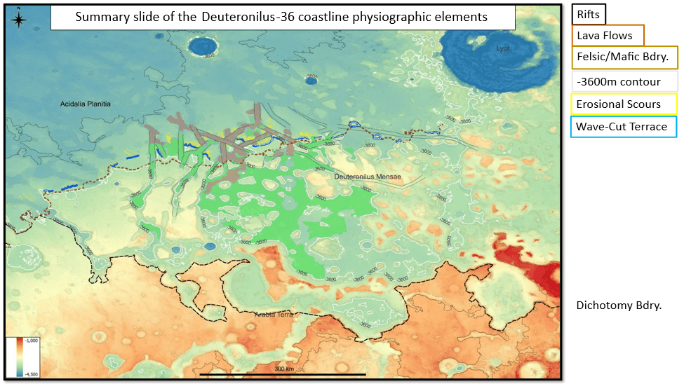
We’ve seen the erosional evidence of a -3600m sea level both on sea stacks and on an indented shoreline on ramps; a dip-oriented pattern of scours extending along ~850km strike of proposed shoreline, most likely due to glacial runoff (the only viable candidate for a line source that long); evidence of post-erosional rifting and associated lava flows.