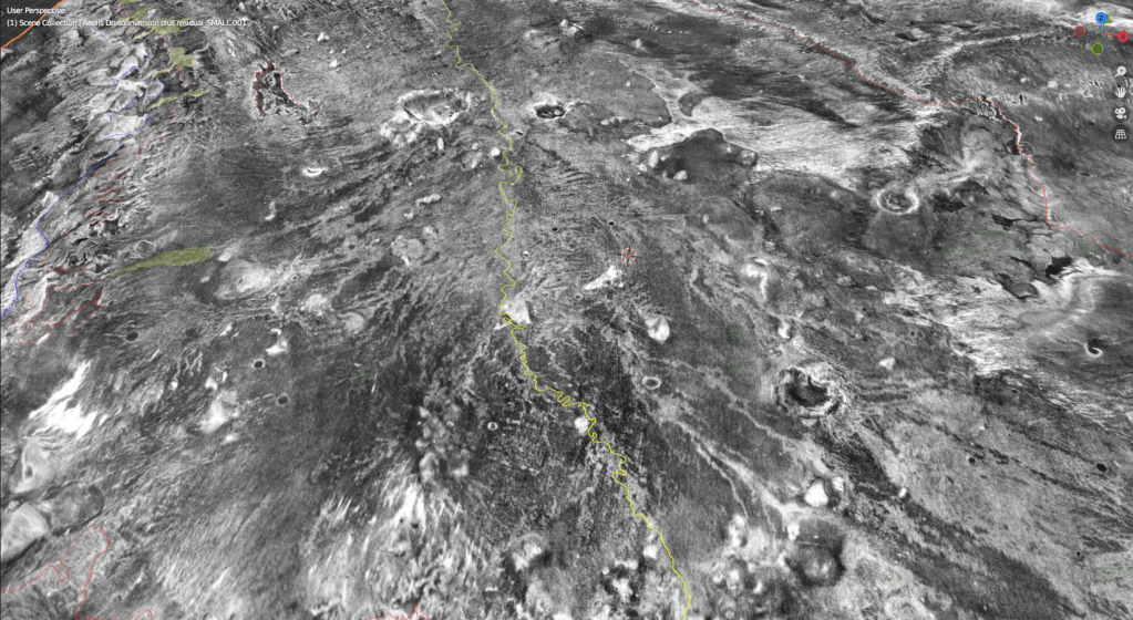
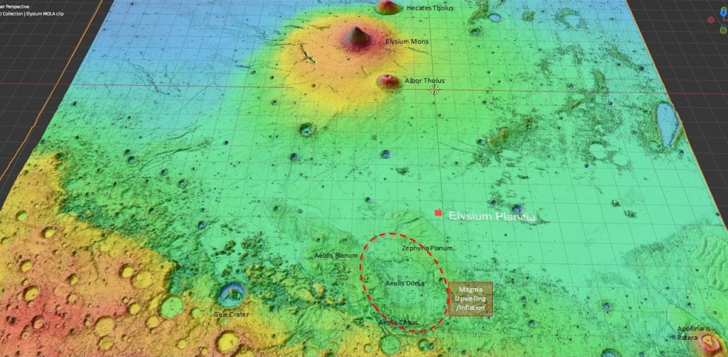
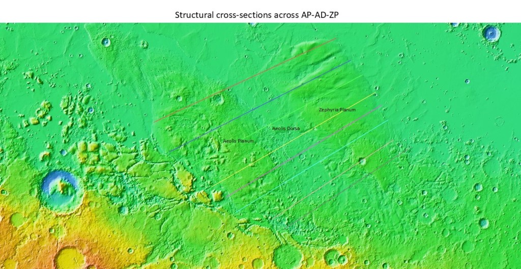
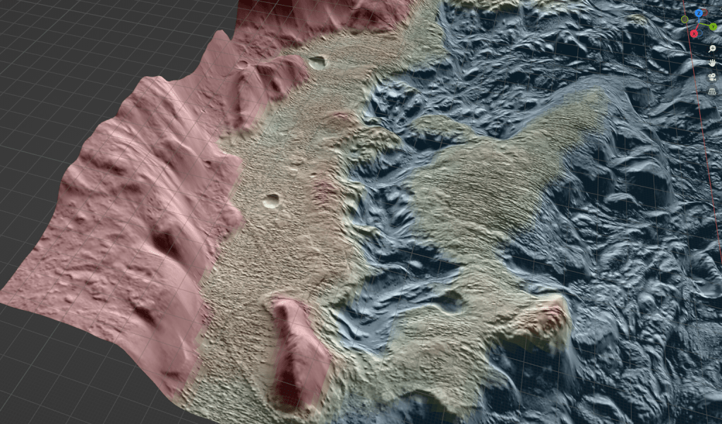
Now, for a change of scenery, we head over to the Aeolis Dorsa area, South of the Elysium volcanic complex. This is the low between Aeolis Planum and Zephyria Planum, and contains some of the best-preserved river, channel, and fan deposits on the planet. These were deposited as coarser and more resistant strata than the surrounding rocks, resulting in their preservation after exhumation by aeolian processes (wind erosion). The country rocks were eroded more deeply causing the riverine rocks to stand out in relief, and be “inverted” in one sense of the term.
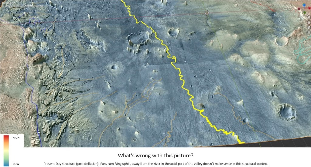
At first sight this is a reasonable picture: a major river running down a giant synclinorium, and a plethora of meandering channels and fans to keep sedimentologists busy for years… until we notice that most of the fans ramify away from the river, apparently in an uphill direction. Since water does not flow uphill, we might consider an alternative solution: that the Aeolis Dorsa region previously constituted a structurally high arch, presumably as a result of a magmatic upwelling (mantle plume?), with fans pointed downhill from the central axis. Then, a collapse of the structure formed an axial valley which became the fairway for the Aeolis Serpens River. In other words, a structural inversion.
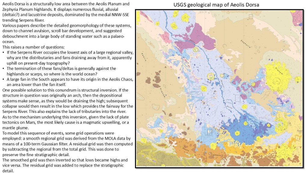
An illustration showing the location of Aeolis Dorsa between Aeolis Planum and Zephyria Planum:
Present day structure of the AD valley, with fans seemingly delivering sediments up the limbs of the syncline:
An attempt at restoring the structure to the time of fan deposition:
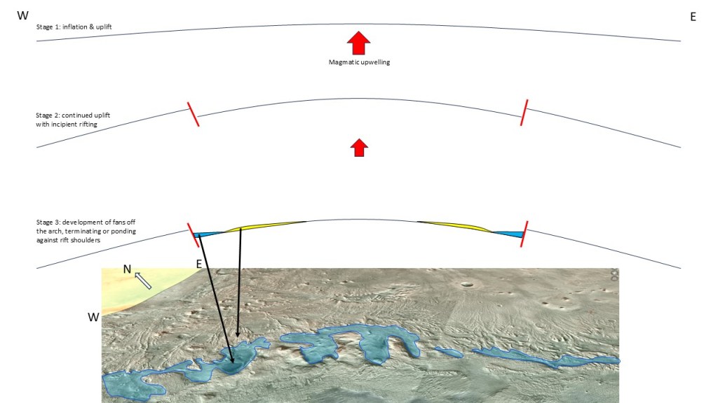
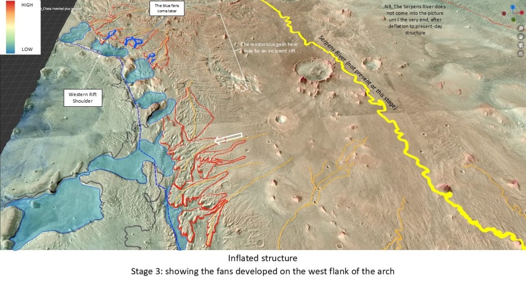
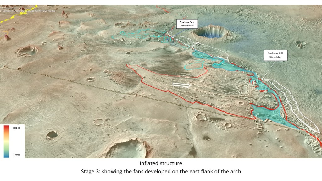
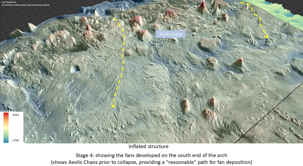
The inflation of the structure complete with rift shoulders and fan development in 3 stages:
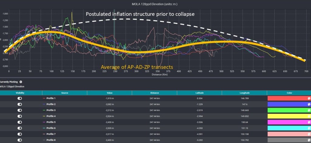
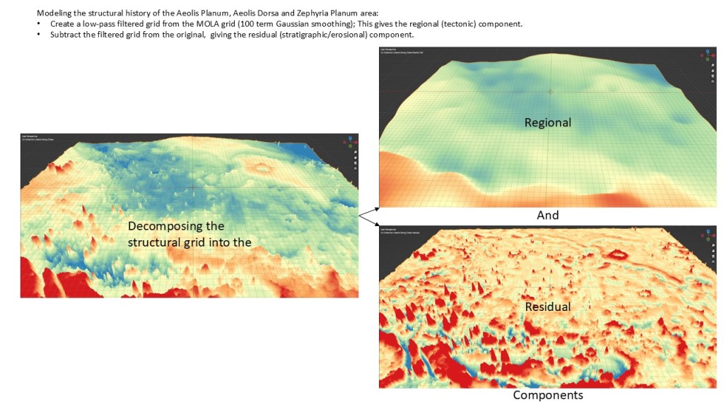
In order to model and visualize this inversion we create a grid of the inflated structure; a low spatial frequency version of the MOLA DEM grid was computed, and subtracted from the original grid yielding a residual grid which was used to preserve the stratigraphic and fine structural detail:
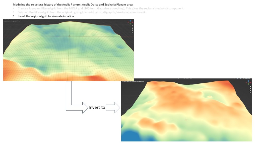
The low frequency grid was then inverted:
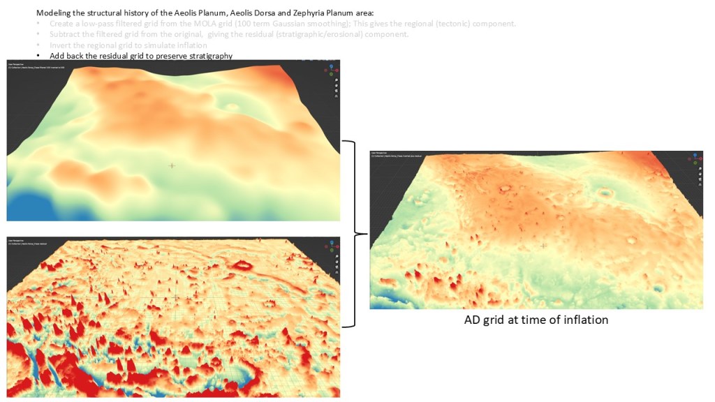
And the residual grid was added back in (failing to do this would have inverted the impact craters into buttons, the rift shoulders into moats, and the fans into gulleys)
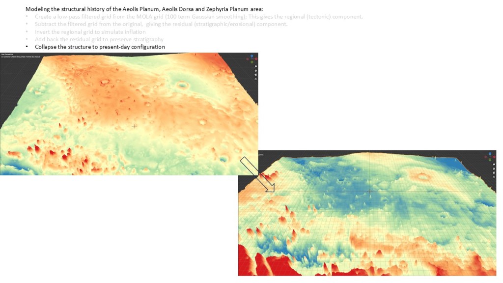
Comparison of the inflation grid with the post-inflation (present day) grid:
With an arch in the center, water is now flowing downhill and the fans make sense. The fans look like their terminal lobes end up in water, so I have drawn in some lakes here, ponded against he rift margin. Note that the river is not present at this time; it appeared after collapse or deflation of the structure.
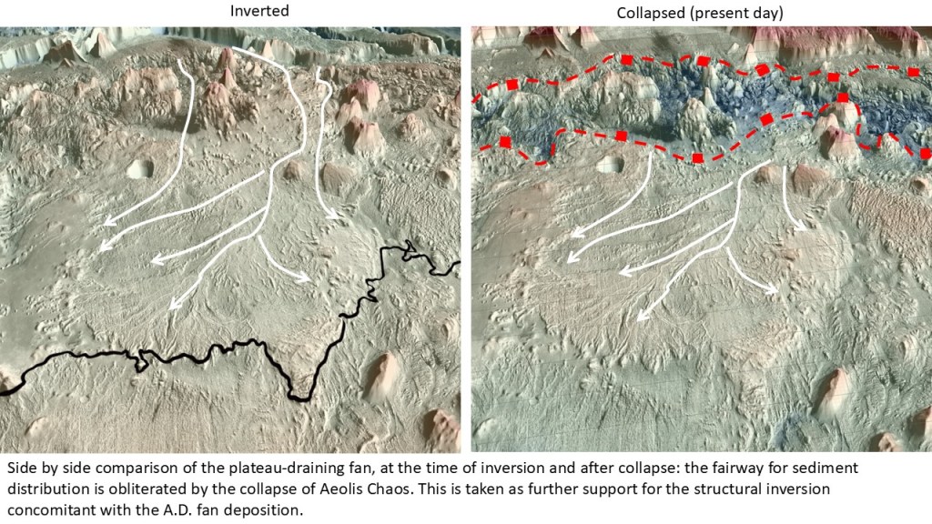
The inversion of Aeolis Chaos also connects the southern fan to its catchment area on the southern platform
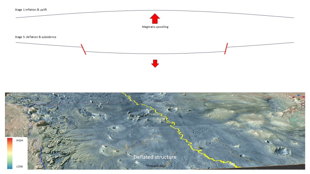
Reversing the process, the arch collapses, providing a fairway for the Serpens River
Below, collapse of Aeolis Chaos disconnects the southern fan from the platform; note the shoreline etched into the Chaos wall at around -2000m, indicating that there may once have been a lake there. The water that once fed the southern fan may now have filled this lake.

Close-up of the shoreline:
One last look at the Aeolis Chaos fan before and after chaos collapse:
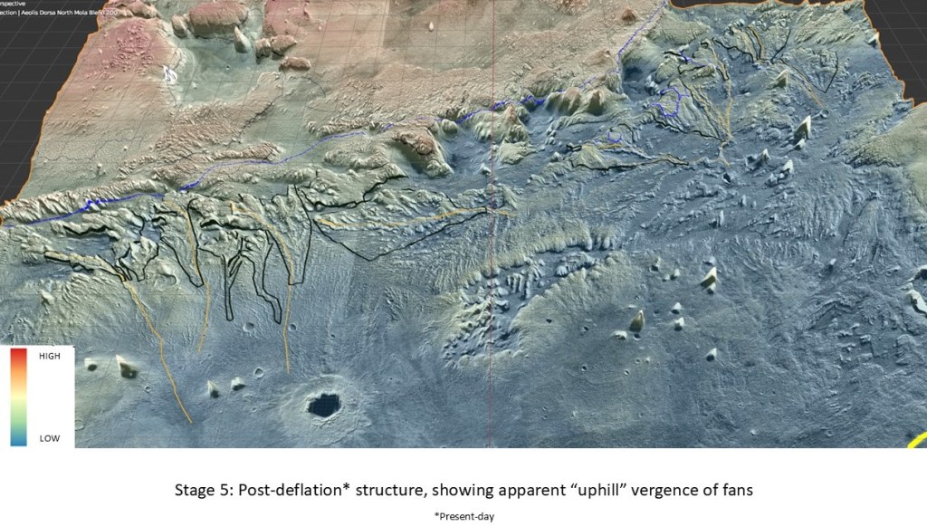
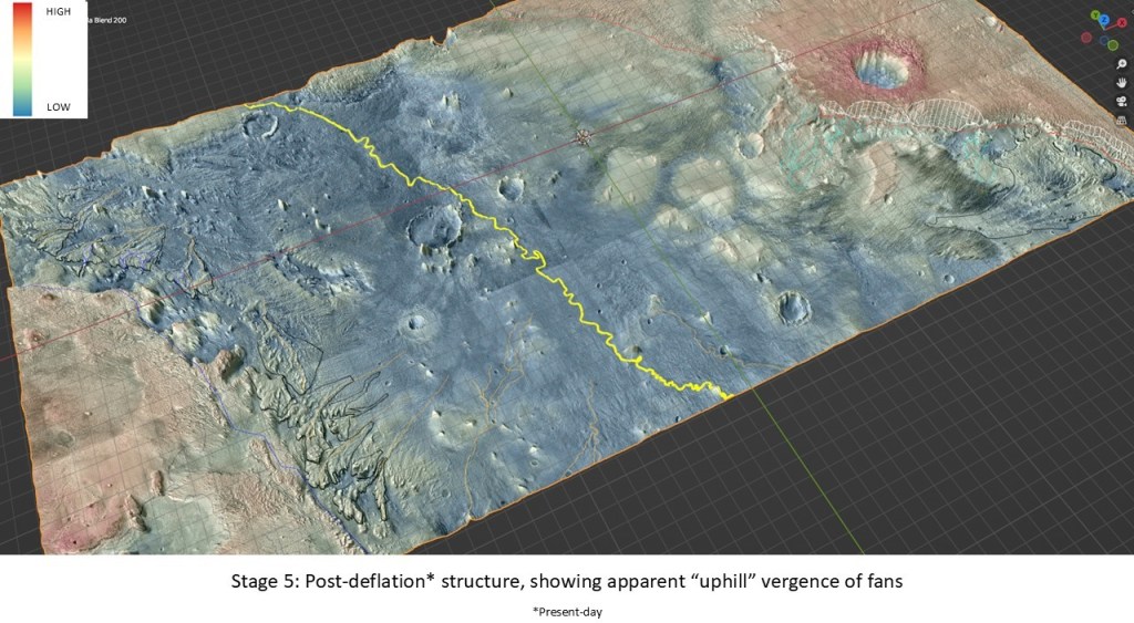
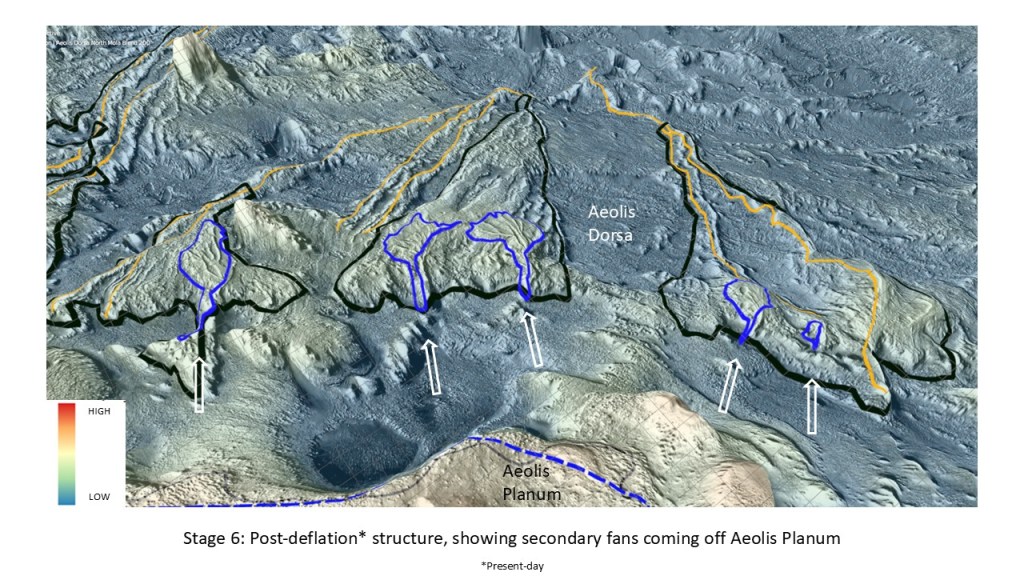
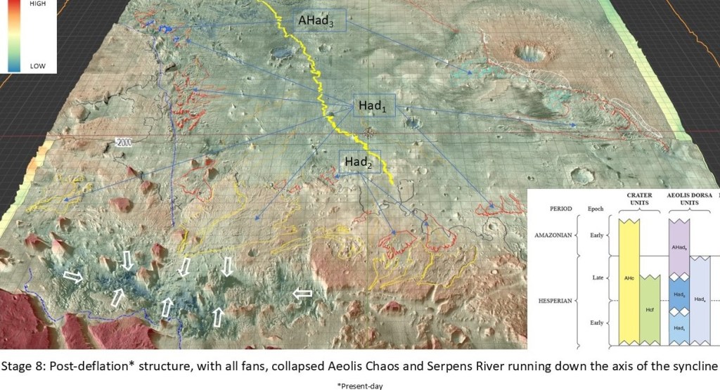
Post-deflation model:
And
With the deflated structure, the fans are now reversed, with a new set coming off the Aeolis Planum high:
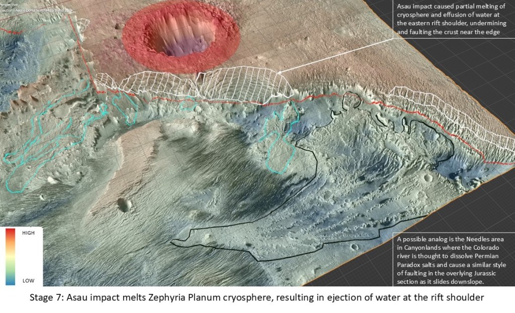
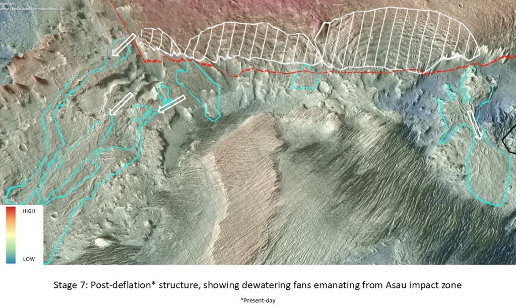
On the east flank, the Asau impactor has heated the cryosphere, expelling water down from the rift shoulder and building out some small fans in the process. It appears that this may have weakened the rocks and caused some faulting down to the west.
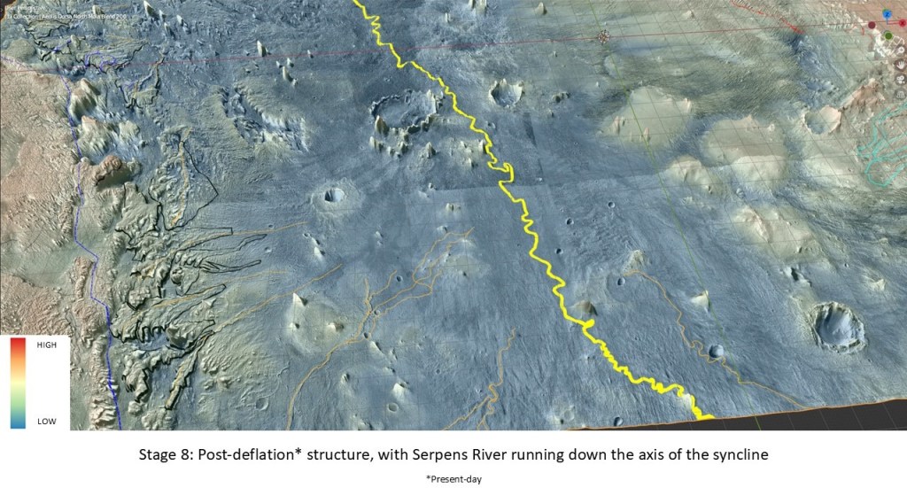
The new topograpy allows for the Serpens River drainage:
A summary slide showing all the fans from oldest to youngest: Had2>Had1>AHad3
Bonus slide: night infrared (on the inflated structure) showing the paleo-drainage off the arch prior to the emplacement of the Serpens River. This shows more features than the surface expression, presumably due to the thermal properties of deeper, buried layers.